GRP® Millevaches
Following the GRP® Millevaches hiking route means discovering the diversity of the plateau's landscapes, the wealth of small villages and the peace and quiet of the paths.
6 points of interest
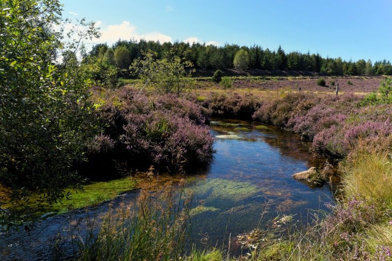
G.Salat - CC HCC  Heritage site
Peyrelevade
Located in the heart of the Millevaches Regional Nature Park in Limousin, in the north of the Corrèze department, the commune of Peyrelevade is rich in the architectural, natural and landscape heritage so characteristic of the Millevaches Plateau.
The commune takes its name from one of these standing stones (Peira Levada in Occitan), frequent in the region before Christianisation.
It has 850 inhabitants. In 2015, an asylum seekers' centre was opened, accommodating 70 people.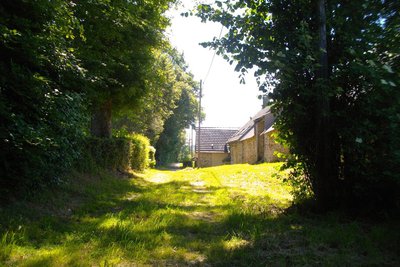
CC HCC  History
Montely and Bel-Air
The third and fourth stops on your tour, the villages of Montely and Bel-Air. Villages of a few houses and a few souls for whom the postman's visit could become their link with the outside world, with news arriving from elsewhere.
 Forestry
The Douglas Fir
The forest crossed is composed of Douglas fir (Pseudotsuga menzierii), a species planted since the middle of the 20th century under the national reforestation campaigns set up by the National Forest Fund. Due to its intrinsic qualities (mechanical strength, rot-proof red core), Douglas fir wood is used mainly for construction and outdoor work.
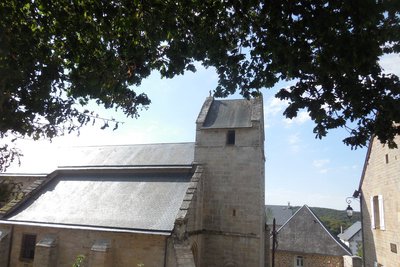
CC HCC Heritage siteChavanac
This church, built in the 13th century, is dedicated to Saint John the Baptist, as are many of the shrines built by the soldier monks. It retains a certain charm despite its slightly steep slate roof (formerly thatched).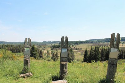
O.Nugueo - CC HCC  Panorama
Reading the landscape
Educational panels are installed here to help you understand the landscape. Please take a moment to read them to understand better the panorama that is available to you.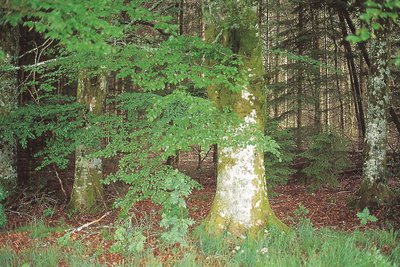
Les hêtres  Flora
FloraRound-leaved Sundew
The round-leaved Sundew (rosolis rotundifolia) which cannot find its food in the soil will seek it in the animal environment by capturing small insects in its leaves.
Description
- From the La Cramaillotte restaurant, take the road opposite towards Gentioux. Ignore a road coming from the right. (junction with the GR®440 hiking trail).
- Turn right into a hairpin bend on a small road that climbs. It becomes a track and goes to the cemetery. At the road, go down to the right, then turn left (D 174) towards Saint-Setiers/Féniers. At the junction, turn left between the houses and go up to a crossroads.
- Opposite, go down a grassy path. Take the road to the right and go down to the hamlet of Vinzan. Cross the D21, go right, then go down a gravel track on the left. Cross the Vienne and go up the main track. Follow it until you reach a small road; follow it to the left for 150 m.
- Before the village of Cézeyrat, go up a path on the left between the fields. At the edge of the pine forest, turn right. At the T-junction, go left, then left again at the next junction.
- About 200m after a right-angle bend to the left, leave the track and turn right between fields onto a grassy, heather-lined path. The path widens. Cross the bridge over the river and go up to the road (D21); follow it to the left for about 650 m.
- Shortly before the Chassaing bridge, turn right onto a track that is tarmac in places. At the crossroads, go straight on and come out onto a road (D36). Turn left, then immediately right onto a track. This leads to the Mission cross.
- Cross the road to continue straight ahead. At a crossroads, go straight on, then turn right (cross-country ski trail). The route bends to the left and reaches a crossroads. Take the grassy path on the right that descends between the oaks. At the road, continue on the small asphalt descent to Saint-Setiers. At the bottom, turn right.
- Turn left in front of the church onto the D80 towards Sornac. Take the small road on the right towards Malaret and continue.
- After the hamlet, in a left-hand bend, go up a path to the right and stay on the main road, which winds its way to the entrance to Sounaleix. Go through the hamlet.
- On leaving the village, take a stony path to the left and go down (the path is wet at the bottom). At the crossroads, take the wide track on the left and go through the coniferous woods. Reach a fork in the road, continue straight on and descend to a road; follow it to the right.
- At the road, turn right and go down into Feyssac.
- In Feyssac, at the farm with horses, turn left towards Sornac. Be sure to turn right after the last house on the right. A path goes down to the Pont de Feyssac.
- Cross the bridge and arrive at a hairpin bend. Go up on a path on the left. At the top, at the crossroads, continue opposite across a sunken path to a road.
- Go down the track opposite between the meadows for 150 m, away from the direction of Montely, then follow the meadow to the left for 120 m to join a track; follow it to the right. Pass over a pond dike and go up on the left.
- At the road, turn right towards Clamoudeix and continue straight on into the village. At the intersection, at the top of the climb after the village, go straight on. Then walk along the side of the valley; the track veers right, then left and becomes gravelled to reach Tafalechas.
- Go through the village on the right and go up a small road. Continue along a track that passes through a coniferous wood and then passes under the high-voltage line. Go downhill and turn left, and at the junction, turn right.
- Take the path on the right that leads to Millevaches. Pass by the bivouac area and the Maison du Parc.
- At the road, turn left and at the church, turn right and go straight on.
- Turn right, then immediately right onto a carriage road which becomes a path. After a big bend, reach the hamlet of La Brugère. Go around the first house and turn right onto a path. At the edge of the wood, turn left and reach a road at the entrance to Chavanac.
- Opposite, a short path leads to a road; follow it to the right for 2 km. It crosses the Vézère and continues through the undergrowth.
- Turn right and go over the causeway of the old Bournel pond. Pass the hikers’ footpaths and the pond causeway.
- Turn left onto the path and follow the river.
- At a fence on the left, open the gate and close it properly. Walk down towards the river, cross the bridge and continue to the right along the river.
- Turn left along the hikers’ footpath and continue to the road.
- At the road, turn right.
- At the intersection that has the La Borde sign, leave the left-hand path and follow the road to the right to reach the village of Saint-Merd-les-Oussines by crossing the bridge on the right.
- At the crossroads, turn left on the D164 towards Bugeat for 70 m. Turn right towards a fountain and the cemetery. Continue opposite as far as La Côte.
- Go past the buildings in La Côte and continue straight ahead along a sunken path which leads to a road; follow it to the right for 700 m.
- At a wood storage area, turn right onto a wide track. At the crossroads, continue straight ahead to Chabennes (or Chabanes). Go into the village by the road to the left.
- Turn right onto the Puy Lagrange forest track. Follow this main route to the village of Chamboux, ignoring a left turn to Monteil, then tracks on either side. In the village, take the road on the left for a few metres, then go down a track on the right for 150 m.
- Fork right into the woods onto a grassy path. Cross the Chamboux stream on a plank bridge, and go up: a few stones mark the path that leads to the bend in a wide track; follow it to the right, then take a small road to the left. Pass the campsite and the stadium, and go back to Peyrelevade (point n°1).
- Departure : Ardesia hotel restaurant, Peyrelevade
- Arrival : Ardesia hotel restaurant, Peyrelevade
- Towns crossed : Peyrelevade, Saint-Setiers, Sornac, Saint-Sulpice-les-Bois, Millevaches, Chavanac, Meymac, Saint-Merd-les-Oussines, and Tarnac
Forecast
Altimetric profile
Recommandations
Information desks
7 route d'Aubusson, 19290 Millevaches
Access and parking
80 km from Limoges, follow the D979 then the D992.
25 km from Meymac, follow the D36 then the D21.
37 km from Aubusson, follow the D23.
Parking :
More information
Report a problem or an error
If you have found an error on this page or if you have noticed any problems during your hike, please report them to us here: