The priory
Saint-Angel
The priory
Medium
4h
12,4km
+259m
-259m
Loop
Yellow markers
Embed this item to access it offline
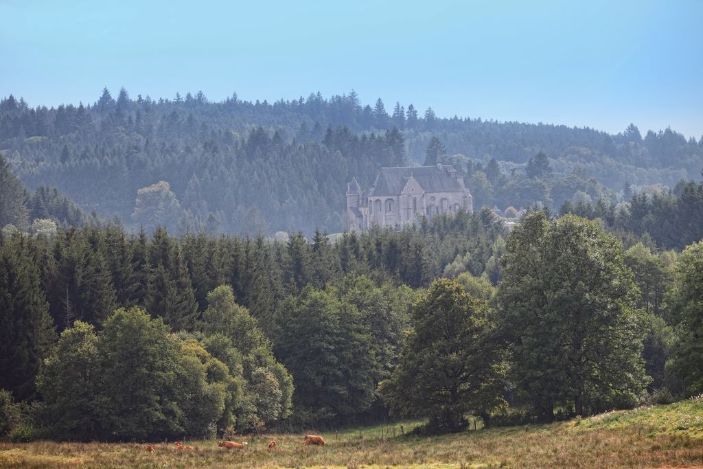
Standing on its promontory since the 12th century, the imposing priory of Saint-Michel des Anges takes hikers under its protection before they escape towards the Triouzoune valley, then walk up through woods and hamlets to find an old 'chapoule' or watering place while they admire the diversity of the landscape. Two variants allow you to shorten the main route.
4 points of interest
V.Mendras - CC HCC  Heritage site
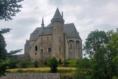
Priory
The priory and the church of Saint-Michel-des-Anges were a dependency of the Poitevin abbey of Charroux. Initially built in the Romanesque period, the church was heavily modified in the 15th and 16th centuries, with the construction of Gothic vaults.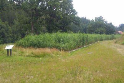
CC HCC  Site
SiteSewage treatment plant
Commissioned on May 29, 2011, the plant is equipped with a sand filter planted with reeds. There are two stages of processing: the first one is made up of three pools of 330 m² each and the second one of two pools of the same size. It treats the water for 660 inhabitants.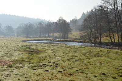
M.Brock - CC HCC  River
RiverThe Triouzoune
The Triouzoune is nearly 50 km long and has its source at an altitude of 900 m in Corrèze on the Millevaches plateau. It passes to the east of Neuvic and forms a 410 hectare reservoir: Lake Triouzoune. It joins the Dordogne a few kilometres to the south between the communes of Sérandon and Neuvic.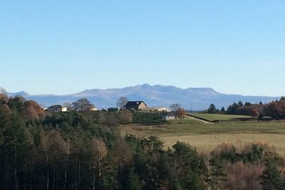
M.Brock - CC HCC  Panorama
Sancy
This trail offers a remarkable view of the highest volcano in metropolitan France, the Puy de Sancy. At 1,885 metres above sea level, this summit is the highest point of the Massif Central. The two streams, the Dore and the Dogne, originate there, and their confluence forms the Dordogne.
Description
- Cross the bridge over the Augières stream and go up the Pradal road (view of the priory and its terraces). Leave the road to enter the meadow on the left. Follow the fence on the right and go down to the footbridge, which you have to cross. Follow the Triouzoune along the path on the right
- Take the second footbridge and as you leave it, take a right turn to the road. At the road, go left to the bridge.
- At the bridge, cross the Triouzoune and then go through the farm and stables. At the first crossroads, turn right. In La Boëtie, take the track on the left at the corner of the old farm and pass in front of the bread oven. Follow the path between the spruce trees.
- Take the path to the left. Continue for 150 m and take the next on the left (view over the Massif of Sancy and the Monts du Cantal).
- Cut across the D 108 and continue on the opposite side of the road. Continue through the woods. Take the track on the right (there's a menhir on the edge of the track) as far as the road, then turn left. In Beaune, after the old farm, take the track on the left. Pass in front of the Montupet pond.>
- Cross the road and continue opposite. Take the D 108 facing you for 200 m, then take the path opposite, which passes in front of the water reservoir and continue straight ahead to the town of Saint-Angel.
- Take the wooden staircase that leads to the priory terraces. Pass through the cemetery and take the Rue du Fort to reach the starting point of the hike.
- Departure : Place de la Mairie, Saint-Angel
- Arrival : Place de la Mairie, Saint-Angel
- Towns crossed : Saint-Angel and Valiergues
Forecast
Altimetric profile
Recommandations
This circuit has two shorter circuits of 6 and 11 km. These circuits are described in a separate description sheet.
Information desks
Access and parking
From Meymac, take the D 979 road towards the A 89 motorway. When you reach the D 1089, in the centre of Saint-Angel, turn right towards Tulle, then 100 m further on, turn left at the post office and the town hall. Park in the car park.
Parking :
Place de la Mairie, Saint-Angel
More information
Report a problem or an error
If you have found an error on this page or if you have noticed any problems during your hike, please report them to us here: