The Crosses Circuit
Féniers
The Crosses Circuit
Medium
3h30
12,7km
+373m
-374m
Loop
Yellow markers
Embed this item to access it offline
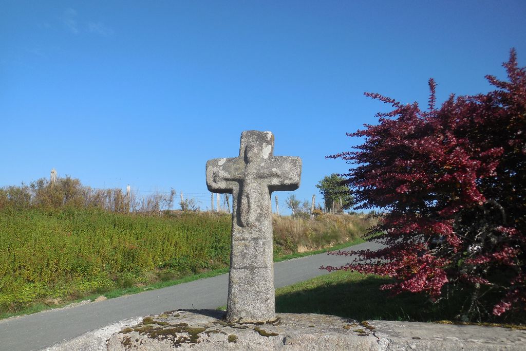
Departing from the church square, discover the old machines of a mill under the communal wash-house, and then the hike makes a loop through the Rebeyrolle. At the highest point of the route, an altitude of 880 m, on a clear day, look at the view of the Monts d'Auvergne, before going through the hamlet of La Vialle, in the commune of Mas d'Artiges. On the way back to Féniers, detour to the source of Creuse. Throughout the trip, you will find crosses, hence the name given to this walk.
6 points of interest
G.Salat - CC HCC  Heritage site
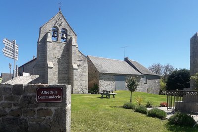
Village of Féniers
Féniers, whose name is said to come from hay, had 94 inhabitants at the last census. It was the headquarters of a Knights Hospitallers' administrative centre with a sub-command in the village of Crabanat. The present church was placed under the authority of the commander.
Note the sizeable communal washhouse. Of recent construction and well-maintained, it shelters old tools used for flour-milling.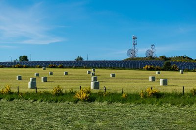
M.Boniface  Renewable energies
Photovoltaic solar power plant
Commissioned in 2014, the Feniers photovoltaic power plant occupies 6 ha. It can produce 5,455,000 kWh per year, equivalent to the annual consumption of a thousand French households.
It is located on a former military field with two radars behind the panels.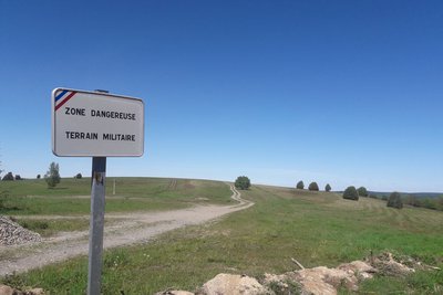
G.Salat - CC HCC  History
Aircraft and military field
On the D36, a stretch carries a sign "military field". This is the former Féniers airfield. The latter, under the jurisdiction of the Courtine camp, was included in the list of airfields as early as 1926 but, surrounded by steep slopes, often snow-covered, it was not adapted to new aircraft models and was closed to public traffic in 1947; it was used for some time to train the troops. As a tribute to this period, a Fouga school plane is on display at the entrance to Féniers.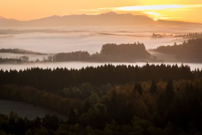
M.Boniface  Panorama
Massif du Sancy
This hike will offer you a remarkable view of the highest volcano in metropolitan France, the Puy de Sancy. At 1885 metres above sea level, this summit is the highest point of the Massif Central. The two streams, the Dore and the Dogne, originate there, and their confluence forms the Dordogne.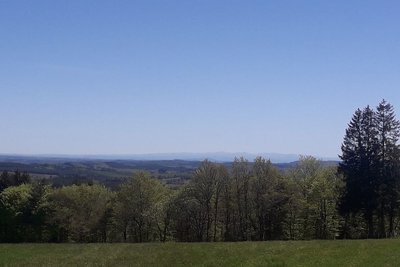
G.Salat - CC HCC PanoramaThe Cantal Mountains
Another Auvergne massif with Le Sancy, the Cantal Mountains, presents itself to us during this hike. This massif is, in fact, the remnant of a stratovolcano born 13 million years ago, the largest in Europe, eroded by collapse and glacial erosion.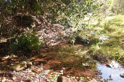
G.Salat - CC HCC  Source
Source of the Creuse
A short round trip allows you to discover a source mentioned on the 1834 land register, such as the Creuse spring: The D36 road marks the watershed between the Dordogne basin (fed for a tiny part by the springs located in the village of Crabanat) and the Loire basin (which has the Creuse and then the Vienne as tributaries).
Description
Depart from the church square. Go down the D 8 towards Le Moulin.
- At the end of the village, turn left down the side road. Cross the Creuse then take the track to the right. At the next crossroads, take the track to the right. Follow it straight ahead to return to the D8.
- Take the road to the right and cross the stream again. On the left at an abandoned road, take the uphill path to the D8. Follow it to the right; then, when you reach the cross at the village entrance, follow the road to the left. Continue straight ahead until you reach the power line and then turn right down the path.
- Take the road to the left. At the cemetery, go up on the left by the track that runs alongside the solar energy park. Cross the D36 to take the track opposite. 200m. further on, take a forest path on the right that leads to La Vialle.
- Enter the village and take the road on the right. At the next crossroads, take the departmental road on the left. At the crossroads with the road to Crabanat, go ahead and then immediately take the path below the road. Follow it for quite a long time. It begins a descent: at the Y-junction, take the path on the right that goes up.
- Take the road to the right. In Crabanat, take the road on the left (when you get to the top of the meadow, turn around for a view of the Sancy and Cantal massifs) and go on to the D36.
- Cross over and continue on the track ahead. A little further on, turn left (10 mins) towards the source of the Creuse river. Continue on the track straight ahead to get back to Féniers.
- Departure : Church Square, Féniers
- Arrival : Church Square, Féniers
- Towns crossed : Féniers and Le Mas-d'Artige
Forecast
Altimetric profile
Recommandations
Shooting takes place regularly close to the military camp at La Courtine. Don't worry, it only happens inside the military compound.
Information desks

Place Quinault, 23500 Felletin
Access and parking
Follow the D36 that links Felletin to Meymac. Féniers is 1 km away from this axis on the road to Gentioux.
Parking :
Church Square, Féniers
More information
Report a problem or an error
If you have found an error on this page or if you have noticed any problems during your hike, please report them to us here: