Along the Dejoune - shorter route
This hike goes up the Dejoune River to the sources of the many streams that make it up, bordering the La Courtine military camp. Walking on the high part of the valley, elements of traditional architecture, the history of the hamlets, and viewpoints follow one after another. On the way back, the church of St-Pierre/ St-Paul, dating from the 14th century, and the lime tree known as the "Sully" are inviting places to stop for a break.
6 points of interest
CC HCC  Heritage site
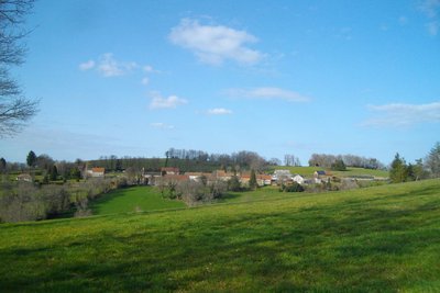
Poussanges
Benefiting from a southern exposure like most of the villages of the Limousin Mountain, the village of Poussanges has developed along a road. The commune had 155 inhabitants in 2017.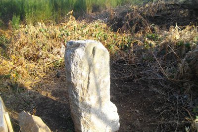
CC HCC Heritage siteStone of the three lords
This stone in the shape of a truncated pyramid located in the commune of Magnat L'Etrange could mark the limit of three 'seigneuries' or manors, including that of Pierrefitte. However, the meaning of the name Pierrefitte, which describes a stone that is fixed to the ground or a menhir, could suggest an older function for this stone.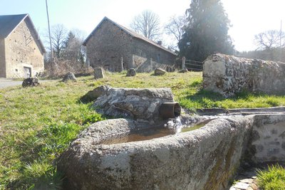
CC HCC  Small patrimony
Village of Lachaud
The villages of Limousin were all strongly involved in agriculture. Walking through these hamlets always produces interesting discoveries during a hike: barns, mansions, crosses and monuments, traditional local architecture... You will take a very pleasant route to Lachaud. Don't miss in the heart of the village where the spring was restored in 2018. Notice the water inlet in an ancient granite sarcophagus.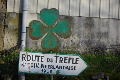
CC HCC Heritage siteThe Cloverleaf Route
As you arrive at Queyriaud, a panel in front of a shed recalls a part of the history of the La Courtine camp. From 1959 to 1964 it became a training base for the Dutch military. As a result, the 4th Engineer Division built a road between Poussanges and the camp's northern entrance, called the Route du Trèfle, the cloverleaf route, named after the regiment's floral symbol. This auspicious period for the region was to end with France's withdrawal from NATO. The Museum of Remembrance at La Courtine is dedicated to this episode.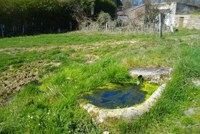
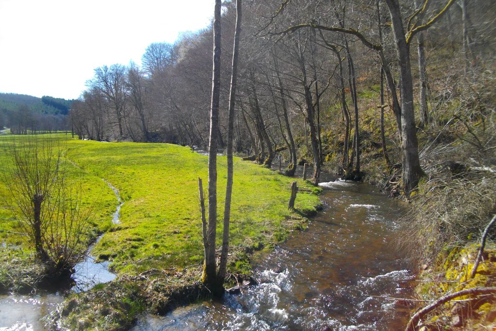
CC HCC Small patrimonyLe Moussard
At the end of the track that runs alongside the Dejoune, a path leads to the village of Le Moussard. Here again, the vernacular heritage is present: note, in particular, a private bread oven and a drinking trough.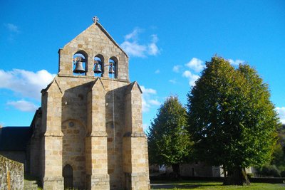
CC HCC Heritage siteChurch of St-Pierre and St-Paul
Built in the 14th century with the addition of side chapels in the 18th century, the church at Poussanges was listed as a historical monument in 1963. It is dedicated to St-Pierre and St-Paul.
Note a beautifully carved two-sided cross under the lime tree.
Description
Departure from in front of the town hall. To the opposite side of town heading towards Croze then Magnat.
- Take the path before the cemetery. Go on alongside the meadows, and go through a wood. The path becomes a trail. Crossed a stream and find a path that rises through a logging area.
- Follow the road to the left for 800 m. Go right at the next crossroads, and go through Pierrefite. Take the path on the right opposite the La Gane crossroads.
- Go up into the woods. At the end of the meadow, turn left then right to find a path that goes up into a plantation. At the top, follow the path to the right. At the Y-junction, go straight ahead until you get to Lachaud.
- Keep to the left in the village. After the water tower, take the path to the right. Continue for 300 m. then fork right onto the trail. Turn left at the next crossroads to cross a stream. 50 m. after this, on the right, take an inconspicuous trail that goes into the woods. Follow the markings carefully. Find a path that goes back to the road. Turn right to Queyriaud.
- Keep to the left in the village. The road becomes a trail that you follow as far as La Somme.
- Cross the road, follow the track for 1.2 km. In a bend, take the path on the right, continue to Le Moussard.
- Turn right at the entrance to the village. Go down alongside the meadows. In the forest, go right at the wooden cross. A little further on, turn left to cross the Dejoune by the bridge. Go up to the road on the right and return to the starting point by going through the village.
- Departure : Car park at the Town Hall, Poussanges
- Arrival : Car park at the Town Hall, Poussanges
- Towns crossed : Poussanges, Magnat-l'Étrange, and Clairavaux
Forecast
Altimetric profile
Recommandations
Shooting takes place regularly close to the military camp at La Courtine. Don't worry, it only happens inside the military compound. This circuit has a longer variant (Au filde la Déjoune).
Information desks

Place Quinault, 23500 Felletin
Access and parking
As you leave Felletin heading towards Ussel, follow the D23 towards Poussanges. From Ussel, follow the D982 towards Felletin. 15 km beyond La Courtine, turn right, go through Clairavaux, then head towards Poussanges.
Parking :
More information
Report a problem or an error
If you have found an error on this page or if you have noticed any problems during your hike, please report them to us here: