Hautefeuille
Saint-Merd-la-Breuille
Hautefeuille
Medium
3h
11,3km
+159m
-159m
Loop
Yellow markers
Embed this item to access it offline
A favourite season for exploring this path is spring when Mother Nature is waking up. You can explore several sites in the commune, starting with the Puy de la Garde (805 m), which offers a view of the Puy de Dôme and then the Massif du Sancy. The walk continues to the villages of Manoux (tumulus) and Gourseix. In the latter, a reused stone that may have come from the former Château d'Hautefeuille features the coat of arms of the château owners.
6 points of interest
G.Salat - CC HCC  Heritage site
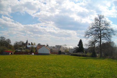
Saint-Merd
The name St-Merd is very strange and is, in fact, a contraction of St-Médard. The commune had 191 inhabitants at the last census. In the centre of the village, you will find the church, which was rebuilt in 1527, then refurbished in the 18th and 19th centuries, perhaps to replace an older Templar chapel.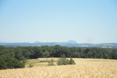
B.Reuge  Panorama
Puy de Dôme
The Puy de Dôme is an ancient volcano which gave its name to the eponymous department. At the height of 1,465 metres above sea level, it is the highest volcano in Chaine des Puys, a volcanic complex of 80 volcanoes.
A TDF antenna has become the symbol of the site and makes it very easy to identify. Also, at its summit, is a Gallo-Roman temple dedicated to Mercury. While the bravest can make the ascent on foot, a rack and pinion train gives access to the summit.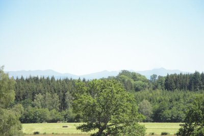
B.Reuge PanoramaMassif du Sancy
This hike will offer you a remarkable view of the highest volcano in metropolitan France, the Puy de Sancy. At 1885 metres above sea level, this summit is the highest point of the Massif Central. The two streams, the Dore and the Dogne, originate there, and their confluence forms the Dordogne.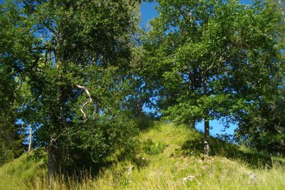
G.Salat - CC HCC  Archaeology
Tumulus of Manoux
At the exit of the village of Manoux, you will notice a strange mound that turns out to be a tumulus. These man-made hills, made of earth and stones, house in their centre a funerary chamber that was the tomb for a dead person. A little further along the path, the wet meadows were once home to three ponds.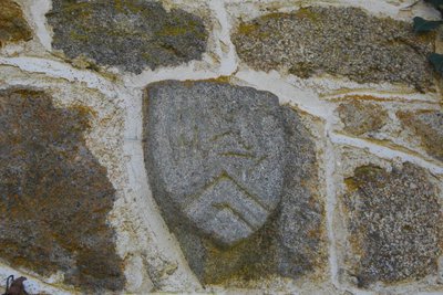
G.Salat - CC HCC Heritage siteCoat of arms of Gourseix
In the centre of the village, take a short round trip to the right and up towards the barn. To the right of the door, take a look at the carved stone which could represent the coat of arms of the Motier de La Fayette family, owners of the Château de Hautefeuille.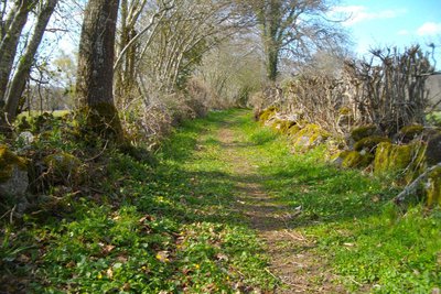
G.Salat - CC HCC  History
Near Hautefeuille
Locate the 763 metre point marked on the map: this was the site of the château d'Hautefeuille. Its owner, Jean Motier de La Fayette, was killed in 1568 during the Wars of Religion at the battle of Cognat, in the Allier, by the Protestants; they also burned down this fortress. The land was sold by François de La Fayette, husband of the novelist. A château was rebuilt. Described as intact in the 19th century, it was destroyed and then used as a stone quarry.
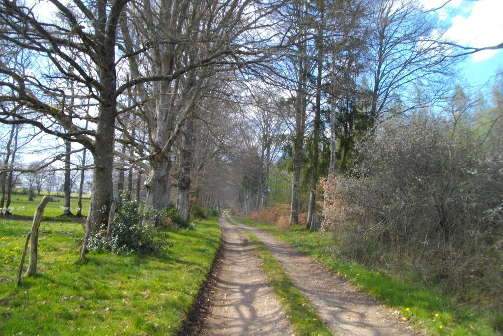
Description
Departure: park in the church square. Go back towards the centre of the village. Follow the D18. As you leave the village, turn right towards the cemetery
- At the cemetery, take the path on the left that joins a track. Follow it to the right; keep straight ahead as far as the road.
- Take the road on the right for 200 m. Follow the track on the left, which becomes a path. At the next crossroads, turn left. The path becomes a track; on a bend, go left until you reach the road.
- Follow it to the right for 300 m, then take the path to the left. At the next crossroads, turn left and continue for 50 m, then leave the track for a grassy path on the left that leads to Les Manoux. Continue straight on in the village.
- Take the road to the left and, 50 m after the bridge, a trail to the right. At the first crossroads, follow the track to the right; cross the stream and then the meadow. In the woods, turn left to find a path. It joins a track that you can take on the left to reach Gourseix.
- While you are there, take a 50 m return trip to the right: an interesting stone with a coat of arms can be seen up on the right-hand side of the wall of the barn adjoining the first house. As you leave the village, take the path on the left which joins the road.
- Follow it to the right. At the next crossroads, turn left. 200 m. after the La Barrre, after a transformer, take a trail to the right. Follow it, keeping straight ahead; ignore a path on the left; go to the crossroads just before the road on the left. The path meets the road.
- Turn left onto it; after the sorting area, take the path on the left to reach the village. Turn right to find the church.
- Departure : Church Square, Saint-Merd la Breuille
- Arrival : Church Square, Saint-Merd la Breuille
- Towns crossed : Saint-Merd-la-Breuille and Flayat
Forecast
Altimetric profile
Recommandations
Several areas are wet, be sure to wear study shoes.
Information desks

Place Quinault, 23500 Felletin
Access and parking
From La Courtine, follow the D996 towards St-Oradoux. Pass St-Oradoux then the pond of Méouze. Turn right on the D. 18 towards St-Merd la Breuille.
Parking :
Church Square, Saint-Merd la Breuille
More information
Report a problem or an error
If you have found an error on this page or if you have noticed any problems during your hike, please report them to us here: