Saut de la Virole
Lestards
Saut de la Virole
Difficult
2h30
3,8km
+161m
-161m
Loop
Yellow markers
Embed this item to access it offline
Born in the heart of the Tourbière du Longeyroux, the river meanders peacefully through the honeycombed landscapes of the Plateau de Millevaches. However, it had to be cut off abruptly to go around the Massif des Monédières to the north. So, this route winds its way through steep gorges and rocks before heading up towards the man-made landscapes and hamlets of the Plateau. The highlight of the route is the Saut de la Virole, where the river makes its way through the granite boulders before falling with a dizzying crash several metres below.
5 points of interest
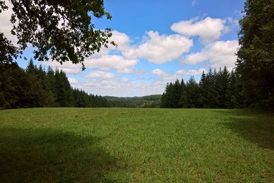
OT Vézère-Monédières-Millesources  Panorama
Viewpoint over the Viam-Lestards state-owned forest
A ‘domaniale’ forest is, in France, a forest belonging to the State. It is managed by the National Forestry Office (ONF) in accordance with the Forestry Code. They were established in the time of Charlemagne, categorising them as “the first natural areas to be rigorously managed”.
The forest occupies an area of approximately 1.17 km².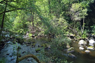
La Vézère - OT Vézère-Monédières-Millesources  River
RiverLa Vézère
The Vézère river flows in these gorges for nearly 5 km between the Monceaux la Virole dam (Lac de Viam) and the Treignac dam (Lac des Bariousses), rising from 684 to 553 metres in altitude.
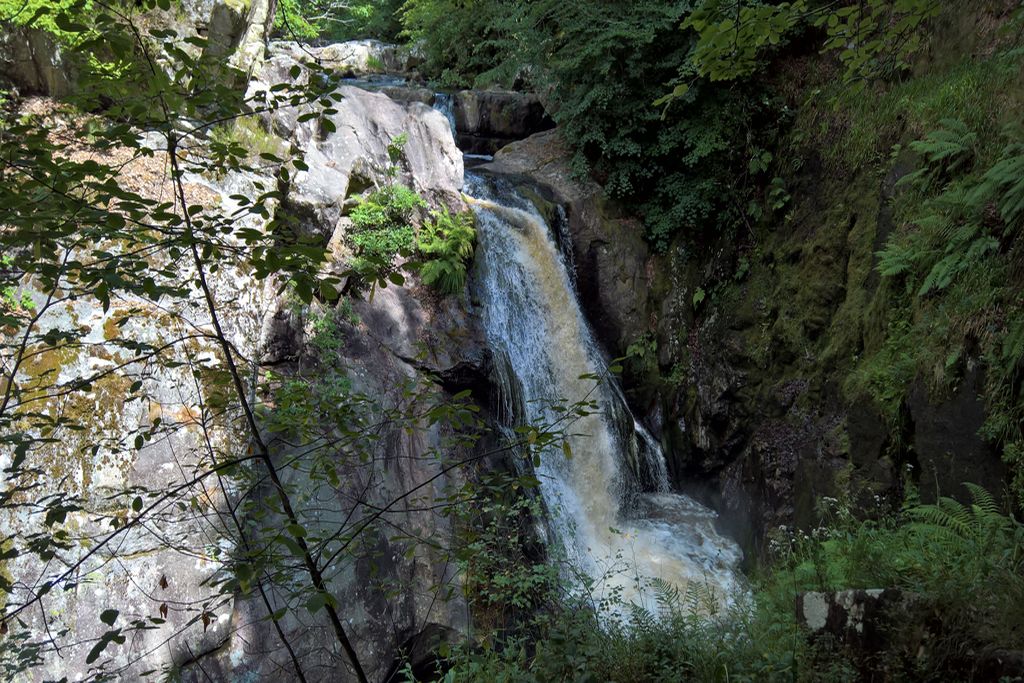
Here it scrambles through the blocks of granite before plunging several metres down to a waterfall called “Le Saut de la Virole”.
 Waterfall
Le Saut de la Virole
From its source, situated about thirty kilometres away, and after having crossed the peat bogs of the Plateau de Millevaches, the Vézère makes its way through the blocks of granite before falling several metres lower and forming this natural waterfall: le Saut de la Virole.
The colours of the landscape change with the seasons, from the soft green of spring to the grey-brown of winter, and the flow of water through the Vézère River, which varies according to the management of the Monceau-la-Virole hydroelectric dam, offer different aspects to this waterfall.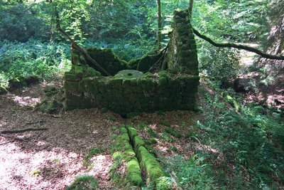
OT Vézère-Monédières-Millesources  Small patrimony
The old mill of Coissac
Traditional local architecture. This mill belonged to the inhabitants of the village of Coissac. It was once used to grind grain including rye and buckwheat.
No more than ruins remain today, but you can still see the granite grindstones in the remains of the mill.
You can also see a remnant of the forebay that used to supply the mill with water and the ruins of a building dating from the same period as the mill, but whose use is unknown.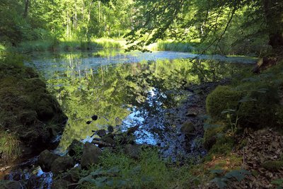
OT Vézère-Monédières-Millesources  Pond
PondThe Coissac pond
The Coissac pond supplied water to the mill when it was still operational. Now inactive, the water from the latter is first lost in a “cariçaie” (vegetation dominated by sedges and grasses) and then contributes to the formation of a peat bog at the tail of the pond.
Description
- Take the road that goes to the north of the hamlet of Coissac. Ignore a first path on the right, then a second on the left.
- Cross a meadow and at the next fork in the road continue on the left.
- At the clearing, on a level with the interpretation panel, take the path that goes down to the left. When you reach a fairly flat area, a round trip takes you to the Saut de la Virole.
- Go back to the fork in the road and continue straight ahead. Cross a stream and go up into the underbrush. This path leads to the top of the dam pipe. Continue for 50 metres.
- Turn left, and you can see the ruins of the mill. The path runs along a stream and into the woods.
- Going on past a pond on the left, go back to the path you took at the beginning. Turn right to reach Coissac.
- Departure : Hamlet of Coissac, Lestards
- Arrival : Hamlet of Coissac, Lestards
- Towns crossed : Lestards
Forecast
Altimetric profile
Information desks

Access and parking
Coming from Treignac, on the D16.
More information
Report a problem or an error
If you have found an error on this page or if you have noticed any problems during your hike, please report them to us here: