The villages
Imagine the paths taken by children going to school, farmers going to the fields, women to the market... Although many of them have been altered, transformed into roads, widened or have even disappeared, they are evidence of a mode of travel that is now popular with hikers. This "re-discovery" of the countryside also marks the rebirth of villages as primary or second homes, with new owners seduced by an iconic material, granite.
3 points of interest
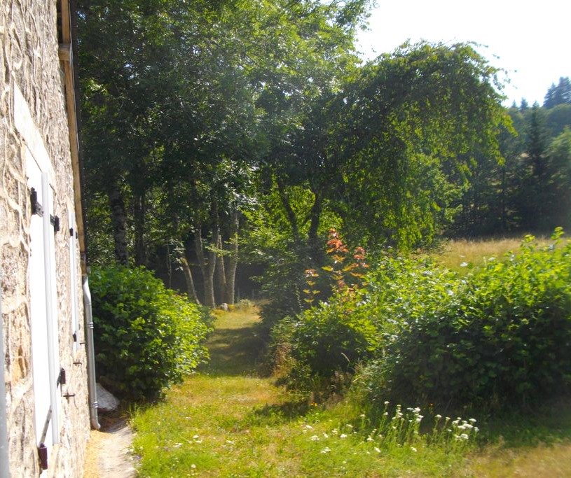
G.Salat - CC HCC  River
RiverThe Rochers stream
Plateau of a thousand sources: such could be the possible meaning of the Plateau de Millevaches, as many watercourses originate in the heart of this veritable water tower. This is the case of the Rochers stream, which, for the record, rises at an altitude of 900 m. as the Ruisseau d'Orluc, takes its definitive name from the Rochers on the approach to Bugeat and then joins the Vézère.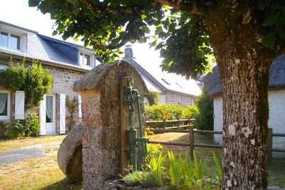
G.Salat - CC HCC  Heritage site
L'Echameil
The villages of Haute-Corrèze are all involved in agriculture. Walking through these hamlets always produces interesting discoveries during a hike: barns, mansions, crosses, bread ovens... At l'Echameil, don't miss the old well. Broussouloux then Coulournat are also characterised by their traditional granite buildings.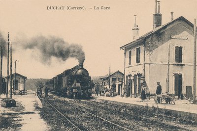
CC HCC Heritage siteThe railway
You're going to walk along a railway track on the way back from this hike. It is a portion of the line that connects Limoges to Clermont-Fd. This line, opened in 1883, contributed to the opening up of the region. The section between Ussel and the capital of Auvergne has been closed since 2014.
Description
Departing from the plot, go down after the town hall. Pass under the bridge, continue on the road to Gourdon.
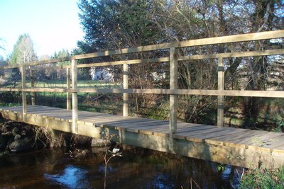
- As you leave Vezou, take the path on the left. A footbridge crosses the Rochers stream; the path rejoins the road on the right. In Bel Air, follow the road to the right to reach l'Echameil.
- Go through the village, follow the track that goes up into the woods. When you arrive on the flat, continue for 250 m, then leave the track for the small path on the left in the undergrowth. This path descends and crosses a stream. Go up to follow a path on the left that leads to Broussouloux. In the village, take the road going up on the right.
- At the last house, turn left on a track that crosses a meadow crosses a stream and reaches the village of Coulournat. Go through the village.
- Join the departmental road, which you follow on the right for 50 m, then take the track which rises on the left. On the flat, where the tracks meet in a Y, turn left. Before reaching the level of the pastures, follow the track on the left in the fir trees which joins a road.
- Turn right to go to Ambiaud. Turn right in front of the barn at the end of the village and follow the track to the stream. Leave the track to take a path on the left. At the next crossroads, turn left onto a small trail that fords a stream. Continue on to find a path again. Further on, to the right, a footbridge crosses the Rochers stream again. The path rises above the stream. Turn left at the next crossroads and then right at the rocks to reach Le Massoutre.
- Go through the village, and go over the bridge. Take the road to the left and then go left again at the end of the village. Follow the path straight ahead. At the bridge, turn right and then left to go through the housing development. Follow the track that overlooks the railway to get back to the starting point.
- Departure : Plot after the town hall
- Arrival : Plot after the town hall
- Towns crossed : Bugeat and Bonnefond
Forecast
Altimetric profile
Recommandations
Small ford between Broussouloux and Coulournat.
Information desks

Transport
Bugeat SNCF railway station, on the Limoges-Ussel line
Access and parking
Plot after the Town Hall. In Bugeat, follow the D32 towards Gourdon-Murat. Park on the plot on the left between the town hall and the railway bridge.
Parking :
Accessibility
- Emergency number :
- 112
More information
Report a problem or an error
If you have found an error on this page or if you have noticed any problems during your hike, please report them to us here: