
Les Sources de la Creuse
Discovering the spring where the Creuse was born. This imposing river, which gave its name to a départment, crosses the Creuse, the Indre, the Indre-et-Loire and the Vienne rivers over its 263.6 km length before joining the Vienne river. With its remarkable flora, it will amaze you every season.
3 points of interest
G.Salat - CC HCC  History
The water tower of France
The Millevaches Plateau is the birthplace of many springs that make their way to larger rivers and river tributaries. It is nicknamed the "water tower of France" because here the annual rainfall is between 1000 and 1600 mm of water. It is these peat bogs, streams and rivers that have formed the vast and remarkable landscapes of the Plateau.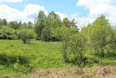
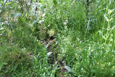
La friche marécageuse - O.Nugueo - CC HCC  Flora
FloraThe marshy wasteland
This area, once a swampy pasture used for grazing, has been transformed over time into a swampy wasteland. The latter will surprise you with its highly diversified flora, which has adapted to this very humid environment, renewing itself each season and offering you a selection of species each more surprising than the next. It is, therefore, a perfect example of the environment evolving. Nowadays, it tends towards being a megaphorb (tall perennial grasses).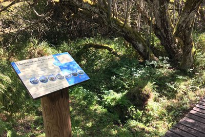
M.Barreau - CC HCC  River
RiverThe birth of a great river
This is where you can see the source of the Creuse. The river springs from this small remote place in the woods before travelling many kilometres to reach, finally, its neighbour the Vienne. In fact, the Vienne originates a few kilometres from here, at the foot of Mont Audouze. These two neighbours on the Plateau de Millevaches travel many kilometres before meeting again to finally form tributaries of the Loire.
Description
Blue water drop markings (not to be confused with the partly shared route marked with the red water drops, the "Line of the parting of the waters" which is 12 km long).
From the car park take the B-road D8 for 100 metres. Then take the small path on the right signposted "Sources de la Creuse".
- Continue through the undergrowth. At the information panel, continue straight ahead and follow the wooden walkway.
- At the crossroads, continue straight ahead to see the source of the Creuse. Go back and turn left at the crossroads.
- At the intersection with the "Line of the parting of the waters" hike (red water drop markings), turn right and follow the narrow trail through the woods.
- At the T-junction, turn left. Back on the road, turn left to reach the car park again.
- Departure : Sources de la Creuse car park, le Mas d'Artiges
- Arrival : Sources de la Creuse car park, le Mas d'Artiges
- Towns crossed : Le Mas-d'Artige
Forecast
Altimetric profile
Information desks

Place Quinault, 23500 Felletin
Access and parking
From La Courtine, take the D982 towards Felletin. Continue straight ahead for 10 km, and turn left on the D8 towards Féniers. The car park is 50m further on.
Parking :
More information
Report a problem or an error
If you have found an error on this page or if you have noticed any problems during your hike, please report them to us here: