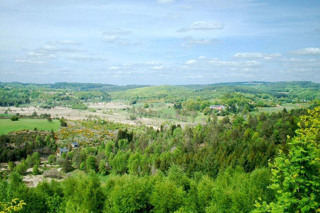
The Chandouille Valley
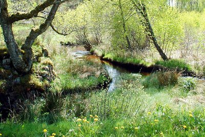
Come and taste the charm of the authentic landscapes of the Plateau de Millevaches and let yourself be lulled by the birds singing while you explore the facilities near the Chaumont mill, built by the Ligue de Protection des Oiseaux (Bird protection league). The freshness of the ever-present water in this small valley will be welcome in summer. Finally, you will know what plank bridges are; it is not uncommon to cross them to reach the other side of streams.
2 points of interest
La Chandouille - Le Lac de Vassivière  River
RiverLa Chandouille
The Chandouille flows through wet and peaty heathland before flowing into the lake of the Chammet dam in the commune of Peyrelevade-en-Corrèze where the chapel and the rocks of Le Rat are also located. The latter are part of the village of Le Rat, where Jeanne Moreau shot Tony Richardson's Mademoiselle (1966). Located on a rocky summit overlooking the Chandouille valley, the Chapelle du Rat (17th-century) was the place where dogs were blessed on Saint-Roch's day.
La vallée de la Chandouille - Le Lac de Vassivière RiverAt the roots of heritage
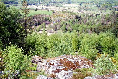
Gentioux and Pigerolles joined forces in 1972. This vast territory has a steep slope between Pigerolles; the Puy Groscher peaks at an altitude of 831 m; and the lake of Vassivière (650 m of altitude). The springs of the Maulde, Thaurion and Chandouille feed rivers much appreciated by trout fishermen. Ponds, mills and bridges dot the rivers that meander between moors, peat bogs and woods, while crosses, chapels and fountains decorate the sunken paths and old hamlets.
Description
- From La Lézioux, turn left onto the D16A towards Gentioux until you reach the bend at the end of the village (before the 16th-century fleuronnée cross).
- Go down to the right by the sunken path. Walk through the pastures, then follow the perimeter of the pond to the right. Pass on the edge of the pond on the left then take the sunken path on the right under the trees. You will reach the village of Verginas.
- In the village, turn right, pass in front of a cross, then follow the road: after a stream on the right and a cross on the left, you arrive at a crossroads.
- Fork right onto the path: it runs alongside woods and pastures on the side of the valley and leads to Chaumont.
- In the village, turn right, then, at the paved crossing, turn left into a path that goes down to a peat bog. Go along the edge of it to the right; several granite ""plank bridges"" provided access to it - and arrive at an old mill, showing traces of the diversion of water from the Chandouille stream.
- Continue on the left. A wide track rises as the path goes on, panorama. It turns to the left before joining the D16.
- Follow the D16 on the right through the woods and go up to Arfouilloux.
- After the houses, turn right for 1 km on the forest path that runs alongside woods and pastures.
- In the bend to the left, you pass a stream and follow the beech-lined sunken path to the right until you reach the D16A. Then turn left to reach La Lézioux. A small building housing an old bread oven is on the right."
- Departure : La Lézioux
- Arrival : La Lézioux
- Towns crossed : Gentioux-Pigerolles
Forecast
Altimetric profile
Information desks

Place Quinault, 23500 Felletin
Rue de Vassivière, 23460 Royère-de-Vassivière
Transport
Public transport >> www.aubusson-felletin-tourisme.com
Access and parking
23,5 km from Felletin, take the D992.
Parking :
Accessibility
- Emergency number :
- 112
More information
Report a problem or an error
If you have found an error on this page or if you have noticed any problems during your hike, please report them to us here: