Combrignac

Champagnac-la-Noaille
Combrignac
Easy
2h
6,1km
+178m
-179m
Loop
Yellow markers
Embed this item to access it offline
Combrignac, a pier for pike fishing or a starting point for walkers. Its stone paths lead you through woods on the slopes and plateaus of the Doustre.
2 points of interest
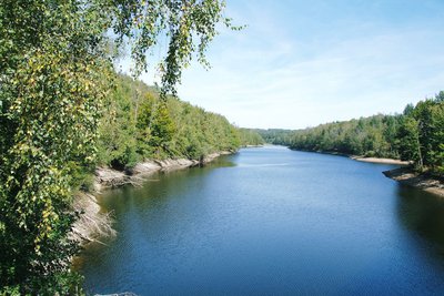
Le lac de la Valette - D.Agnoux - CC VEM  Site
SiteLa Valette Dam
The La Valette reservoir covers 224 ha. Fed by the Doustre, it has a nautical base and beaches designed for the pleasure of summer visitors. The tail of the lake is enjoyed by a large number of boat fishermen. Ranked in the second category, the lake is home to a large population of predators such as zander, perch and pike, but also carp and more recently catfish.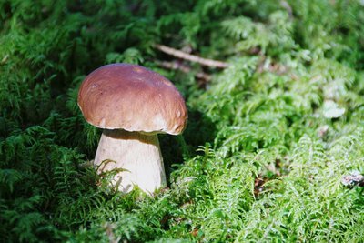
Le cèpe de Bordeaux - D.Agnoux - CC VEM  Forestry
The mushrooms
As autumn arrives, mushroom picking attracts young and old into the undergrowth, eager to flush out ceps, chanterelles and other trumpets-of-death. The essentials: a wide and shallow wicker basket (even a cloth bag, never a plastic bag) and a knife, with a thin and sharp blade. Have a good harvest!
Forecast
Altimetric profile
Information desks
Carrefour de l’Epinette, 19550 Lapleau
1 rue Joseph Vialaneix, 19300 Egletons
Access and parking
1.6 km from Champagnac la Noaille, take the D99, then turn left onto the Combrignac road, cross the bridge, and park by the roadside.
Parking :
Combrignac Bridge, Champagnac la Noaille
More information
Report a problem or an error
If you have found an error on this page or if you have noticed any problems during your hike, please report them to us here: