The rocks of Chaveroche
Péret-Bel-Air
The rocks of Chaveroche
Easy
2h30
7,6km
+188m
-189m
Loop
Yellow markers
Embed this item to access it offline
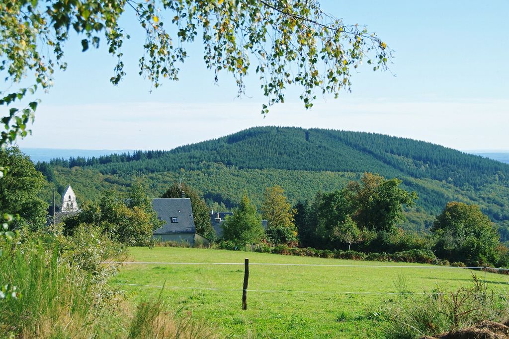
The rocks of Chaveroche, gigantic granite outcrops, leave you astonished. How do they balance, what giant carved their rounded shapes, did they shelter, protect our ancestors, did they serve as places of worship... ?
3 points of interest
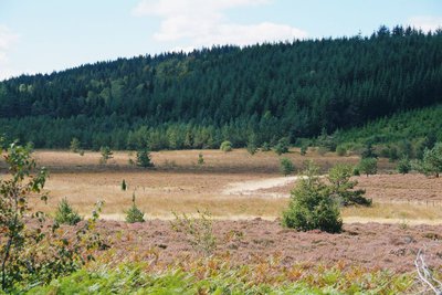
Tourbière - D.Agnoux - CC VEM  Peat bog
Peat bog and heath
On the Puy Bessergue, a gap between the coniferous trees reveals a landscape of puys, reforested by man, and pockets of peat. To the northwest, the Naucodie peat bog is a remarkable area and protected under Natura 2000; bordered by callune and heather moors, it is a beautiful hunting area for the largest bird of prey in the region, the short-toed snake eagle and its 1.80 m wingspan.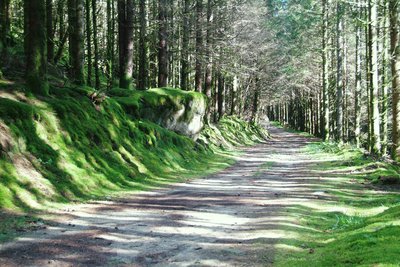
Plantation de résineux - D.Agnoux - CC VEM  Forestry
Coniferous forest
Spruce, Douglas fir or even Larch cover the puys of the Limousin mountain. The history of forestry in Corrèze is relatively recent and developed mainly in the 1950s with the reforestation policy instigated by the National Forest Fund. Essentially more than 90% private, the forest is a rapidly growing sector of activity that occupies second place in terms of employment in the department.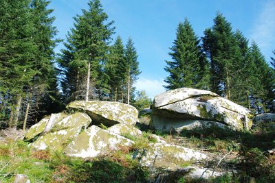
Les rochers de Chaveroche - D.Agnoux - CC VEM  Geological interest
The rocks of Chaveroche
How did the stone mastodons appear? In a few tens of millions of years, the earth from this puy was swept away by wind and rain, letting the granite mother rock appear on the surface. Geometric cracks (diaclases), have formed and the granite blocks, under the action of frost, have cracked and broken. Water and wind continued this long erosion work on the periphery of each monolith to give outcrops these rounded shapes.
Description
- From the car park, take the first forest track on the left. It runs alongside many spruce plantations with prickly needles. Leave the track coming from the left and continue to the right for 400 m until you reach the Pierre-Dure valley.
- Climb the steep track to the left. It climbs up to the Puy de Bessergue (915 m). At the top, leave the semblance of a path on the left, and go down the main track. 50 m further down, take the left track through the coniferous trees. Continue straight ahead along the track. Turn left onto the D119
- Take the track on the left. It goes around the Puy de la Justice, planted with Douglas fir. Continue by the track on the right, then by the D76 on the left for 500 m.
- Take the forest track on the right. Continue straight ahead along the track then, facing the slope, turn right and continue into the conifer plantations.
- At the crossroads, continue straight ahead to see the site of the rocks of Chaveroche, 300 m to the right (gigantic granite blocks that dominate the village of Péret-Bel-Air; remain vigilant with children), then retrace your steps.
- Follow the track on the right, then the wide track on the left and the D76 on the left to return to the starting point.
- Departure : Parking alongside the D76, before the Col de la Blanche
- Arrival : Parking alongside the D76, before the Col de la Blanche
- Towns crossed : Péret-Bel-Air and Davignac
Forecast
Altimetric profile
Recommandations
Chaos de Chaveroche: be careful with children from point 5.
Information desks
Carrefour de l’Epinette, 19550 Lapleau
1 rue Joseph Vialaneix, 19300 Egletons
Access and parking
10 km north of Egletons, by the D16 (in the direction of Saint-Yrieix-le-Déjalat) and D76.
Parking :
Parking alongside the D76, before the Col de la Blanche
More information
Report a problem or an error
If you have found an error on this page or if you have noticed any problems during your hike, please report them to us here: