Autour de la Sombre
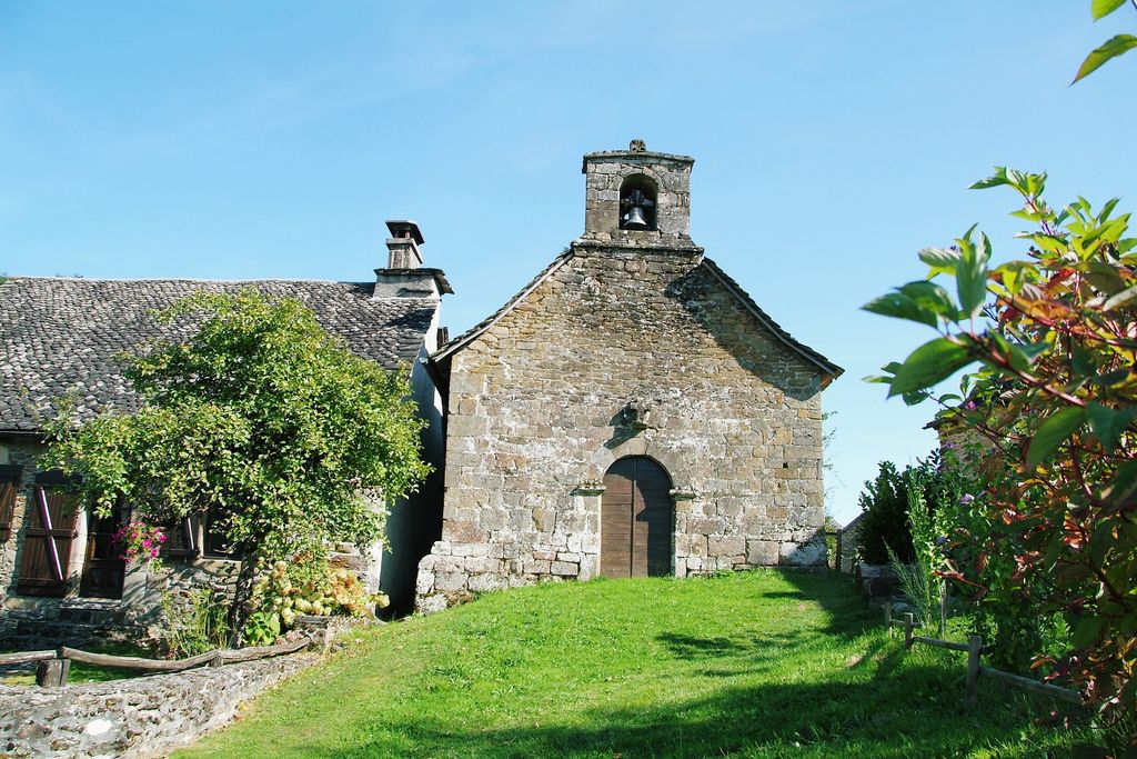
Laval-sur-Luzège Blue markers
Autour de la Sombre
Easy
3h
6,6km
+192m
-190m
Loop
Embed this item to access it offline
From the catchment of the Saint-Simon fountain to the Chastang reservoir and the Sombre micro-power station, man has never ceased to control and use watercourses for his needs.
5 points of interest
La Sombre - CC VEM  River
RiverThe Sombre
The source of this watercourse is on the heights of the municipality of Lafage-sur-Sombre, and it runs for about fifteen kilometres before falling precipitously into the Dordogne. La Sombre, ranked in the first category, is home to populations of Trout, Minnows and Gudgeon that breed in its clean, fresh waters.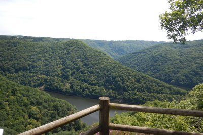
Belvédère du Roc Grand - CC VEM  Site
SiteMicro-power plant
The landscape opens onto the immense reservoir which covers more than 700 ha and supplies the last of the Dordogne's large dams, the Chastang. On different scale, below the viewing platform, is the micro-power station at La Sombre. A penstock carries water from the plateau to a turbine 170 m lower. This facility is private.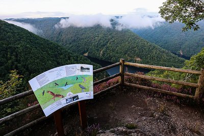
Belvédère du Roc Grand - D.Agnoux - Office de tourisme VEM  Panorama
Roc Grand
Overlooking the stream at Le Sombre and the Chastang reservoir, the Roc Grand belvedere offers an exceptional panoramic view. Cliffs and surrounding rocks offer a holiday home for two bird species accustomed to these rocky environments, the Peregrine Falcon (Falco peregrinus) and the Great Raven (Corvus corvax).
 History
The Gabariers
The Dordogne was a favoured commercial route to Bordeaux and the Atlantic coast. Large flat-bottomed boats, called garbariers, well-adapted to the turbulent and dangerous course of the river, carried wood (staves for barrel making, coal, etc.) during the very short flood period, in autumn or spring when the water is referred to as "marketable". The crews of the gabariers then embarked on a dizzying descent, among whirlpools, rapids and rocks.
La chapelle Saint-Simon - CC VEM HistoryThe Chapel of L'Herbeil
A young girl who had seen the White Lady on the edge of a wood spoke to the young Simon Mérillou of Le Suquet about it. He laughed at the story, saying that the White Lady was his fiancée. Later, she appeared to Simon, reminding him that she was his fiancée, "Woe to your Queen," she added, alluding to his young lady friend. A few days later, Simon discovered his Queen, perched on a rock overlooking the Dordogne, and the White Lady reaching out to him. There was a violent flash, and both sank to the bottom of the water. Simon discovered that the two deceased were twin sisters and built a chapel to house his two white queens.
Description
- At the sign, take the track, it runs alongside broad meadows (you may see the European stonechat). Continue on the path on the left.
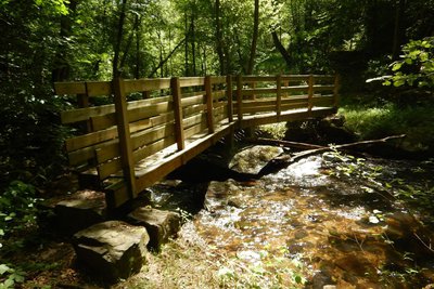
- At the next crossing turn left on the earth path, cross a small stream and after 50 m take a trail that descends on the right. Cross the bridge over the Sombre and continue on the trail until you reach the track
- Turn left onto the track. At Rouzeyrol, take the road on the right for 300 m. Then take the track on the left towards Roc Grand for 400 m.
- Continue along the track on the right. It leads to the Roc-Grand lookout point which overlooks the confluence of the Sombre and Dordogne rivers.
- Return to the fork (2.5 km round trip).
- Go along the meadow on the right, pass between the trees, alongside a field, then take the path through the coniferous trees that descend into the valley of the Sombre. Cross the stream (naturally dark in colour) and go up ahead by the road that leads into L'Herbeil. Go on through the hamlet to the Fontaine Saint-Simon sign.
- Turn right alongside the low walls to reach the Saint-Simon fountain. Go back to the road and turn right. Pass in front of the chapel Saint-Simon. Then leave a road on your left.
- Where a track crosses, continue on the road for 250 m then fork left onto another path. At the road continue straight ahead to find your starting point again.
- Departure : Path to the mobile phone mast, at the separation of the roads to Herbeil and Echamel
- Arrival : Path to the mobile phone mast, at the separation of the roads to Herbeil and Echamel
- Towns crossed : Laval-sur-Luzège and Saint-Merd-de-Lapleau
Forecast
Altimetric profile
Information desks
Carrefour de l’Epinette, 19550 Lapleau
1 rue Joseph Vialaneix, 19300 Egletons
Access and parking
Three km from the village of Poteau du Gay (located on the D 978 between Marcillac-la-Croisille and Spontour), take the road to l'Herbeil and Echamel.
Parking :
Path to the mobile phone mast, at the separation of the roads to Herbeil and Echamel
More information
Report a problem or an error
If you have found an error on this page or if you have noticed any problems during your hike, please report them to us here: