Les Agaries
Marcillac-la-Croisille Blue markers
Les Agaries
Medium
2h
2,8km
+145m
-144m
Loop
Embed this item to access it offline
Between the village of Nougein and Pierre Levée, this tour, with explanatory panels, offers a discovery of the natural heritage and past human activities in the gorges of the Dordogne.
8 points of interest
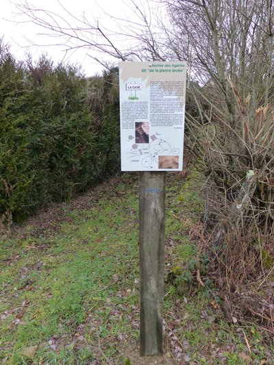
La cave - CC VEM  Heritage site
The cave
In 1990, the construction of a forestry track led to the discovery of a cavity, with the ground, which gave way under a lorry. After an excavation carried out with the authorisation of the Regional Directorate of Archaeology, the structure carved into the granite... (see the following panel 1).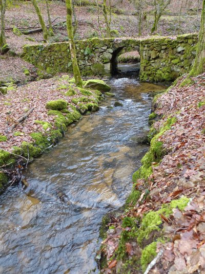
L'ancien pont - CC VEM Heritage siteBridges and Windmills
The Napoleonic land registry (1818-1842) shows the Agaries stream crossed by the trail you are following. You will cross two bridges, usually called "Roman bridges"... (see the following panel 2).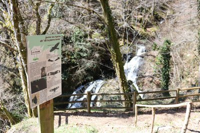
La Faune - CC VEM  Fauna
FaunaThe Fauna
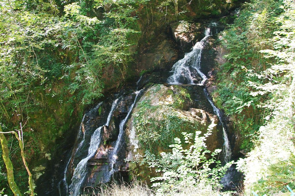
The Chastang dam not far from here is a very important breeding site for two bat species, the Greater mouse-eared and the Lesser horseshoe. (see the following panel 3).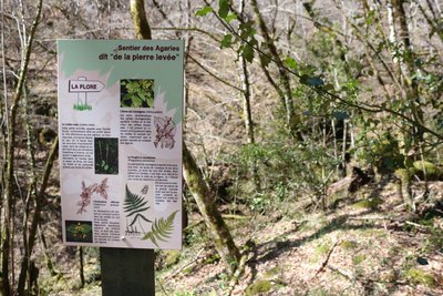
La Flore - CC VEM  Flora
FloraThe Flora
The Northern Beech Fern: this mountain pteridophyte appreciates lush undergrowth, stream banks and wet slopes and avoids very acidic soils. Alive and well in Corrèze... (see the following panel 4).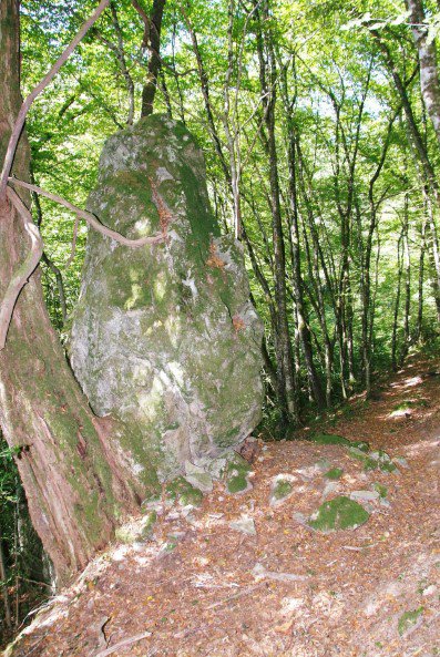
CC VEM Heritage siteThe "Pierre Levée"
Raised halfway down the slope, this monumental sentinel reminds us irresistibly of a powerful menhir from the depths of time. It doesn't take a lot of imagination to see strange shapes on these sides... (see the following panel 5).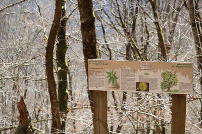
Séchoirs et châtaignier - CC VEM FaunaThe chestnut grove dryers
Known as the "Bread tree" and present in our countryside for many, many years, the chestnut tree was cultivated for its edible fruit, the chestnut. The result of selection and cultivation, there are more than 80 species of sweet chestnuts and more than 25 varieties of horse chestnuts... (see panel 6 below).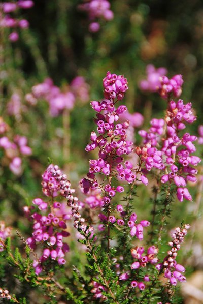
La lande - D.Agnoux - CC VEM FloraThe moorland
The moorlands, common in the past, have become very rare in Limousin today. Their conservation is also of European interest. There are several types of moorland whose composition is different depending on the geological substrate. (see the following panel 8).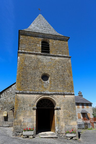
Eglise de Nougein - D.Agnoux - Office de tourisme VEM  Small patrimony
The chapel
Nougein would have had a chapel as early as the 12th century. Ruined in 1775, it appeared on the 1835 land register as an almost square construction of 7 m on each side, surrounded by a 40 x 10 cemetery... (see panel 9 below).
Description
- From the information panel, go down the track (the countryside of the Dordogne gorges), pass the panel (cave found during the excavation of the track) and continue along the track. In the undergrowth, turn left onto the trail edged by old dry-stone walls. It passes through the beech woods and descends.
- On the track, keep to the left for a round trip to the "Les Ponts et Moulins" panel, then retrace your steps and take the wooden stairs on the left, then go over the old bridge.
- Take the trail to the right on the embankment and go down along the stream, the Agaries, (vaulted bridge, diversion canal, imposing dyke and irrigation riser, witnesses of the past relating to water control). Continue on the trail to the left of the stream (lookout point and wildlife information panel facing the waterfall). Continue the descent (follow the markings carefully; the ground is slippery in wet weather). Pass the information panel about the flora, ford the stream and follow the right-hand bank of the stream to a footbridge (Access to Pierre Levée by the footbridge).
- Go up into the old chestnut grove (remains of a chestnut dryer). The path climbs up into the undergrowth (information panel about the forests of the gorges). Cross the track and continue the ascent by the path. It crosses the remains of the heather moorland and reaches the plateau. Continue along the small road and pass the bakehouse covered with stone (schist) tiles.
- Take the road to the right and pass the church.
- Follow the road towards Vergne and go straight ahead to return to the starting point.
- Departure : Nougein, Marcillac la Croisille
- Arrival : Nougein, Marcillac la Croisille
- Towns crossed : Marcillac-la-Croisille
Forecast
Altimetric profile
Recommandations
The descent along the Agaries stream is steep and slippery in wet weather.
Information desks
Carrefour de l’Epinette, 19550 Lapleau
1 rue Joseph Vialaneix, 19300 Egletons
Access and parking
5.9 km from Marcillac la Croisille, take the D18, then turn left onto the Nougein commune road, and in the hamlet of Nougein, turn left towards Vergne. Parking on the side of the road 50m to the right.
Parking :
Start of the track, Nougein
Report a problem or an error
If you have found an error on this page or if you have noticed any problems during your hike, please report them to us here: