History along the water's edge
Discover Confolent-Port-Dieu, built on a rocky outcrop at the confluence of the Dordogne and Chavanon rivers. From the source of the Bort-Les-Orgues dam to the last vestiges of Port-dieu, you will make your way through a preserved landscape where numerous brooks meander and deciduous and coniferous forests grow. A walk that is both physically challenging and cultural, you will walk through the Gorges of the Haute Dordogne as you discover the rich historical heritage of Confolent-Port-Dieu.
6 points of interest
G.Salat - CC HCC  Heritage site
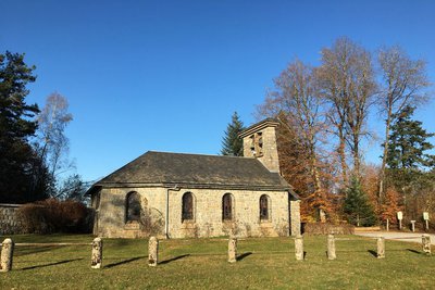
Bourg de Confolent Port Dieu
Confolent-Port-Dieu is a recent commune. In fact, the village of Port-Dieu, which gave its name to the first commune, was swallowed up in 1951 by the waters of the Bort-les-Orgues dam. The hamlet of Confolent, built on the heights and thus saved from the waters, was consequently established as a town and took the name of Confolent-Port-Dieu. And so, when the dam was impounded, a new commune was born. A church and a town hall were then built by EDF in the centre of the new village. This contemporary church is now the parish church. However, Confolent-Port-Dieu has two other religious buildings that bear witness to a rich medieval past.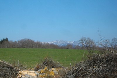
G.Salat - CC HCC  Panorama
Le Sancy
This hike will offer you several viewpoints overlooking the highest volcano in mainland France, the Puy de Sancy. At 1885 metres above sea level, this summit is the highest point of the Massif Central. The two streams, the Dore and the Dogne, originate there, and their confluence forms the Dordogne.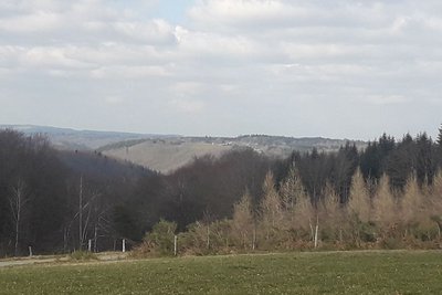
G.Salat - CC HCC  River
RiverThe Chavanon valley
A natural boundary between the Corrèze and the Puy de Dôme, the Chavanon is born from the confluence of two streams, the Ramade and the Méouzette.
It continues its course through gorges then flows into the Dordogne, upstream of the Bort-les-Orgues dam reservoir.
Classified Natura 2000 along its entire course, it is a river famous for its trout.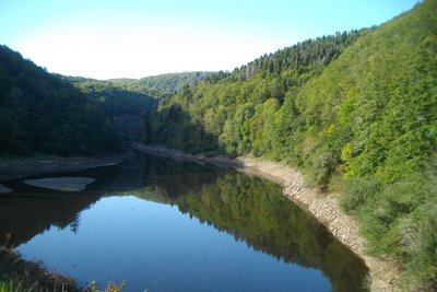
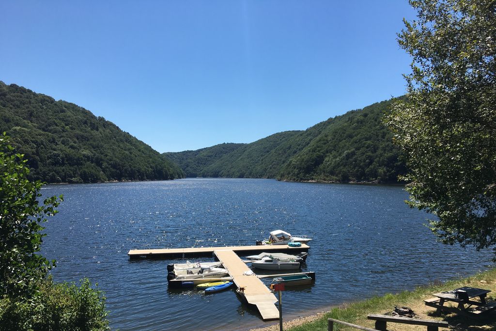
G.Salat - CC HCC  Lake
LakeBort Lake
The Bort-les-Orgues lake is an artificial lake of 10.72 km2 and results from the creation of the Bort-les-Orgues dam on the high course of the Dordogne. It marks the point where the river enters its gorges and is the first upstream hydroelectric development on the Dordogne.
The lake is 21 km long and is shared between the departments of Corrèze, Cantal and Puy-de-Dôme. Although there is no walking tour of the lake yet, a nature-sports festival takes place every year around 14 July, the Aquaterra, which includes trail and water sports.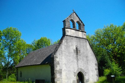
G.Salat - CC HCC  Small patrimony
The church of Saint Martin
Before the priory of Port-Dieu was founded, the parish church was that of Saint Martin. Built on the plateau at an altitude of 690 metres, the church of Saint Martin is today isolated next to a farm that has not been in use since 1920. In any case, Saint Martin is the original cradle of the parish.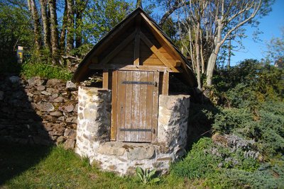
G.Salat - CC HCC Small patrimonyThe Bourrière well
The villages of Haute-Corrèze have all been involved in agriculture. Passing through these hamlets always provides a few unique discoveries during a hike: barns, manor houses, crosses, bread ovens... You have already come across several fountains from Port-Dieu. Don't miss the well and the bread oven in Bourrière.
Description
Park in the village near the church. Go towards the town hall and then follow the D 159 towards Singles.
- As you leave the village, turn right towards Confolent below for 50 m, then the forest track on the left. At the bend in the road, turn left down the trail. Cross the road and continue on the trail. Go right at the next two crossroads; the trail overlooks the Chavanon gorge.
- Off the route: a 200 m return trip to the Arpiat bridge. Go up the road to the right for 600 m, and at the hairpin bend, take the forest track to the left. Follow it for 1.5 km.
- Be careful: the path is not very visible: leave the track for a small trail on the right that winds upwards. It joins a path that you take on the left. Follow it for some time and join the road. Turn left onto it. At the crossroads with the path that leads to the church of St-Martin, go back as far as the Chapelle de la Manants: go down; at the barricade, turn left onto a trail that leads down to the chapel. Push on to the reservoir. Go up the road (on the left, you can make a round trip to the remains of the tower and the fountain).
- Take the trail on the left that leads up to the church of St Martin. Continue past the church; the path passes in front of a spring and then follows the stream in the coombe: cross it and follow the markings carefully in this part because the trail is sometimes not very visible. Once you reach a clearing, cross the stream again; continue to the right: the trail continues to climb and joins a path that you take to the right to reach the village of Bourrière.
- As you leave the village, take the path on the left. When you get to the wood, the track becomes a path and crosses a stream. Go back up to the road.
- Cross it, and continue on the path opposite. Follow this road to the right to return to the starting point.
- Departure : Bourg, Confolent-Port-Dieu
- Arrival : Bourg, Confolent-Port-Dieu
- Towns crossed : Confolent-Port-Dieu and Monestier-Port-Dieu
Forecast
Altimetric profile
Recommandations
Please note, the second part of the route is quite challenging.
Information desks
Access and parking
Coming from Ussel, follow the RD 1089 towards Clermont-Fd. Turn right onto the D27 and D159 towards Confolent-Port-Dieu
Parking :
More information
Report a problem or an error
If you have found an error on this page or if you have noticed any problems during your hike, please report them to us here: