Crossing paths
Saint-Pardoux-le-Vieux
Crossing paths
Easy
2h45
10,5km
+202m
-201m
Loop
Embed this item to access it offline
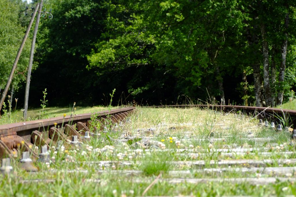
Hiking trails and railways intersect on this walk which, after an initial section through the woodland undergrowth, follows the line of the old Ussel-Felletin railway. Opened to the public in 1905, it facilitated transport of all kinds for the locals as well as for the soldiers at the Courtine camp.
4 points of interest
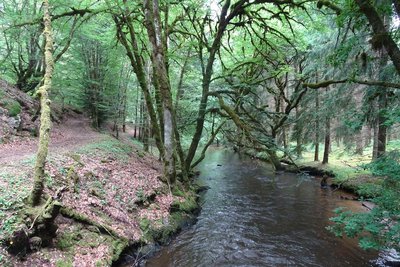
J.Primpier - PNRML  River
RiverLa Diège
The peaceful river Diège meanders through beautiful meadows before flowing through wild gorges. Rising a few kilometres upstream towards St Setiers, it flows into the Dordogne at the Marèges dam. The Diège valley is classified as a Natural Zone of Interest for its Fauna and Flora, its wild and preserved character allowing it to host the otter in particular.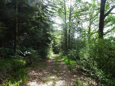
J.Primpier - PNRML  Flora
FloraThe sloping forest
The forest covers 50% of the area of Saint-Pardoux. In the past, most of its territory was covered by moorland. Following the agricultural revolution and the rural exodus of the 20th century, the forest appeared in various forms: either it arose and grew spontaneously on areas left fallow because they had become difficult to exploit, or it was planted by people in search of additional income. Three forest types exist: deciduous (on the slopes of steep valleys), coniferous and/or mixed.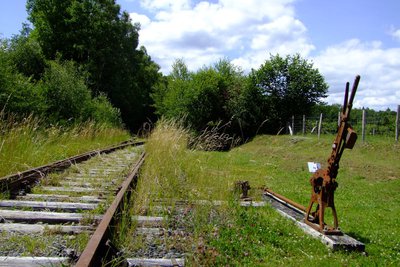
CC HCC  Site
SiteThe SNCF line
The forest covers 50% of the area of Saint-Pardoux. In the past, most of its territory was covered by moorland. Following the agricultural revolution and the rural exodus of the 20th century, the forest appeared in various forms: either it arose and grew spontaneously on areas left fallow because they had become difficult to exploit, or it was planted by people in search of additional income. Three forest types exist: deciduous (on the slopes of steep valleys), coniferous and/or mixed.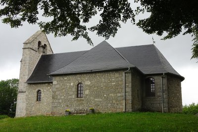
J.Primpier - PNRML  Heritage site
The town of Saint-Pardoux
Next to the village church stands a cross built by local people, who marked their territory with directional and protective signs for the inhabitants, peddlers and travellers in the past.
Description
From the town hall car park, return to the church and turn right.
- Cross the railway line and continue straight ahead. After going up into the forest, turn left.
- Where the paths cross, go right.
- Don’t forget to leave the road and go down the inconspicuous path on the left. Don't hesitate to get closer to the banks of the Diège.
- At the road turn left, then immediately turn right. Further on, leave the departmental road and take the right-hand path.
- Turn right at the railway and follow it as far as the intersection with the road.
- Join the departmental road to the left and then take the second path immediately on the left.
- Opposite the fence, go around the meadow, forking right and then left to reach the path again.
- Turn right at the small road to get to the car park.
- Departure : Saint-Pardoux Church
- Arrival : Saint-Pardoux Church
- Towns crossed : Saint-Pardoux-le-Vieux
Forecast
Altimetric profile
Recommandations
The banks of the Diège can sometimes be flooded during rainy periods.
There is a shorter variant of 7.5 km. At point 5, turn left to follow the SNCF line that goes to the station. For this variant of the route, you can start at the station.
There is a shorter variant of 7.5 km. At point 5, turn left to follow the SNCF line that goes to the station. For this variant of the route, you can start at the station.
Information desks
Access and parking
8 km from Ussel, follow the D 982 then the D 80.
Parking :
Saint-Pardoux Church
More information
Report a problem or an error
If you have found an error on this page or if you have noticed any problems during your hike, please report them to us here: