Two peaks circuit, short variant
Saint-Oradoux-de-Chirouze Red markers
Two peaks circuit, short variant
Easy
1h30
4,5km
+85m
-85m
Loop
Embed this item to access it offline
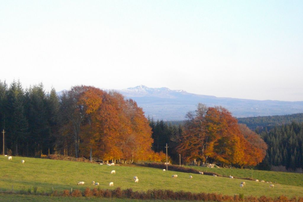
Head for the Puy des Chaires, the highest point of the Creuse, through the Châteauvert forest. With an exceptional view of the Massif du Sancy as a bonus.
4 points of interest
G.Salat - CC HCC  Small patrimony
La Croix de Barbe
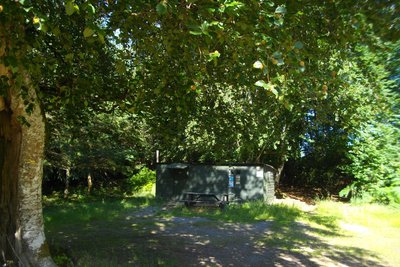
The presence of the typical hunters' hut at the start of this hike (the testimonies in the visitors' book inside prove that it is also used as a shelter for hikers, soldiers on manoeuvres...) reminds us of the richness of the woodland undergrowth of the Plateau de Millevaches: game, blueberries, mushrooms, so many gourmet treasures that can be found on our restaurant owners’ menus.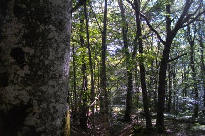
G.Salat - CC HCC  Forestry
The Châteauvert forest
The forest of Châteauvert is a vast massif composed mainly of deciduous trees and, more particularly, beeches. At over 900 metres, this forest has one of the highest beech forests in the region. It is defined as an old growth forest, which has been continuously wooded for at least 150 years: naturalists, therefore, consider that its ecosystem corresponds to an optimum close to environments where man has never intervened.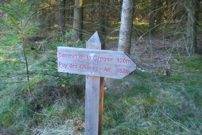
G.Salat - CC HCC  Source
The highest point of the Creuse
On your right in the undergrowth, under the moss, try to locate a high point marked with a small cement marker: this is the highest point in the Creuse at 932 metres. We are also at a watershed: the springs that run north-west join the river Creuse, a tributary of the Vienne and then the Loire, while the others run towards the Dordogne.
Note that the low point of the Creuse is at the edge of the Creuse at Crozant, altitude 197 m.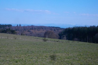
G.Salat - CC HCC  Panorama
The Massif du Sancy
This hike will offer you several viewpoints overlooking the highest volcano in mainland France, the Puy de Sancy. At 1,885 metres above sea level, this summit is the highest point of the Massif Central. The two streams, the Dore and the Dogne, originate there, and their confluence forms the Dordogne.
Description
Park at the Croix de Barbe crossroads. Take an earth path opposite the hut. Continue always straight ahead.At the high point sign, walk back to the small cement marker that marks this point. Continue straight ahead. Ignore the path for variant 1 on the right. The path becomes a track; go right at the next crossroads.At the crossroads, follow the track on the right. Continue straight ahead until you reach the road.Follow this road to the right to return to the starting point.
- Departure : La Croix de Barbe clearing, St-Oradoux de Chirouze
- Towns crossed : Saint-Oradoux-de-Chirouze, Saint-Martial-le-Vieux, and Lamazière-Haute
Forecast
Altimetric profile
Recommandations
This path has a shorter version and is also the shorter version of a longer circuit. Each is the subject of a separate information sheet. Shooting takes place regularly near the military camp of La Courtine. Don't worry; it only happens inside the military compound.
Information desks
Access and parking
From La Courtine, follow the D996 towards St-Oradoux for 6 km. Then follow the "route forestière" for 2 km. The circuit starts at the Croix de Barbe clearing.
Parking :
La Croix de Barbe clearing, St-Oradoux de Chirouze
More information
Report a problem or an error
If you have found an error on this page or if you have noticed any problems during your hike, please report them to us here: