The field of birds
Eygurande
The field of birds
Medium
4h
15,1km
+264m
-267m
Loop
Embed this item to access it offline
The name of this hike is a reference to the rural landscapes of Eygurande but also to the melodious songs of the birds, which, with a little luck, will accompany you on this walk. From the cockerel to the magpie, from the blackbird to the woodpecker to the chaffinch, we invite you to a real concert.
4 points of interest
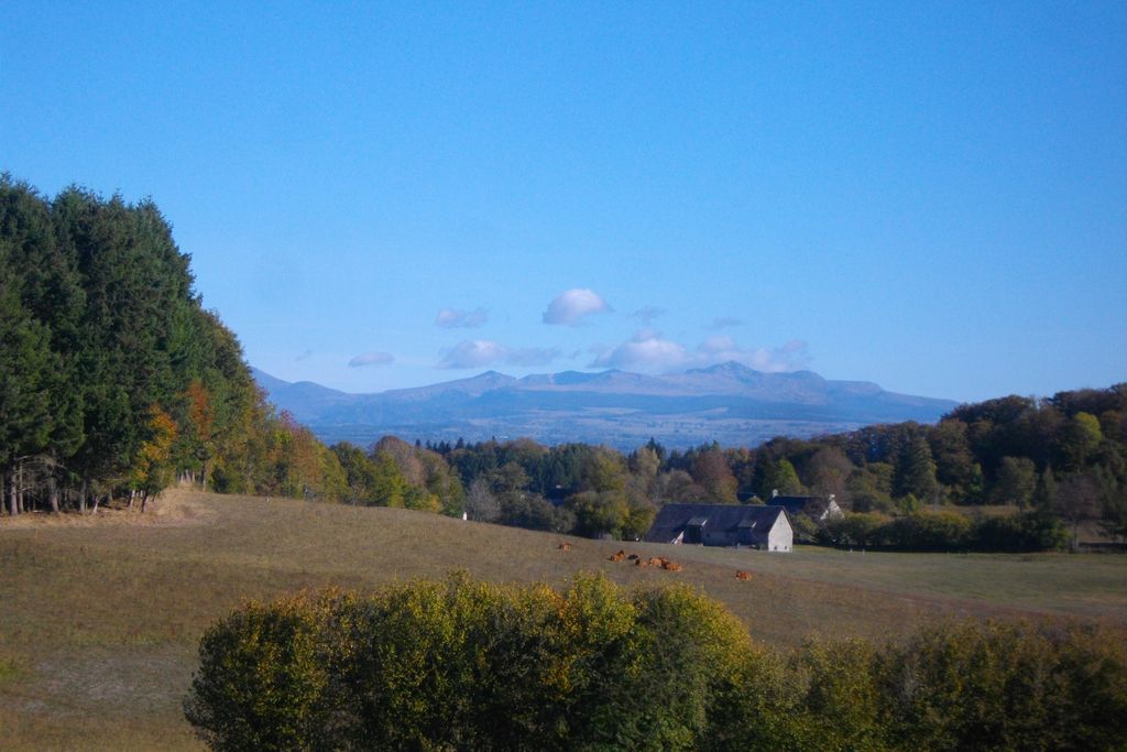
Bourg d'Eygurande - G.Salat - CC HCC  Heritage site
Town of Eygurande
Eygurande is a transitional region between the Auvergne Volcanoes and the Limousin Mountains. Its name comes from the Gallic word Icoranda, meaning a territorial boundary.
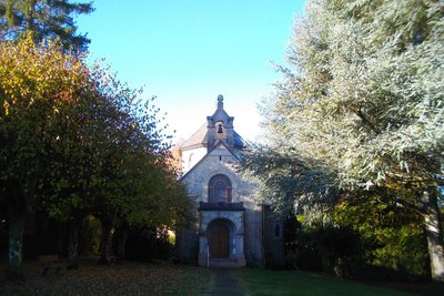
The commune has 700 inhabitants and offers all the services of a small rural town. Don't miss the neo-Roman style chapel of Notre Dame d'Eygurande, built in 1922, behind the town hall square; and the parish church of St-Loup.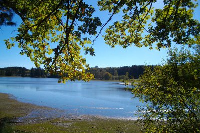
Etang de l'Abeille - G.Salat - CC HCC  Pond
PondAbeille pond
Tourism in Correze is based on the richness of its rivers and ponds. From the 1970s onwards, a number of communes created a lake with a campsite, holiday village, swimming... However, the Abeille pond (which takes its name from the river that feeds it) has a more unusual history since the Dutch engineers stationed at the La Courtine camp created the swimming area and sports fields in 1964. Ideal for family holidays, the lake offers an original form of accommodation with floating chalets.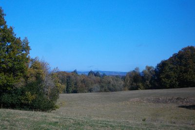
Vue sur le Puy-de-Dôme - G.Salat - CC HCC  Panorama
Puy de Dôme
The Puy de Dôme is an ancient volcano that gave its name to the eponymous department. At the height of 1,465 metres above sea level, it is the highest volcano in Chaine des Puys, a volcanic complex of 80 volcanoes.
A TDF antenna has become the symbol of the site and makes it very easy to identify. Also, at its summit, is a Gallo-Roman temple dedicated to Mercury. While the bravest can make the ascent on foot, a rack and pinion train gives access to the summit.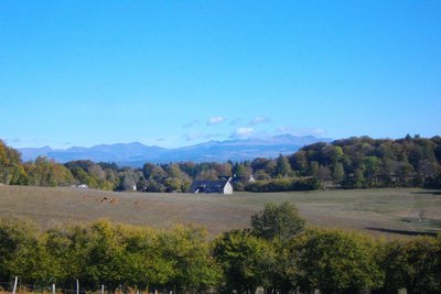
Vue sur le Sancy - G.Salat - CC HCC PanoramaMassif du Sancy
This hike will offer you several viewpoints overlooking the highest volcano in mainland France, the Puy de Sancy. At 1885 metres above sea level, this summit is the highest point of the Massif Central. The two streams, the Dore and the Dogne, originate there, and their confluence forms the Dordogne.
Description
Depart from Place de la Mairie, the Town Hall. Head towards the church. Take the street on the left just after it; pass in front of the multi-purpose hall.
- Find the D21 and turn right. Pass the Lavergne stream and then the residential area.
- Turn right onto the small road to the right towards VVF. Follow it for 100 m and turn right onto the path that leads down to the lake. Go around it to the right. After 2 footbridges, you arrive at the road.
- Cross and go up the road opposite. At the old rural dwelling, take the path on the right that climbs into the wood. At the top on the right; turn right at the next crossroads to return to the road.
- Follow the D22 to the left for 300 m. Follow the track on the right to Fouleix.
- Follow the road to the right for 50 m. and then the tarmac track to the left, towards La Vialatte. Ignore the first path to the right and take the second. Find a road that you take on the right, leave a track on your left, take the second one on the left. Leave a path at the bottom of the valley on your left and then a track on the hill. The track becomes a road. At the next crossroads, turn left to reach the departmental road.
- At the crossroads, take the tarmac track that climbs upwards at the wooden cross. Follow it for 1 km. At the T-junction, turn right for 150m and then left along a trail that is not very clear and runs through a plantation. Find a path and turn left.
- At the crossroads, follow the sign to Bigoulette; at the next crossroads, go towards Lascoux. Leave Lascoux on your right, continue to Fontvieille. Take the road to the left and go through this village.
- The road becomes a track; leave a track on the left; continue. Take a path to the right before the SNCF bridge.
- Take the road to the left, then the right. Go through Les Verges. Turn left at the next crossroads. Continue straight on to reach Eygurande.
- Departure : The City Hall Square, Eygurande
- Arrival : The City Hall Square, Eygurande
- Towns crossed : Eygurande and Lamazière-Haute
Forecast
Altimetric profile
Information desks
Access and parking
Coming from Ussel, follow the RD1089 towards Clermont-Ferrand; In Merlines, turn left towards Eygurande.
Parking :
The City Hall Square, Eygurande
More information
Report a problem or an error
If you have found an error on this page or if you have noticed any problems during your hike, please report them to us here: