The Servières Rocks
A circuit marked by water and granite: after exploring Lake Servières and going through the village of the same name, the walk leads to the Rocks of Servières. Erosion has sculpted these strange blocks of granite, where the River Vienne flows through the gorges. You then follow a Roman road alongside the lake and go up into the Chamboux state forest. On the way back, you can admire the Vinzannet bridge, the Luguet mill, the Rebière Nègre peat bog and the Mouton cross.
9 points of interest
G.Salat - CC HCC  Heritage site
Peyrelevade
Located in the heart of the Millevaches Regional Nature Park in Limousin, in the north of the Corrèze department, the commune of Peyrelevade is rich in the architectural, natural and landscape heritage so characteristic of the Millevaches Plateau.
The commune takes its name from one of these standing stones (Peira Levada in Occitan), frequent in the region before Christianisation.
It has 850 inhabitants. In 2015, an asylum seekers' centre was opened, accommodating 70 people.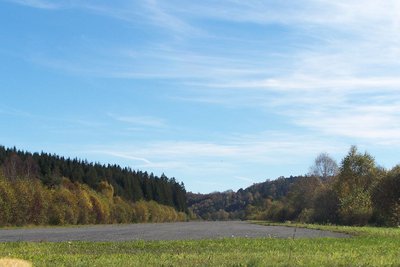
Piste de l'aérodrome - G.Salat - CC HCC Heritage sitePeyrelevade airfield
In the heart of the Plateau de Millevaches, the commune built the airfield at the end of the 1980s. Driven by aviation enthusiasts, the project also included the creation of an aviation development. It was used as a training site for the Egletons school of public works.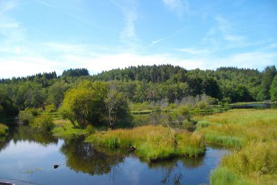
Etang de Servières - G.Salat - CC HCC  Lake
LakeLake Servières
The Servières lake belongs to EDF and diverts part of the flow of the Vienne to the hydroelectric complex at Lake Vassivière. Due to lack of maintenance, the site was drying up. Implementing a Natura 2000 contract in 2011 has enabled major restoration work to be carried out, particularly logging accompanied by skidding using animal traction. The site has been restored and is now maintained by grazing.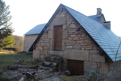
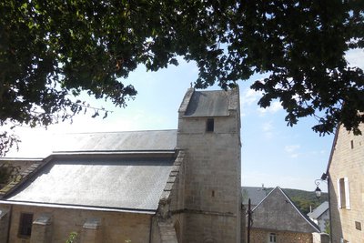
Village de Servières - G.Salat - CC HCC Heritage siteThe village of Servières
The village of Servières will captivate you with its authentic granite houses, its low stone walls and its traditional architectural elements. At the edge of the village, a bakery has been restored by the La Pierre Levée association, which brings this building back to life each summer during a bread festival.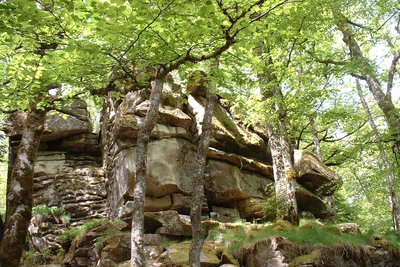
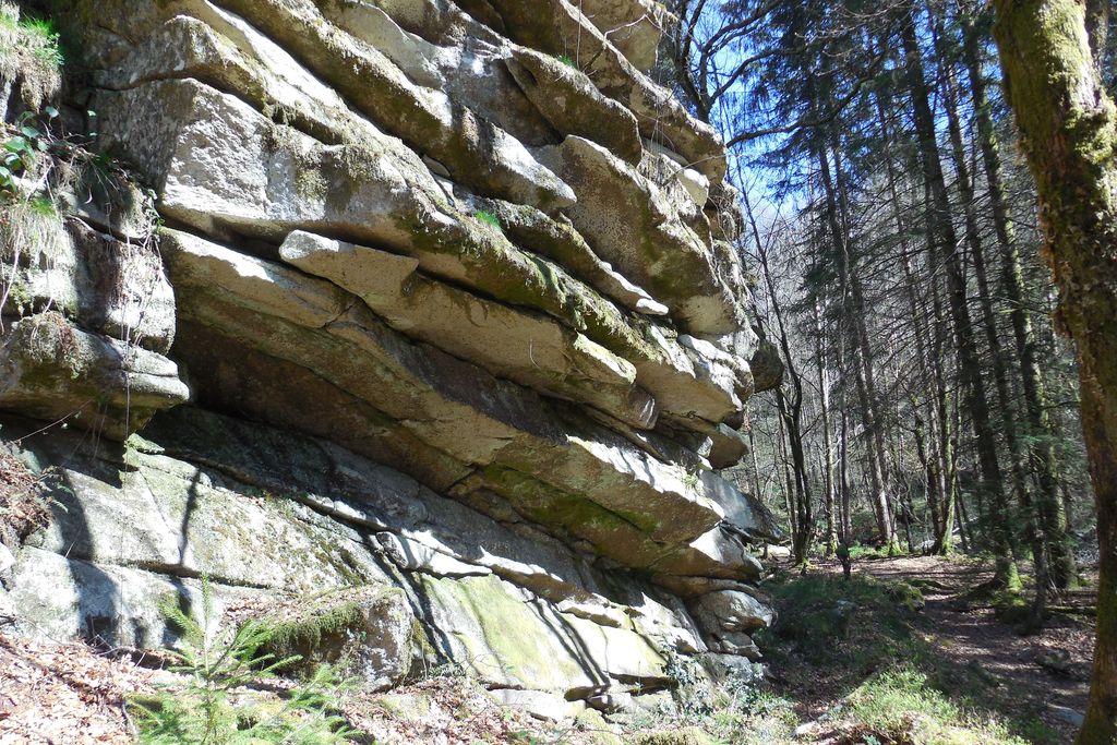
Les Rochers de Servières - G.Salat - CC HCC  Geological interest
The Rocks of Servières
Servières is a mysterious site where the granite rock is affected by both horizontal and vertical fracturing, which cuts it into blocks several metres wide. Horizontal cracks (or diaclases) give a "millefeuille" appearance”.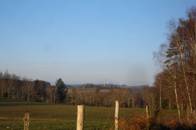
Eoliennes - G.Salat - CC HCC  Site
SiteWind turbines
This itinerary will focus on renewable energies since after hydroelectricity, here comes wind power. In the distance, on the flat area beyond the Chamboux forest hill, there are 6 wind turbines.
In 2005, the first wind turbines were installed in Limousin (the only project to date). These 6 wind turbines produce the equivalent of the needs of a town of 17,500 inhabitants.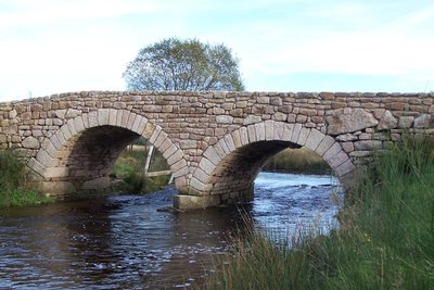
La Vienne - G.Salat - CC HCC  River
RiverThe Vienne
A tributary of the Loire, this 370 km long river has its source a few kilometres upstream from Peyrelevade (there is an interpretation circuit so you can get to know it). Classified as a Natura 2000 site, it winds through wetlands and peat bogs. Don't miss the magnificent Vinzannet and Luguet mill bridges which allow you to cross the river.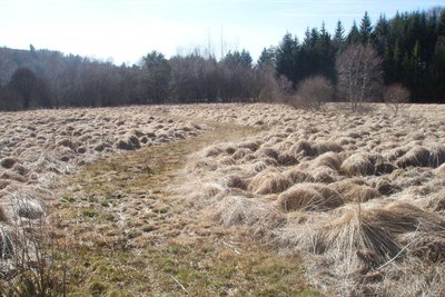
Tourbière  Peat bog
The Rebière-Nègre peat bog
At the Peyrelevade campsite, the water body created in 1976 was removed in 2019: the River Vienne once again winds its way through the bog. Typical alveolus (honeycomb) landscape of the Plateau de Millevaches: the granitic peaks are covered with heather moorland (off the circuit. The ascent of the Puy du Gué offers a magnificent view of this site), the slopes are farmland dotted with south-facing villages, and the wetlands are once again of interest for grazing herds in times of drought.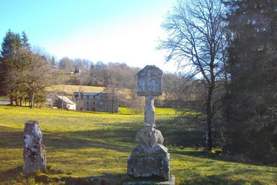
Croix du mouton - G.Salat - CC HCC Heritage siteThe Sheep cross
This granite cross, which can be dated to the 16th century, is undoubtedly one of the most beautiful and imposing roadside crosses in the Corrèze; with four elements in detail: a capital, a shaft resting on a ram that is itself installed on a plinth.
This cross is located in an area marked by the presence of the Templars, and some have put forward the controversial hypothesis of a Templar cross in connection with the nearby commandery of Feniers...
Description
Depart from Pra Bé. Go up to the Place de la Fontaine. Head towards Gentioux. At the church, on the right, go towards St-Setiers, then left towards the cemetery
- At the cemetery, the track on the left leads to Chez Le Prou.
- In the village, turn left and then immediately right. At the last house, take the track to the right. At the first crossroads, turn left. Next, go right to the end of the airfield runway; go up to Ludinas.
- In the village, turn left. At the departmental road, turn right for 20 m. then left onto the track. At the next crossroads, take the track on the left. It joins a road that you take on the left towards Lake Servières.
- At the lake, turn right then left to go into Servières. Go straight through the village.
- Continue along the path, which will describe a loop, ignoring several tracks on the left. Go past the site of the rocks and return to point 5. Take the path to the right: go past the bakery and down towards the Vienne.
- After the bridge, turn left onto the path that runs alongside the river. Pass to the right of the embankment; go on alongside the lake to reach the road.
- Turn left and, after the bridge, follow the track on the right that rises into the Chamboux forest. On the flat, the track on the left leads to Vinzannet.
- In the village, at the crossroads, go straight ahead. The road becomes a track leading down to the Vienne. After the bridge, go straight on to join the road.
- Follow it to the right for 300 m. At the crossroads with the Ludinas road, follow the track to the right. Cross the Vienne. At the next crossroads, turn left; join the road and follow it to the left. Descend to a wetland.
- Go along beside it, passing below the gîtes and the campsite. Pass below the play area and cross the Rebière Nègre peat bog by the decking; straight on to join the road and the Croix du Mouton, the sheep cross.
- Follow the road to the left, then the right. keep going straight ahead: the Chemin des Côtes returns to the start.
- Departure : Pra Bé Square, Peyrelevade
- Arrival : Pra Bé Square, Peyrelevade
- Towns crossed : Peyrelevade and Tarnac
Forecast
Altimetric profile
Recommandations
At the Servières site, this route crosses another route starting from Tarnac. Follow the route markings carefully.
Information desks
Access and parking
From Meymac, follow the D36 towards the town centre. Millevaches. 4 km after Millevaches, take the D21 towards Peyrelevade.
Parking :
More information
Report a problem or an error
If you have found an error on this page or if you have noticed any problems during your hike, please report them to us here: