The path to the summit of the Agriers
Lamazière-Haute
The path to the summit of the Agriers
Medium
3h
12,5km
+275m
-275m
Loop
Yellow markers
Embed this item to access it offline
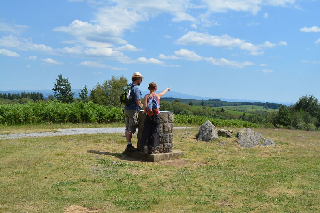
Formerly heathland, the Agriers forest massif has been wooded since the 1970s. This walk will be an opportunity to discover several elements of heritage, objects of stories and legends: the stones of the Plaine des Filles, the cross of the 4 trees, the counterweight well, and the dolmen at Chevatel. Culminating at 915m, the Puy du Vareyron with its orientation table offers an exceptional view of the Monts d'Auvergne.
6 points of interest
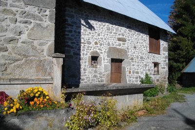
Bourg, lavoir - G.Salat - CC HCC  Heritage site
Lamazière-Haute
The commune of Lamazière-Haute, with 67 inhabitants, is divided between meadows and forests. The village is located on a south-facing flat area, well-sheltered from the north by the Redon and Salé Puys. Relatively off the beaten track, it is home to a beautiful 12th-century church and some interesting traditional features: A carved barn lintel, a wash house/laundry, and a bread oven.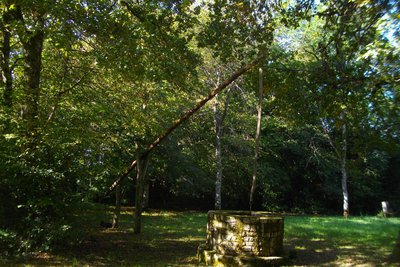
Puits - G.Salat - CC HCC  Small patrimony
The counterweight well
The counterweight well is the only visible evidence of the village "Chez Nanet".
Its operation is simple: it is based on the principle of a lever, supported in its middle on a pivot and carrying a container at one end and a counterweight at the other. Simply vary the weight of one of the arms to give it a rocking movement.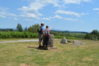
G.Salat - CC HCC  Flora
FloraLes Agriers
This massif which culminates at 915 m at the Puy du Vareyron, is the property of a forestry syndicate, managed by the Office National des Forêts. It covers 600 hectares, most of which is used for forestry production. This afforestation was carried out from the 1970s onwards, on heather moors with juniper bushes, which were used for grazing sheep. An arboretum, a fire pond and a sports trail also make this forest a place of welcome.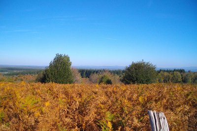
Puy de Dôme - G.Salat - CC HCC  Panorama
The Puy de Dôme
The Puy de Dôme is an ancient volcano that gave its name to the eponymous department. At the height of 1,465 metres above sea level, it is the highest volcano in Chaine des Puys, a volcanic complex of 80 volcanoes.
A TDF antenna has become the symbol of the site and makes it very easy to identify. Also, at its summit, is a Gallo-Roman temple dedicated to Mercury. While the bravest can make the ascent on foot, a rack and pinion train gives access to the summit.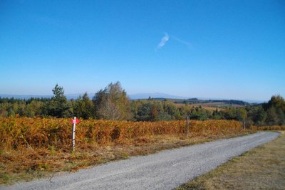
Vue sur le Sancy - G.Salat - CC HCC PanoramaLe Massif du Sancy
This hike will offer you several viewpoints overlooking the highest volcano in mainland France, the Puy de Sancy. At 1885 metres above sea level, this summit is the highest point of the Massif Central. The two streams, the Dore and the Dogne, originate there, and their confluence forms the Dordogne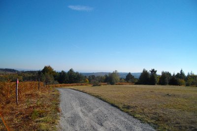
G.Salat - CC HCC PanoramaThe Cantal Mountains
Separated from the Sancy by the Cézallier Plateau, the Monts du Cantal lie to the west. This massif is, in fact, the remnant of a stratovolcano born 13 million years ago, the largest in Europe, eroded by collapse and glacial erosion.
Description
Park on the edge of the D21E3 road towards the town hall and the war memorial. Set off towards the village.
- At the exit, follow the road towards the Massif des Agriers. Go on alongside the cemetery and straight ahead at the "Chez Nanet" rest area. At the next crossroads with the road, go left. A little further on, turn left onto the path that climbs and then drops down to the road. Pass in front of "la Plaine des Filles" and continue to the crossroads.
- Go straight on towards Bongue; go past the pond and the arboretum. At the Croix des Quatre Arbres crossroads, turn left towards the orientation table; continue straight ahead until you reach the Puy du Vareyron.
- Take the path behind the orientation table. Follow the track to the left and then the road that runs downhill for 200 m. Take the path on the left alongside the pastureland. It joins a track, which you take to the right; go straight on at the next crossroads towards the "reception area".
- At the next crossroads, turn right to take the track you already took on the way out. A little further on, climb the path that cuts the bend. At the next crossroads, take the track on the right that leads to the "Chez Nannet" rest area.
- In this area, take the path to the right, pass the well and join the road, which you follow to the left.
- Turn left at the next crossroads. A little further on, take the road to the right for a round trip to the dolmen. Proceed to Lamazière.
- Departure : Car park at Placette de la Mairie, Lamazière-Haute
- Arrival : Car park at Placette de la Mairie, Lamazière-Haute
- Towns crossed : Lamazière-Haute, Couffy-sur-Sarsonne, Eygurande, and Saint-Martial-le-Vieux
Forecast
Altimetric profile
Recommandations
This path describes a figure 8, so follow the signs. A portion marked in yellow after the Puy du Vareyron is also common with the "white track" of St-Martial le Vieux.
Information desks
Access and parking
The departure point is 5 km from Eygurande: follow the D21 headed towards Couffy, then the D21E3 towards Lamazière.
Parking :
Car park at Placette de la Mairie, Lamazière-Haute
More information
Report a problem or an error
If you have found an error on this page or if you have noticed any problems during your hike, please report them to us here: