The large water Valley
Sainte-Marie-Lapanouze
The large water Valley
Medium
3h
10,6km
+191m
-190m
Loop
Yellow markers
Embed this item to access it offline
Country walk around Sainte-Marie Lapanouze. A first small circuit allows you to explore the neighbourhood of the village. The second part of the walk leads to the valley of the Eau Large stream, a tributary of the Dordogne.
4 points of interest
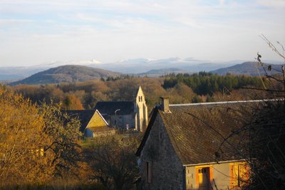
G.Salat - CC HCC  Panorama
Le Massif du Sancy
This hike will offer you a remarkable view of the highest volcano in metropolitan France, the Puy de Sancy. At 1885 metres above sea level, this summit is the highest point of the Massif Central. The two streams, the Dore and the Dogne, originate there, and their confluence forms the Dordogne.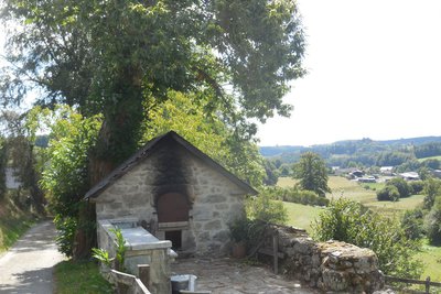
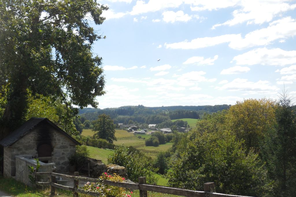
Four à pain - G.Salat - CC HCC PanoramaViers
At the end of a long stretch in the woodland undergrowth, arriving in the village of Viers surprises with the panoramic view of this wide valley. The Eau Large Haut stream meanders through the meadows before joining the Dordogne at an impressive waterfall, the Saut de Juillac (see the Milan trail at Liginiac). Note the pretty bread oven on the roadside.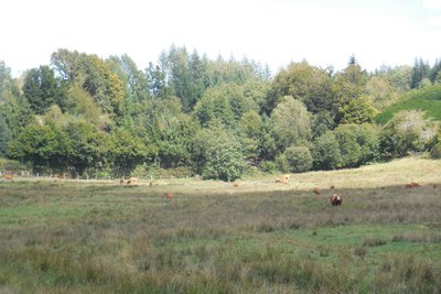
Prairies - G.Salat - CC HCC  Flora
FloraWet meadows
Situated at the bottom of valleys, often in spring areas or on the bank of a stream that is barely flowing, wet meadows and peat bogs provide small reserves of fodder in times of drought. Livestock find food there during very hot and dry weather events. In the spring, these areas are also good for dragonflies.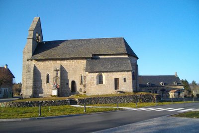
Eglise - G.Salat - CC HCC  Heritage site
Sainte-Marie Lapanouze
The 55 inhabitants of Ste-Marie enjoy the peace and quiet of this fertile countryside, Lapanouze, meaning rich in wheat.
The church dates from the 12th century and is listed as a Historic Monument (note the originality of its sculpted corbels), as is the base of the cemetery cross, an ancient altar. Note also the church gate with its disturbing decoration, contrasting with the bucolic charm of the walk.
Description
Departure from in front of the Mairie, the town hall. Go towards St-Etienne la Geneste and turn right before the multi-purpose hall.
- Follow the road for 200m, then turn left onto the track. Turn left at the next crossroads to find the RD168 at the village of Cornecul.
- Cross the main road and take the road opposite, which you follow for 500 m. Turn right at the crossroads and then right again onto a wide track that follows the power line.
- Fork left and then go right. Continue straight ahead; the track becomes a trail through the undergrowth. It joins a tarmac track.
- Follow this to the right, then take the road to the left. Go through the village "Chez Babar". Leave a track on your right, then, at La Besse, leave the road to take a small path on the left that crosses a wetland.
- Where the paths cross, turn right; continue straight on through the woodland.
- At the crossroads with the road, follow the track to the left; ignore the first path to the right and take the second. Keep straight on to reach the village of Viers. Go through it, and go down to the crossroads.
- Turn right to reach the village of Vedrenne. At the crossroads, turn left to go up towards the farm. Just after it, take a small, inconspicuous path on the left. Follow it to a crossroads with a track.
- Follow it to the left; join the road that you take on the right and then on the left to reach the starting point again.
- Departure : Town Hall Suare, Sainte-Marie Lapanouze
- Towns crossed : Sainte-Marie-Lapanouze, Saint-Étienne-la-Geneste, Chirac-Bellevue, and Liginiac
Forecast
Altimetric profile
Information desks
Access and parking
From Ussel, follow the D982 towards Bort. As you leave Mestes, take the D168 towards Ste-Marie. From Liginiac, D 20 towards Bort then the D168 towards Ste-Marie.
Parking :
Town Hall Suare, Sainte-Marie Lapanouze
More information
Report a problem or an error
If you have found an error on this page or if you have noticed any problems during your hike, please report them to us here: