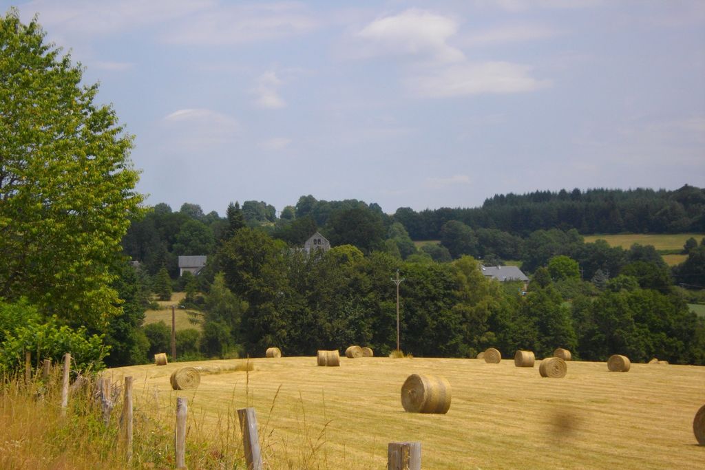
A country path
Bellechassagne
A country path
Medium
2h
7,4km
+148m
-148m
Loop
Yellow markers
Embed this item to access it offline
Take this trail to explore the countryside in the heart of the Millevaches plateau. Enjoy the Haute-Corrèze, a calm and gentle place. The village was an important administrative centre for the Knights Templar. The remains still visible, both the church and the crosses, allow you to imagine the settlement and its interesting past.
5 points of interest
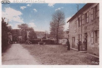
Auteur inconnu  Heritage site
Bellechassagne
The origin of the name "Bellechassagne" would simply be "Beautiful oak". In an ancient writing it is referred to as "the Garden of the Mountain", a sweet oasis amid the cold heathers that so uniformly cover the Plateau de Millevaches. ». The 89 inhabitants of Bellechassagne counted in the 2017 census have adopted a gentle way of life.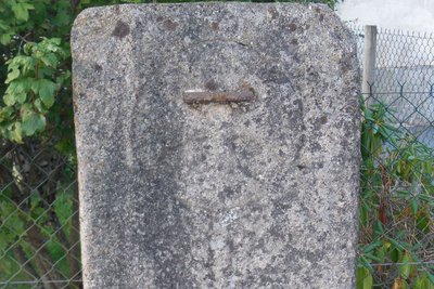
Dalle funéraire - G.Salat - CC HCC  Archaeology
The Templar Commandery
Bellechassagne was the seat of a prosperous Templar administrative centre with an agricultural vocation.
However, in the middle of the Religious Wars, this administrative centre was destroyed. Falling into the hands of a Protestant leader who was taken prisoner, it regained its freedom against the abandonment of Bellechassagne, which was razed to the ground in 1588.
The headquarters was in the centre of the town. Just a few elements are visible: a door lintel of the village hall, the cross in front of the church above the bells and the funeral slab behind the fountain.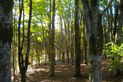
G.Salat - CC HCC  Forestry
The beech wood
The beech grove on the edge of the track is a reminder that the Plateau de Millevaches forest is not only made up of softwood trees.
As a result of agricultural abandonment on the one hand and landowner awareness-raising campaigns on the other, the landscape has changed over the last century from moorland to heath to planted forests.
It is impossible not to mention Marius Vazeilles who, as a visionary, promoted an economic system based on the complementarity of agriculture and forestry.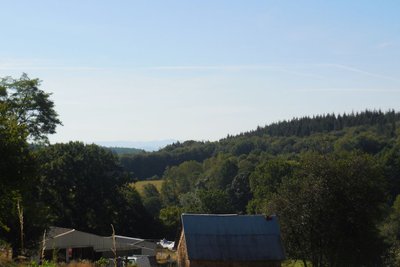
G.Salat - CC HCC  Panorama
The Cantal Mountains
Before the village of Le Bouix, in the background, the Cantal mountains. This massif is, in fact, the remnant of a stratovolcano born 13 million years ago, the largest in Europe, eroded by collapse and glacial erosion.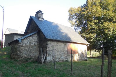
G.Salat - CC HCC Heritage siteThe bread oven
The villages of Limousin were all heavily involved in agriculture. Walking through these hamlets always produces interesting discoveries during a hike: barns, mansions, crosses and monuments, traditional local architecture...
Notice the bread oven at the entrance of the village, which is sometimes re-lit for social events.
Description
Departure from the Place de Bellechassagne. Take the RD 80 south towards Saint-Germain-Lavolps.
- Take the wide path on the right at the end of the village. It joins a road that you need to take on the left.
- At the next crossroads, turn left towards the RD 30 E3. At the departmental road, follow this road on the left for about a hundred metres and take the trail on the right. Follow it to the small village of "Seringour". Turn right on this side road to get back onto the RD 30 E3.
- Take the track on the right towards the small village of "Bos Jean". Follow it straight on for about 2.5 km.
- Take the tarmac road on the right. Go past Le Bouix. At the next crossroads, take a road on the left to get back to the starting point.
- Departure : Bellechassagne Town Hall
- Arrival : Bellechassagne Town Hall
- Towns crossed : Bellechassagne, Saint-Germain-Lavolps, and Sornac
Forecast
Altimetric profile
Information desks
Access and parking
From Sornac, follow the D 21 towards Ussel, then the D. 80 towards Bellechassagne. From Ussel, take the D982 towards La Courtine, then the D21 towards Sornac and, finally, the D30 towards Bellechassagne.
Parking :
Bellechassagne Town Hall
More information
Report a problem or an error
If you have found an error on this page or if you have noticed any problems during your hike, please report them to us here: