Walk in the devil's footsteps…
A promontory at the confluence of the Dordogne and the Diège rivers, the site of St-Nazaire has something spectacular for those who know how to look at it and listen to it... First of all, it is the breathtaking views of the Dordogne gorges that catch the eye. Returning from this spellbinding landscape, the wooden crosses that punctuate the path, the statue of St. Nazaire on its high pedestal and the devil's footprints inscribed in the rock invite the hiker to meditation for the rest of the walk...
5 points of interest
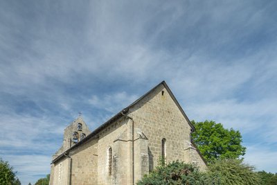
Eglise de Saint-Julien - J.Matthiaud - CC HCC  Heritage site
Saint-Julien
Built on a promontory, the church dominates the village of the former commune of Saint-Julien-pré-Bort. We say former commune because, in 2017, the communes of Saint-Julien and Sarroux united and became the new commune of Sarroux-St-Julien. It now has a population of over 850.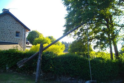
Puits à balancier - G.Salat - CC HCC  Small patrimony
The pendulum well
The villages of Haute-Corrèze are all involved in agriculture. Walking through these hamlets always produces interesting discoveries during a hike: barns, mansions, crosses and monuments, traditional local architecture...
The pendulum well is based on the lever principle. It is supported in its centre on a pivot and carrying a container at one end and a counterweight at the other. Simply vary the weight of one of the arms to give it a rocking movement.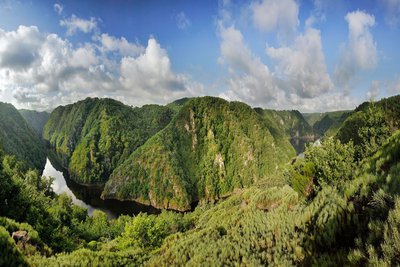
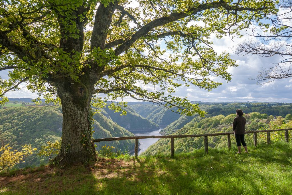
Saint-Nazaire - J.Matthiaud - CC HCC  History
Site of St-Nazaire
St-Nazaire is an amazing viewpoint over the Dordogne and the Diège and offers one of the most beautiful views of the gorges.
This place gets its name from a legend: Saint Nazaire is said to have chased the devil out of the place, and the devil left the print of a forked foot on a rock while running away in great long strides... The statue of the saint, erected in 1901, still stands guard over the site, and a pilgrimage in his honour has been organised there every year in September by the Way of the Cross which ends facing the abyss.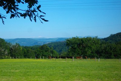
Monts du Cantal - G.Salat - CC HCC  Panorama
Cantal Mountains
This hike offers a magnificent view of the Monts du Cantal. This massif is, in fact, the remnant of a stratovolcano born 13 million years ago, the largest in Europe, eroded by collapse and glacial erosion.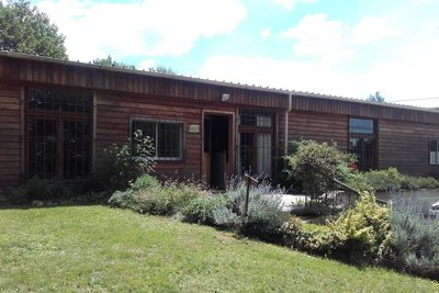
Association Coup de Main - CC HCC  Expertise
Coup de Main Association
Created in 2000 to promote the St-Nazaire site, the association positions itself in the field of social and solidarity economy.
It offers a path to integration for people furthest removed from employment based on experience in real work situations, training and individualised support.
By carrying out maintenance work on green spaces, market gardening, masonry and roofing, employees build their professional skills and abilities.
Description
Departure from in front of the town hall. Pass below the church and continue by road to the site of Saint-Nazaire and then retrace your steps.
- After the first houses, turn right onto a path that becomes a small trail through the woods. Cross a stream and go back up into the woods. Join a track and then follow it on the left to Cronzat. Keep left in the village.
- At the end of the village, follow the road for 600 m. At a crossroads where a cross stands, it is possible to take a short cut by following the path on the left. At the next crossroads, follow a small road to the left. 400 m after this, turn left onto a path bordered by a pond; then turn right onto a grassy path that joins the road.
- Follow it to the right. At the fork, take the road on the left that leads to the buildings belonging to the Coup de Main association. Continue and then take a path on the left (the circuit describes a loop at this level). Continue straight on, passing a stream and then a small river. Go up to a road at the entrance to the village of Laborde.
- Follow the road to the right. In the village of Chassagnac, take the road towards Bort-les-Orgues. 50 m further on, take the tarmac track on the right. This crosses a stream and then rises again. On the flat, leave the track to take a beautiful path on the right. This path joins the track you have already taken, and which you follow on the left.
- At the crossroads, turn right: follow the road past the pavilions. At the next crossroads, turn left to reach the starting point.
- Departure : Town hall car park, Mairie, St-Julien
- Arrival : Town hall car park, Mairie, St-Julien
- Towns crossed : Sarroux - Saint Julien
Forecast
Altimetric profile
Information desks
Access and parking
From Bort-les-Orgues, take the D 979 towards Ussel. 6 km after Bort, turn left and head towards St-Julien on the D20 then the D127.
Parking :
More information
Report a problem or an error
If you have found an error on this page or if you have noticed any problems during your hike, please report them to us here: