The Mystery of the Black Pond
Water is the principal landscape element on this hike. But before reaching the Etang Noir, the woodland and undergrowth and its delicious freshness will quickly reveal the charm of this route. Birdsong, a few stone walls and an old bread oven will guide you to the banks of the pond. Peaceful and green, l'étang Noir, the Black Pond is an invitation to rest and daydream, for those who would like to imagine themselves walking on this mysterious island...
3 points of interest
V.Mendras  Heritage site
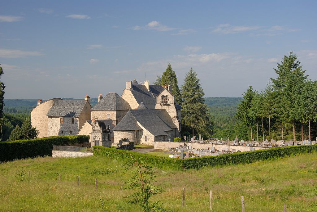
Church and Château of Saint-Victour
As can be seen from the choir covered by a cul-de-four (half-dome), the church of Saint-Victour is of Romanesque origin. However, it was reworked several times, in the 13th, 14th and 15th centuries.
The château, the oldest parts of which seem to date back to the 15th century, comprises two main buildings built at right angles. The north building was flanked by two circular towers, which were demolished during the Revolution. The second dwelling to the west was also flanked by a large tower.
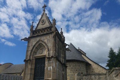
V.Mendras  Small patrimony
Barbazanges
Once you arrive in this hamlet, you will see an old traditional bread oven. A few steps further on, a sweeping panorama reveals a wetland, under which the sources of the Étang Noir are hidden.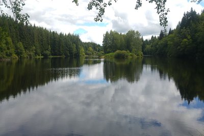
V.Mendras  Pond
PondEtang Noir
Water is the commune's principal resource. Omnipresent, it was used for fish farming and as a source of energy (Saint-Victour had many mills). Then between 1925 and 1927, the Chaumettes dam was built.
Description
- Departure from in front of the church. Go back to the D 979. At the crossroads, turn left and go along the departmental road. 200 metres further on, turn right onto a slightly sloping path. A few metres further on, at the Y-junction, go straight on, ignoring a path on your right. After having crisscrossed the undergrowth, the route leads to a trail lined with dry stone walls.
- At the crossroads, turn left, leaving a farmhouse on the right. The path goes down in a valley then skirts the edge of a wood. At the intersection, turn right and go through the village of Barbazanges.
- At the crossroads, turn left. 30 metres further on, bear right onto the track. At the next two intersections, turn right until you reach some buildings. Continue straight ahead until you reach the road, then turn right, leaving a farm on the left. At the junction after the house, turn left to join the path to l'étang Noir.
- Go around to the left of the lake. Cross the dike. Continue as far as the road and turn left to return to the D 979 passing in front of the town hall of Saint-Victour. Cross the departmental road and go down to the church.
- Departure : In front of the church, Saint-Victour
- Arrival : In front of the church, Saint-Victour
- Towns crossed : Saint-Victour
Forecast
Altimetric profile
Recommandations
This hike has a shorter route (6.5 km) which is described in a fact sheet.
Information desks
Access and parking
Arriving at Saint-Victour from Ussel, via the D 979, take the first road on the right at the entrance to the village, towards the church.
Parking :
More information
Report a problem or an error
If you have found an error on this page or if you have noticed any problems during your hike, please report them to us here: