At the source of the Chavanon
This hike invites you to explore the Méouzette and Ramade, streams whose confluence will become the river Chavanon. The first part of the hike descends into the gorge towards this confluence. More family-oriented, the second loop takes a track in the forest.
6 points of interest
G.Salat - CC HCC  River
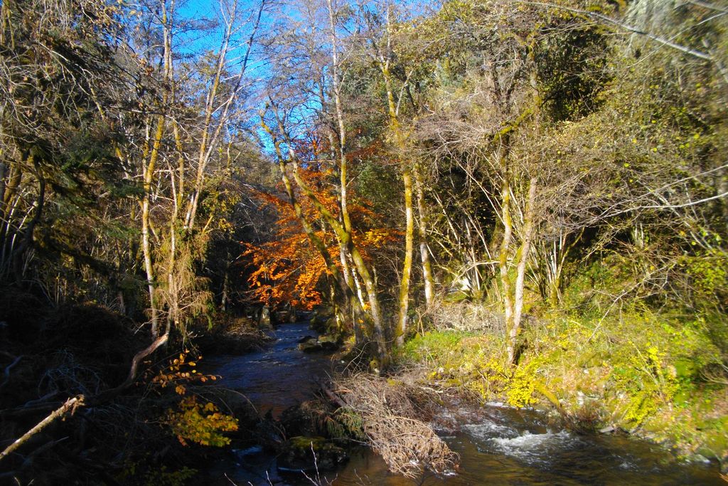
RiverThe Méouzette Gorge
The river Méouzette has its source in the military camp of La Courtine, in the commune of Malleret. It crosses a plateau in the south of Creuse (its course is dammed to create the magnificent Méouze lake) then it cuts in to join the river Ramade and give birth to the Chavanon.
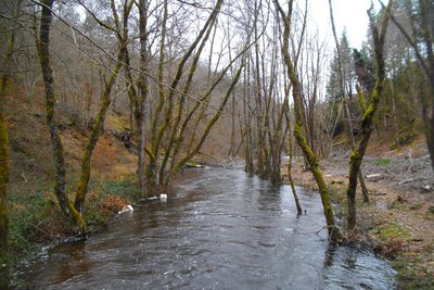
G.Salat - CC HCC RiverThe Chavanon
A natural boundary between the Corrèze and the Puy de Dôme, the Chavanon is born from the confluence of two streams, the Ramade and the Méouzette.
It continues its course through gorges then flows into the Dordogne, upstream of the Bort-les-Orgues dam reservoir.
Natura 2000 classified along its entire course, it is a river famous for its trout. It should be noted that one of the arches of the bridge was set aside as the water supply channel of the old rock mill.
G.Salat - CC HCC  Heritage site
The old church
A few steps lead you to the site of the old church. This promontory dominates the two rivers upstream of their confluence.
This old church was located on a ford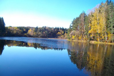
G.Salat - CC HCC  Pond
PondThe lake
After offering views over the Ramade, the hike leads you to a beautiful lake.
While Haute-Corrèze is often identified as the water tower of France because of the many rivers that have their sources there, it is also rich in a multitude of ponds and lakes. All artificial, they were created by humans, who most often dammed a stream at the end of a wetland, mainly for fishing.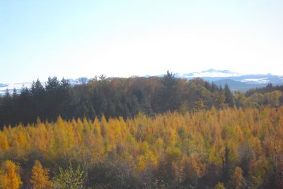
G.Salat - CC HCC  Panorama
Le Massif du Sancy
The recent logging has opened up a remarkable view of the highest volcano in mainland France, the Puy de Sancy.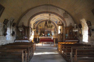
G.Salat - CC HCC Heritage siteVillage of Laroche-prés-Feyt
On the way back, a detour in the village is necessary. Note the name of the restaurant, Le Graphologue; a tribute to Father Michon, the graphologist, whose birthplace is in the village. This clergyman invented graphology, a "science" that analyses the personality of its author through writing.
In addition to admiring the traditional local architecture and a feudal mound, continue on to the church, transferred in the eighteenth century from the gorges. Its interior has been beautifully restored.
Description
Set off in the direction of the playground at the Town Hall, opposite the restaurant. Continue to the opposite side of the village along the small road.
- The latter becomes a path that descends to the Méouzette. Cross it and go straight up to where the trees are being felled.
- Where the paths cross, turn left. Enter the meadow; continue straight ahead by crossing the Feyt stream on a footbridge. Leave the meadow. Continue straight ahead, leaving two paths on your left until you reach the road.
- Turn right and continue for 150 m and then take the track on the left. Continue straight on, the track becomes a path that goes down to the road. Take it to the right.
- At the crossroads, after a short round trip to the bridge over the Chavanon, take the road towards Laroche-prés-Feyt. Just after the bridge over the Méouzette, take the steps on the right for a short return trip to the site of the old church. Go back to the road and continue to the right. When you arrive on the "plateau", take the track on the right. Ignore several paths on your right.
- At the crossroads, take the track on the right after the meadow (go left to go directly to the starting point). Keep straight ahead, passing a pond. Ignore a track on the right and return the road. It takes you back to Laroche-prés-Feyt.
- Departure : Place de la Mairie, Laroche-prés-Feyt
- Arrival : Place de la Mairie, Laroche-prés-Feyt
- Towns crossed : Laroche-près-Feyt
Forecast
Altimetric profile
Recommandations
From Eygurande, follow the D22 then the D101 towards Feyt. In Feyt, go towards Laroche-prés-Feyt.
Information desks
Access and parking
From Eygurande, follow the D22 then the D101 towards Feyt. In Feyt, go towards Laroche-prés-Feyt.
Parking :
More information
Report a problem or an error
If you have found an error on this page or if you have noticed any problems during your hike, please report them to us here: