The Goat Eaters

Saint-Silvain-Bellegarde
The Goat Eaters
Easy
3h
9,8km
+221m
-221m
Loop
Yellow markers
Embed this item to access it offline
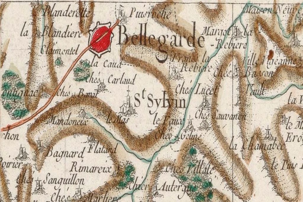
History and legend mingle in this itinerary that leaves room for the imagination... The Middle Ages left their mark on the territory which, at the time, enjoyed a privileged status of exemption!
3 points of interest

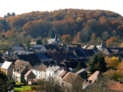
Bellegarde en Marche - Panorama - Association des Amis de Bellegarde et du Franc Alleu  Panorama
Panorama overlooking Bellegarde en Marche
In the Middle Ages, Bellegarde was the capital of the Franc-Alleu. This name designates a territory of full ownership, free of any obligation of paying royalties, unlike the fiefdom.
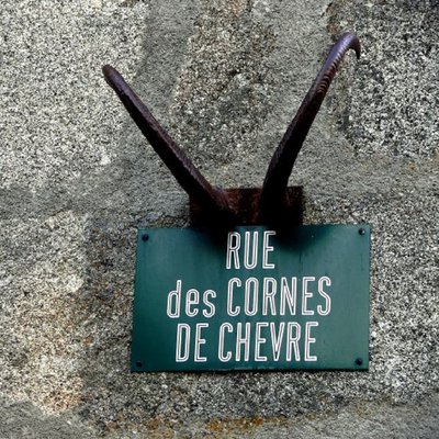
Bellegarde en Marche - Les Cornes de Chèvres - Association des Amis de Bellegarde et du Franc Alleu  Legend
The Goat Horns
During the Hundred Years' War, the inhabitants of Bellegarde, attacked by the English army of the "Black Prince", defended their city with strange weapons: tool handles topped with goat horns. At that time, goats were abundant in this region covered with broom and heath. Afterwards, the alley was decorated with these horns, symbol of the Bellegard epic. This legend is at the origin of the creation, in 1962, of the Confrérie des Mangeurs de Chèvres (Brotherhood of Goat Eaters).
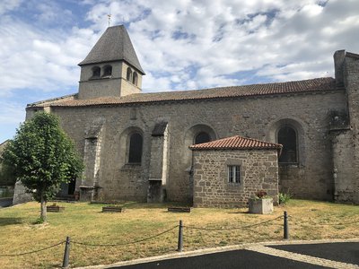
St Silvain Bellegarde - Eglise St Silvain - Commune de St Silvain Bellegarde  Heritage site
Church of St Silvain
A 13th-century church, rebuilt in the 17th century, listed on the Supplementary Inventory of Historic Monuments since 1925.
The altarpiece and its two side altars are classified as historic monuments. The roof of its bell tower is made of chestnut shingles.
Description
- Leave by the path in front of the church gate. After 150 m turn right, follow the path and then the road to the D 9 crossroads. Continue straight ahead and then turn right "Chemin de l'abattoir".
- Turn left into "Rue Basse", cross the road and take "Rue du Château".
- On the right take the GR; leave it at the railway crossing on the left.
- Go into Malleret on the left and then on the right, past a stable block. Take the path that goes downhill. Turn left at the crossroads. Cross the D9.
- At the end of the path turn left; at the stop sign turn to the right.
- Pass the cemetery and go up to La Chapelle to admire the view.
- Take the road that goes down to reach the village.
- At the crossroads, take the "Route du Breu" to the right. Leave the village "Les Bierges". A few metres further on, turn left onto a path that climbs up, keep left for 1 km 400 m and enter Bellegarde.
- In front of the Clock Tower, turn right twice. Take the GR 46 for 1 km.
- Leave the GR, take the path on the left. Follow it to the road. Go a few metres to the right and take the path on the left to St Silvain.
- Departure : Church Square, Saint Silvain Bellegarde
- Arrival : Church Square, Saint Silvain Bellegarde
- Towns crossed : Saint-Silvain-Bellegarde, Bellegarde-en-Marche, and La Chaussade
Forecast
Altimetric profile
Information desks
Rue de l'Etang, 23700 Auzances
Access and parking
From Bellegarde en Marche, take the D9 then right to join St Silvain Bellegarde
Parking :
Church Square, Saint Silvain Bellegarde
Accessibility
- Emergency number :
- 112
Report a problem or an error
If you have found an error on this page or if you have noticed any problems during your hike, please report them to us here:
