From the train station to Manzagol
Come and discover a historical and economic heritage that stretches from the 12th century to the present day. From the fortified château to the manor house, the farms, and further on, the lake, everything here tells you about the toil of inhabitants. Manzagol's orientation table shows the landscape and its subtleties. Back in the town, the Rue du Tacot, which crosses it, was, in the 20th century, teeming with activities on both sides of the road.
6 points of interest
G.Salat - CC HCC  Heritage site
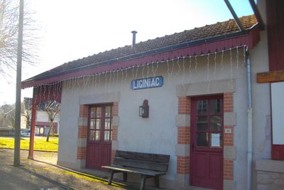
The old Tacot tramway
Between 1913 and 1959, a tramway called the Tacot operated between Tulle and Ussel, serving Liginiac. The current station is not the Tacot station (which was a little lower) but a station for coaches built on the model of the Tacot stations.
The building is composed of three parts with distinct functions. Its central part dedicated to welcoming passengers is framed by a goods shed with a loading dock and by a large canopy serving as a shelter for passengers.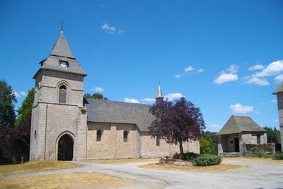
G.Salat - CC HCC Heritage siteLiginiac church
Overlooking the village, the 12th-century church and the former château (now the town hall) form a remarkable heritage complex, contemporary with each other. The town developed only later, along the communication routes. The 12th-century church was transformed in the 14th century by the addition of the porch. The latter houses the tomb of the Maréjou, lords of the Château de Marèges. The door hinges (hardware), the decoration of the capitals and the modillions also deserve your attention.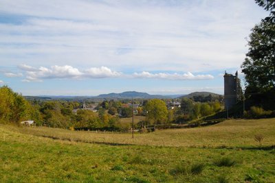
G.Salat - CC HCC Heritage siteThe Tower of Peyroux
Giving the impression of watching the town from a distance, the Peyrou Tower is the last vestige of a much more imposing building, composed of four towers. This château, built by the Ventadour family, existed prior to the 14th century; it was destroyed in 1793.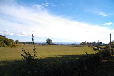
G.Salat - CC HCC  Panorama
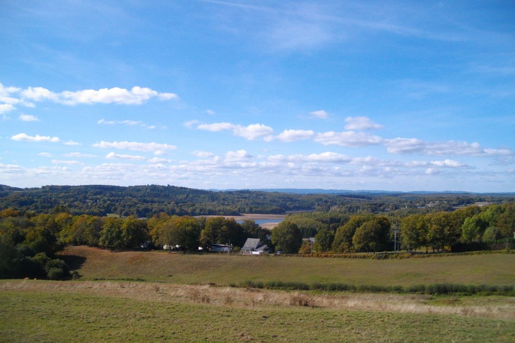
View over the Monts du Cantal
Above and beyond the Dordogne, we will see the Monts du Cantal during this hike. This massif is, in fact, the remnant of a stratovolcano born 13 million years ago, the largest in Europe, eroded by collapse and glacial erosion.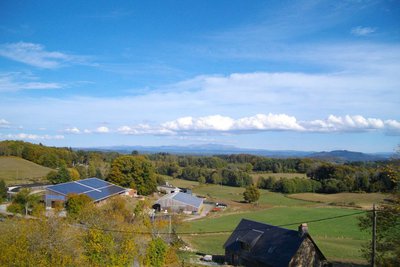
G.Salat - CC HCC PanoramaThe Puy de Manzagol
The Puy de Manzagol offers a view over the Monts d'Auvergne and the Triouzoune lake.
This is a geological curiosity since it was formed in the Tertiary era at the same time as the Monts du Cantal.
Indeed, the formation of Puy Mary caused vibration and, by pressure, basalt would have risen to this weakened place through a crack, creating this "small" puy.
CC HCC  Lake
LakeLake Triouzoune
The river Triouzoune has its source on the Plateau de Millevaches and flows over a length of 46 km. As part of the hydroelectric development of the Dordogne gorges, the construction of a dam on its course has created a 410-hectare lake. A 15 km penstock at the dyke brings the water to the Triouzoune power plant, located upstream of the Aigle dam. This lake has allowed the development of leisure activities such as swimming, boating and golf.
Description
Departing from the old railway station, go up to the town hall. Go down along the edge of the cemetery. Take the road on the left towards the retirement home.
- Follow the road to the right until you reach Peyroux. Take the road on the left, pass the tower; pass by two roads on your left and find the D183. Turn left onto it for 500 m.
- Take the path on the left. Cross a road and go straight on. At the crossroads, turn right to rejoin the road. Turn left onto it. When you get to the village of Pisse-Lèbre, go straight on until you reach the Puy de Manzagol.
- Climb up on the mound for the viewpoint. Continue in the village: take the road to the right then go left then right towards Maury. Go through the campsite towards the tennis court. Then go down to the right towards the lake to find a path that runs along the lake towards the Etang du Maury.
- Take the road to the left, then the path on the right. Go up to the right and then left where the trees are felled. Go back down to the track and take a left.
- Take the road to the left and then, at the crossroads, follow the track to the right. At the crossroads, turn left. Go through a village.
- Take the road to the right and then to the left. Go through La Chastre and continue on the track.
- Take the road to the right. Go right at the next crossroads. Ignore two roads on your left. At the next crossroads, take the road on the left. Continue straight ahead along the track.
- At the crossroads, turn right towards Bonnefond. In a bend, take the path on the left that goes back to Liginiac: turn right in front of the retirement home and then left towards the centre of the village.
- Departure : The old Tacot railway station
- Arrival : The old Tacot railway station
- Towns crossed : Liginiac
Forecast
Altimetric profile
Information desks
Access and parking
The departure point is at the edge of the D20 as it goes through the village of Liginiac.
Parking :
More information
Report a problem or an error
If you have found an error on this page or if you have noticed any problems during your hike, please report them to us here: