To the Coal!
8 points of interest
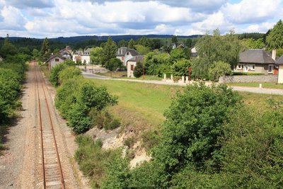
Gare et mine - G.Salat - CC HCC  History
Maussac Gare
It is hard to imagine when discovering Maussac that this site was a coal mining centre. Conceded to a company in 1809, this deposit was mined until 1924; At its peak around 1908, 30 tons were extracted per day. No slag heaps and shafts, but galleries sloping gently down. The station played a major role, the very rich coal was ideal for feeding the forges and the Tulle arms factory consumed almost all the production.
Le Mont Bessou - G.Salat - CC HCC  Panorama
Mont Bessou
In the distance, easily identifiable thanks to its television and telephone broadcasting antenna, stands Mont Bessou. At 976 metres, it is the highest point in the Limousin. When you return from your walk, make a detour to discover a magnificent viewpoint overlooking the Monts d'Auvergne from the top of its panoramic tower.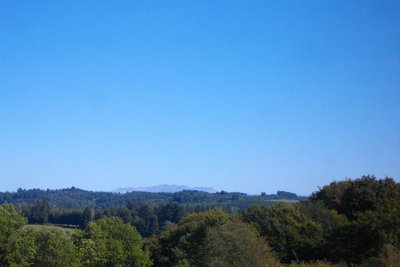
Le Sancy - G.Salat - CC HCC PanoramaLe Massif du Sancy
This hike will offer you a remarkable view of the highest volcano in metropolitan France, the Puy de Sancy. At 1885 metres above sea level, this summit is the highest point of the Massif Central. The two streams, the Dore and the Dogne, originate there, and their confluence forms the Dordogne.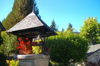
G.Salat - CC HCC  Heritage site
The village of Besse
The villages of Haute-Corrèze are all involved in agriculture. Walking through these hamlets always produces interesting discoveries during a hike: barns, mansions, crosses and monuments, traditional local architecture... In Besse, past the well, don't miss on your left the house with its sculpted lintels and then the calvary cross.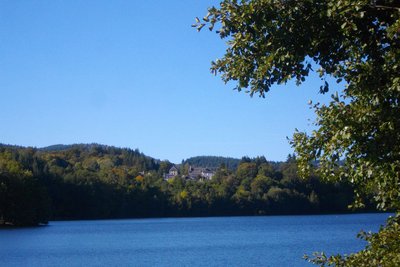
Le Lac de Séchemailles - G.Salat - CC HCC  Lake
LakeLake Sechemailles
The Lac de Sechemailles is a 47 hectare lake developed for leisure activities: swimming, pedal boats and canoes, holiday rentals and camper van area. An ideal place to relax and cool off after this walk.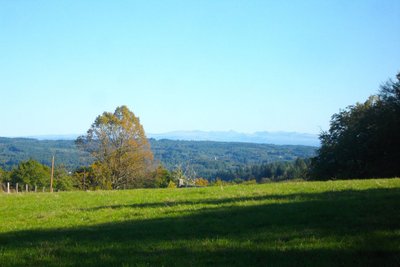
Les Monts du Cantal - G.Salat - CC HCC PanoramaThe Cantal Mountains
Another Auvergne massif with the Sancy, you will see the the Monts du Cantal during this hike. This massif is in fact the remnant of a stratovolcano born 13 million years ago, the largest in Europe, eroded by collapse and glacial erosion.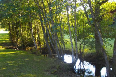
La Soudeillette - G.Salat - CC HCC  River
RiverThe Soudeillette
The Soudeillette is a tributary of the Luzège river which has its source in the peaty bottoms of the Millevaches plateau. The good water quality of the river favours populations of brown trout. The valley is home to many remarkable species, both plants and animals, which is why it has been classified as a Natural Zone of Fauna and Flora Interest. It has also been used by humans to power mills like the one in Pézareix.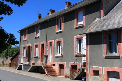
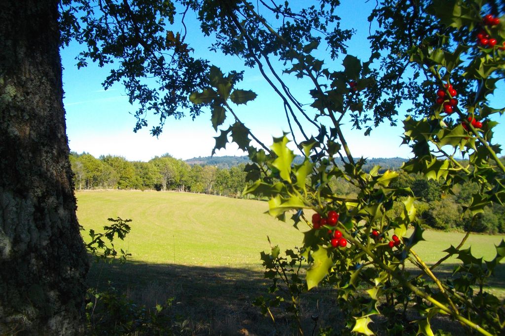
Maison de mineur - CC HCC Heritage siteMining habitat
For the workers employed at the mine, there was no question of returning to their homes every day. The mining company built houses for them, often more comfortable than their peasant dwellings. The engineer, the manager and the mine foremen also had to be accommodated and their rank ensured their residences were more opulent.
The number of miners was always modest, ranging from 60 in 1902 to 20 in 1923, when it closed. The memory of the mine is retained in these dwellings with their very particular architecture.
Description
Departure point on the square on the edge of the D36. Head for the old butcher's shop; turn right and then left on the Rue des Sources. Then turn right on the Rue du Château d'Eau. The latter rejoins the Rue des Sources, which we follow on the right.
- 100 m after leaving the village, follow the road to the left. At the crossroads with the Pézareix road, continue on the track straight ahead. At the next crossroads, take the path on the right. Go straight on to Besse. Take note, at the entrance of the village, turn right on the small path that goes to the well.
- Take the road to the left. At the last house, turn right onto the Chemin des Chèvres follow it straight ahead.
- Take the road to the right and then to the left. Go past the stream, the Ambrugeat. 600 m after the bridge, turn left onto the track. Continue along the motorcycle path, go through the gate to reach the dyke.
- Just after the dyke, follow a path in the woodland to the left. Take the road on the left and then, in a hairpin bend, the path straight ahead. Take the road on the right, then leave the Route des Nèves and go on until you reach a crossroads.
- At the crossroads turn left towards La Chabane. At the top of the hill, take a path on the right. Go left at the first crossroads. This path joins up with a track that you take on the right. It leads to Cisterne.
- In the village, follow the road to the left for 1 km. Take a path to the left. Turn right at the road to reach the Pézareix mill. Take the road on the left which rises and becomes a track. Turn right when you reach the road.
- At the crossroads, turn right: the road runs alongside the ralway line. Turn left at the railway crossing and then take the path on the left just after the crossing keeper's house. Turn left at the next crossroads; the path becomes a track.
- Take the road to the left; go left at the next crossroads; cross the railway line. Turn right at the next crossroads to return to Maussac.
- Departure : Car park, Place de Maussac Gare
- Arrival : Car park, Place de Maussac Gare
- Towns crossed : Maussac, Meymac, Davignac, and Ambrugeat
Forecast
Altimetric profile
Recommandations
The commune includes several villages. The hike sets off from Maussac-Gare. This signposted "circuit 3" hike has two shortcuts with a 7 km circuit 1 and a 9.5 km circuit 2. This circuit is the subject of a specific information sheet.
Information desks
Access and parking
From Meymac, take the D36 towards Tulle. Maussac-Gare is 5 km from Meymac.
Parking :
More information
Report a problem or an error
If you have found an error on this page or if you have noticed any problems during your hike, please report them to us here: