The Customs Officers' Path
Lupersat
The Customs Officers' Path
Medium
3h30
11,5km
+307m
-306m
Loop
Yellow markers
Embed this item to access it offline
Car park at Place de l’église, LupersatThis hike in the foothills of the Auvergne mountains leads you to discover the ancient routes used by salt smugglers to pass from Felletin en Creuse to the Auvergne without being seen.
3 points of interest
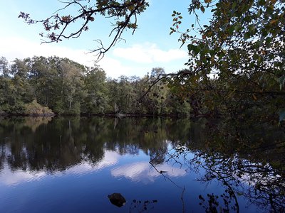
Lupersat-Etang de Goumont - Commune de LUPERSAT  Pond
PondEtang de Goumont
Human activities have increased the presence of water in the landscape:
- ponds and lakes of all sizes were dug and developed in the Middle Ages for fish farming or water power,
- farmers created retention ponds to allow crop irrigation.
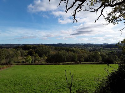
Lupersat-Panorama sur les volcans d'Auvergne - Commune de LUPERSAT  Panorama
Panoramic view of the volcanoes of Auvergne
At the Puy de la Croix, the customs officers' path offers a panoramic view of the chain of volcanoes at Sancy (south) and Toulx-Sainte-Croix (north).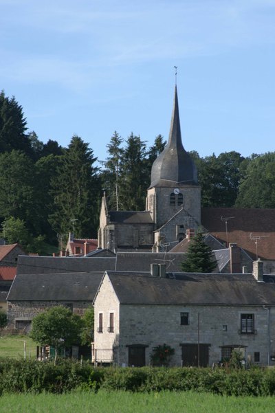
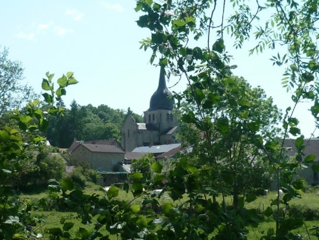
Eglise de Lupersat dans la Creuse - Mathieu Tijeras - Murielle Villejoubert  Architecture
Church of Saint Oradoux
Despite being destroyed several times, the building has kept its original Limousin Romanesque form. Dedicated to St Oradoux, it features sculpted capitals with realistic scenes, sometimes quite crude. Note that it is fairly richly furnished (an 18th-century altarpiece including an altar, statue-reliquaries, a tabernacle and so on).
Description
- Go down the main street and turn right onto the road to Ronnet for 450 m. At La Vierge, take and follow the path on the right for 900 m.
- Take the path on the left. Go down the road to the left at Les Barrières, then follow the road to the right and pass Solignat.
- Turn right onto the path that runs alongside the lake and continue until you reach Villocette. Go through the hamlet to the right and continue uphill. Take the road to the right. Leave Montcors on the right and continue by road until you reach Goumont.
- Go past the road to Montcors on the right, enter the property on the left and immediately take the path on the right. This runs along the road first, and then goes down into the valley and up again. Go around to the left of the lake.
- At the crossroads, turn left. Take the path to the right, then the path to the right again. At the crossroads, continue straight ahead along the path lined with low stone walls and climb the ridge, leaving the paths to the side.
- Take the track on the right and follow it to the end. Leave the car park on the right to get onto the path.
- Where the path branches go left. Pass between the two ponds and go up the hill to the houses in Puy-Bargeron. Continue along the road, go past Eroulletas and continue towards Erolas. At the crossroads, take the road on the left towards La Vergne.
- After the lake, follow the path to the right. Continue straight on to Lupersat.
- Departure : Car park at Place de l’église, Lupersat
- Arrival : Car park at Place de l’église, Lupersat
- Towns crossed : Lupersat, Sermur, and Mautes
Forecast
Altimetric profile
Information desks
Access and parking
From Chénérailles, head in the direction of Aubusson as far as Issoudun Létrieix. Turn left towards Champagnat, then go towards Bellegarde en Marche. In Bellegarde en Marche turn onto the D988 to Lupersat.
Parking :
Car park at Place de l’église, Lupersat
Accessibility
- Emergency number :
- 112
More information
Report a problem or an error
If you have found an error on this page or if you have noticed any problems during your hike, please report them to us here: