The Puy d'Orliac
Veix
The Puy d'Orliac
Medium
2h30
8km
+233m
-232m
Loop
Yellow markers
Embed this item to access it offline
This hike offers superb views and breathtaking scenery. It gives you access to the free flight site (hang-gliding, paragliding and kite flying) and lets you enjoy the panoramic views. Most of the route is through woodland and undergrowth, making it particularly pleasant on hot days.
5 points of interest
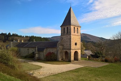
l'eglise de Veix - office de tourisme V2M  Heritage site
Saint-Salvy Church
The present Romanesque church was, according to the abbot Vinatier, started at the end of the 11th century. But nothing remains of those days. It burnt down in 1581 and 1853. Between 1875 and 1894, the old bell tower-wall was replaced by a bell tower-porch and a chapel was added to the north. It has a lovely granite floor. Medieval baptismal font, decorated with a simple cord. Remains of a granite altar table, possibly also of medieval origin. Polychrome wooden statues from the 17th century of St. Anne and St. Salvi, patrons of the church.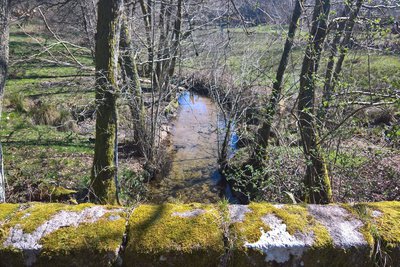
Le ruisseau d'Alembre - OT Vézère-Monédières-Millesources  River
RiverThe Alembre stream
The Alembre is known, according to the Sandre, the National Service for Water Data and Common Repositories Management, as a single stream that first originates in the Monédières massif under the name of the Galingard at nearly 810 metres above sea level, north of the Col des Géants in the commune of Veix.
It passes to the south-west of the village of Lestards and continues under the name the Mill stream and then becomes the Alembre.
The Alembre has five tributaries listed by the Sandre. The longest, at 5.5 kilometres, is the Monédières stream on the left bank.
s.degery  Panorama
Allogne-Puy de Pantou
View over the Puy de Pantou-Pierre des Druides (access Petit Serilhac).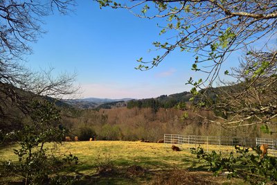
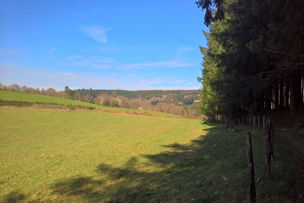
Le Puy d'Orliac - OT Vézère-Monédières-Millesources PanoramaThe Puy d'Orliac
This Puy culminates at an altitude of 705 metres and is part of the Massif des Monédières.
These lines of Puys dominate the Alembre and the village of Veix with to the north, the Peuch Géant, and to the south the Puy d'Orliac and the Puy de la Monédière. They define one of the main valleys of the massif and meet at the Col des Géants, the gateway to the Monédières that everyone knows.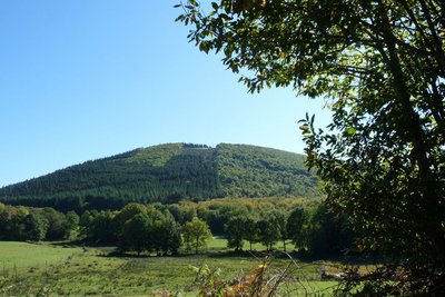
Puy de la Monédière - OT Vézère-Monédières-Millesources PanoramaLe Puy de la Monédière
This Puy culminates at an altitude of 705 metres and is part of the Massif des Monédières.
These lines of Puys dominate the Alembre and the village of Veix with to the north, the Peuch Géant, and to the south the Puy d'Orliac and the Puy de la Monédière. They define one of the main valleys of the massif and meet at the Col des Géants, the gateway to the Monédières that is well-known to all.
The Free Flight Nord-VTT de descente-Trail-Accés Col du bos site.
Description
- Right at the beginning, you can explore the Romanesque church of Veix, with its panoramic view of the Puy de la Monédière. From the church, go down the small road that joins the RD 180 about 150 m further on.
- At the crossroads, turn right towards Treignac. Shortly after the Town Hall buildings, turn left and then go down a path that leads to the Pont d'Allogne bridge that crosses the Alembre stream. Then continue on the stony path that leads to the top of the village of Allogne.
- At the communal road, turn left to continue for 500 m, then turn left onto a forest track. Take this track, which goes around the Puy d'Orliac to the south, until you reach the RD 180 at "Frontomeil".
- Cut across the departmental road to reach the first houses in the village. Turn left on a path that passes in front of a farm building, then continue on this path at the foot of Puy de la Monédière until you reach a small road at the place known as "Les Borderies".
- At the road, turn left and continue for 300 m, leaving the road to turn right onto a path that passes over a small stream.
- Then climb up to the village of "Lasmay". When you arrive in the village, turn left to take a small road. Pass the junction for "La Combe" then 400 m further on, turn right onto an old path that leads to the town of Veix.
- Departure : Church Square, Veix
- Arrival : Church Square, Veix
- Towns crossed : Veix
Forecast
Altimetric profile
Information desks
Le Bourg, 19260 Veix

1 place de la République, 19 260 Treignac
Access and parking
Parking :
Church Square, Veix
More information
Report a problem or an error
If you have found an error on this page or if you have noticed any problems during your hike, please report them to us here: