Along the Sarsonne
Saint-Pardoux-le-Neuf Blue markers
Along the Sarsonne
Medium
3h30
13,6km
+299m
-299m
Loop
Embed this item to access it offline
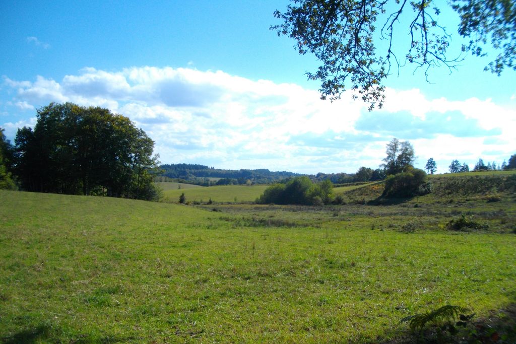
Saint-Pardoux le Neuf isn't one village but several villages that make up the commune; this hike will allow you to explore some of them. Part of the hike will follow the Sarsonne, the river which rises in Creuse and flows for 27 km before flowing into the Diège. Halfway round, the Bois de Conrot arboretum offers you the opportunity to identify different tree species.
5 points of interest
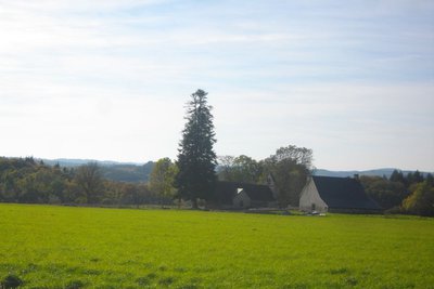
Saint-Pardoux le Neuf - G.Salat - CC HCC  History
Saint-Pardoux le Neuf
It is strange that this church stands, isolated, in the middle of the green meadows of the Haute-Corrèze! It is dedicated to St-Pardoux, former abbot of a monastery around which the town of Guéret was established. The commune, with 78 inhabitants at the last census, is in fact made up of several villages and isolated farms.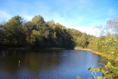
Etang de la Doulange - G.Salat - CC HCC  Pond
PondEtang de la Doulange
Haute-Corrèze is often identified as France’s water tower because of the many rivers that have their sources there, and it is also rich in a multitude of ponds and lakes. All artificial, they were created by humans, who most often dammed a stream at the end of a wetland, mainly for fishing.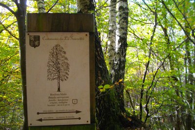
Le bois de Conrot - G.Salat - CC HCC  Flora
FloraConrot wood
This regional forest on the banks of the Sarsonne has been the subject of development as a tourist attraction with an inventory of the tree species present. This circuit allows you to visit and learn from several interpretive panels.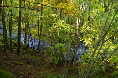
La Sarsonne - G.Salat - CC HCC  River
RiverThe Sarsonne
The source of the Sarsonne is in Creuse, on the edge of the Courtine military camp. With a length of 27 km, it flows into the Diège to the south of Ussel.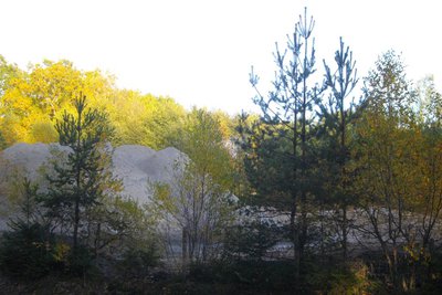
La carrière - G.Salat - CC HCC  Geological interest
The Quarry
Located in the commune of Lignareix, this rock quarry exploits migmatitic granite and produces different types of materials, from boulders to sand, by crushing the rock. This is a private site, closed to the public.
Description
Park in the church square.
- Take the road back to the crossroads.Take the road to the right. At the car park, turn right onto the D161 towards Ussel. Leave the town hall on your left. Continue and fork left towards Salagny.
- At the bottom of the descent, take the path on the right. At the end of the path, turn left. Continue between the meadows, leave the Doulange road on your right (round trip to the lake). The path joins a road that you take straight ahead. Cross the bridge, ignore the road to Chiret on your left; then continue on to Geneix.
- Before the barn on the bend, take the path on the left. Continue through the alley of beech trees. The path becomes a track and then a road that you should follow straight ahead. At the crossroads, follow the road towards Laval for 300 metres.
- At the entrance to the wood, take the path on the right; it runs alongside the meadows, climbs into the woods and then follows the course of the Sarsonne. Ignore all the paths on your left to get back to the road. Follow it to the right until you reach the village of Les Plaines.
- Take the main road to the right and then go left just after the last house. Turn right at the next crossroads to reach Le Montbelet.
- At the end of the track, take the path on the right; continue straight ahead, leaving two paths on the right. The path becomes a trail, go left to join a track.
- Follow it to the right. Turn left at the next two crossroads to reach Les Combes. Follow the road for 400 m. then the path on the right. Go left before the quarry to return to the road.
- Follow it to the right; past the Combeaux brook, take the track on the left. Go straight on through the woodland. When you reach the meadows, take the path on the right that goes up into the young plantation. Turn right at the next road to reach the village of Les Plats.
- Take the road on the left for 1.5 km to return to the starting point.
- Departure : Place de l'église, Saint-Pardoux le Neuf
- Arrival : Place de l'église, Saint-Pardoux le Neuf
- Towns crossed : Saint-Pardoux-le-Neuf, Ussel, and Lignareix
Forecast
Altimetric profile
Recommandations
Follow the blue markings, the circuit crosses two other hiking trails marked in yellow. Saint-Pardoux is made up of several villages and the church, the starting point, is relatively isolated.
Information desks
Access and parking
From Ussel, follow the D982 towards La Courtine for 5 km then turn right towards St-Pardoux le Neuf. After the sign for St-Pardoux, take the small road on the right up to the church.
Parking :
Place de l'église, Saint-Pardoux le Neuf
More information
Report a problem or an error
If you have found an error on this page or if you have noticed any problems during your hike, please report them to us here: