The Ponds
Viers, Montsour, Les Ganes, Le Grenouiller and Trompette welcome walkers and nature lovers. This is undoubtedly one of the most beautiful hikes in this sector of the Haute-Corrèze and its famous ponds and lakes. This hike is ideal in all seasons for a family with young children.
5 points of interest
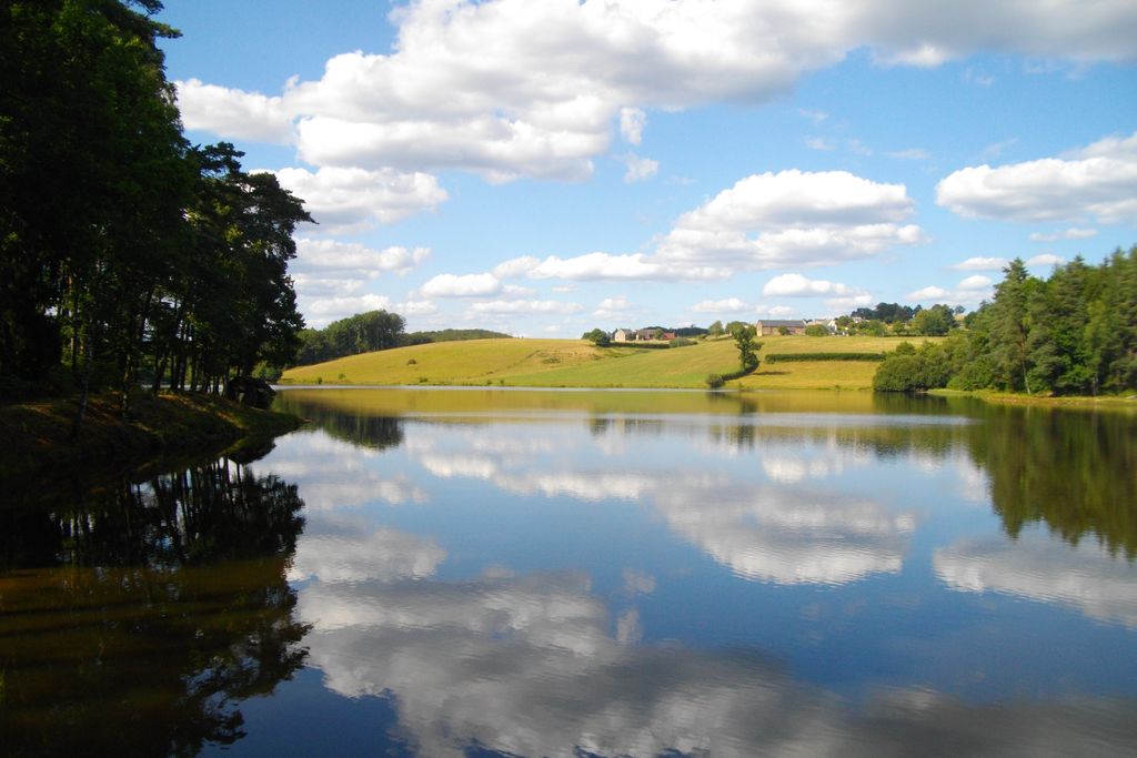
Etang de Viers - Bourg - CC HCC  Pond
PondEtang de Viers - village of Lamazière
Although this hike starts from the Viers lake (7 ha), be sure to return to the village of Lamazière-Basse, to explore its church, which is dedicated to St-Barthélémy and the old presbytery which has become the town hall.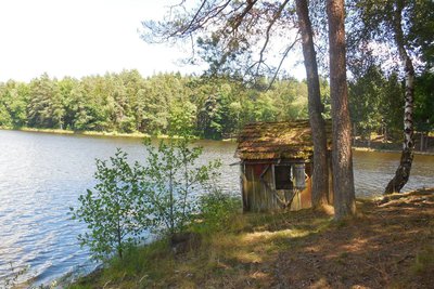
Etang de Montsour - G.Salat - CC HCC PondEtang de Montsour
The Montsour lake (11 ha) is a classified site surrounded by woods and meadows. Be sure to make the round trip to an old wooden shelter, known locally as La Pergola. A text from the immediate post-war period indicated that during the summer months canoeists and swimmers would meet on the serene shores of this body of water.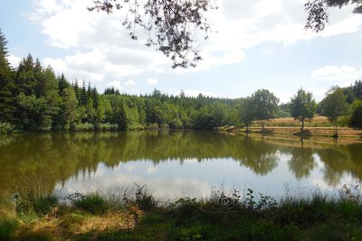
Etang dees Ganes - G.Salat - CC HCC PondEtang des Ganes
Haute-Corrèze is often identified as France’s water tower because of the many rivers that have their sources there. It is also rich in a multitude of ponds and lakes. All artificial, they were created by humans, who most often dammed a stream at the end of a wetland, mainly for fishing. This is, of course, the case of the Ganes lake (1.5 ha.), famous for its trout.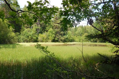
Etang du Grenouiller - G.Salat - CC HCC PondGrenouiller lake
This 4,000 m² lake is undoubtedly the wildest of the five bodies of water on this walk. It is a splendid observation point for waterfowl and amphibians. The shallow depth of this lake is undergoing eutrophication: in other words, the plants are growing and will fill the available space in the water. This body of water will become successively swamp, then wet meadow.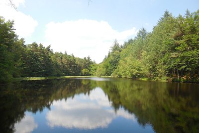
Etang de la Trompette - G.Salat - CC HCC PondEtang de la Trompette
A final opportunity for a "lake break" at the edge of the Trompette lake (1 ha) with a name to inspire the imagination.
Description
The itinerary starts at the small car park on the edge of the Etang de Viers. Take the small road on the dyke then, on the right, take the path which goes up the lake.
- Before you reach the woods, take the path on the right that runs alongside the meadow and then go up to the road. Opposite, go back as far as the hut by the lake at Montsour.
- Take this road on your left for 800 m, ignoring the track leading to the stadium on your left, and then the Trompette road. After the houses, take a left turn onto a woodland track; go right at the next crossroads. At the road, turn left for 100m and then right at the next track to reach the Etang des Ganes.
- Walk alongside the lake by the footbridge then go up by the tarmac track as far as the village. In the village, take the road to the left and then to the right after the last house. At the next crossroads, turn right to Bouix. Take the departmental B-road on the left for 100m. Then, at the end of the straight section, the road on the left.
- This path runs alongside the Etang du Grenouiller. Go straight on at the next crossroads to reach the Trompette lake. Go over the dam. Continue to the hamlet of Viers. Continue straight on to reach the starting point again.
- Departure : Parking on the edge of the Viers lake, Lamazière-Basse
- Arrival : Parking on the edge of the Viers lake, Lamazière-Basse
- Towns crossed : Lamazière-Basse
Forecast
Altimetric profile
Recommandations
Some passages are muddy during rainy periods.
Information desks
Access and parking
Parking on the edge of the In Neuvic, follow the road to Mauriac, then the D 991 to Lamazière-Basse. In Lamazière, head towards Egletons, then turn left towards Combressol - Etang de Viers.Viers lake, Lamazière-Basse
Parking :
More information
Report a problem or an error
If you have found an error on this page or if you have noticed any problems during your hike, please report them to us here: