Heather Trail
Saint-Merd-les-Oussines Purple markers
Heather Trail
Easy
3h
8km
+117m
-117m
Loop
Embed this item to access it offline
Look, listen, feel, smell: the peat bog is open to you! In the heart of the Millevaches plateau, this 8,000-year-old natural site is a calm place to pause for a while. A protected area of 255 hectares, this peat bog is full of distinctive fauna and flora. During the hike, you can admire these wetlands and the puys around them. By getting closer, you can also discover new species.
8 points of interest
O.Nugueo - CC HCC  Flora
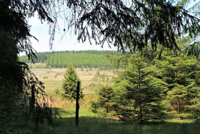
FloraSoftwood panorama
The softwood forest in front of you is not natural, as you can tell from its very precise alignment of trees. It was only in the early 1920s, and at the initiative of Marius Vazeilles, that the Limousin mountain began to be forested. Today, as a region marked by silviculture, it is common to see human-made forests like the one before you.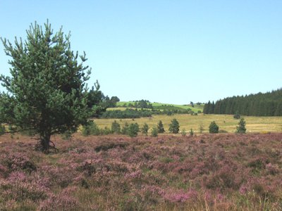
Landes traditionnelles - G.Salat - CC HCC  Panorama
The traditional moorland
Here you can admire a traditional moorland, composed mainly of heather. Its existence is due to the grazing by Limousin sheep during the last century. With the abandonment of this practice, the moorland has decreased enormously, occupying 5% of the space today against 70% at the beginning of the 20th century. It should be noted that about 98% of the moors in Limousin have disappeared in the space of 100 years.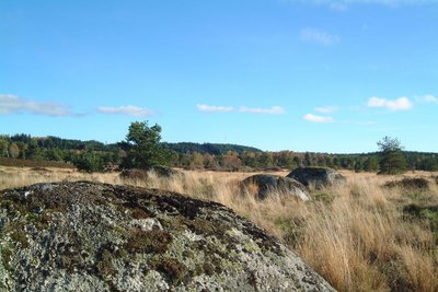
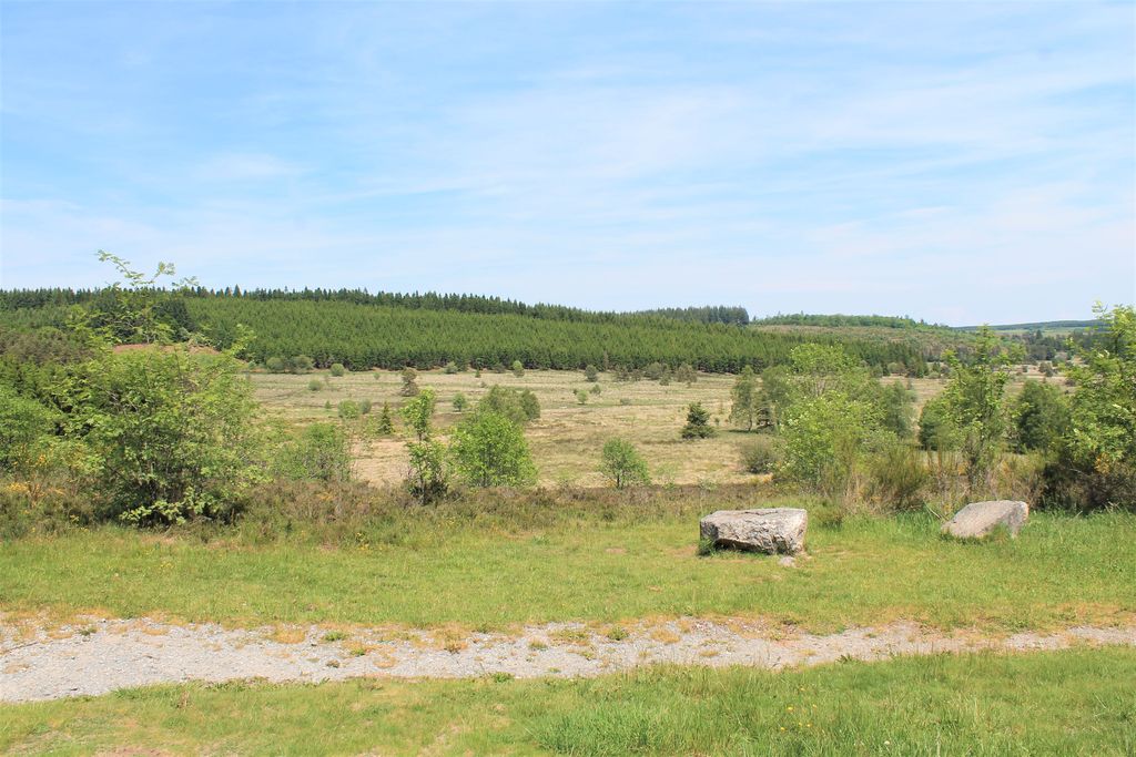
Les cent pierres - G.Salat - CC HCC  Legend
The Hundred Stones
These granite boulders, also called outcrops, arrived here by sliding from the top of the surrounding puys. The legend of the hundred stones tells of the existence of a chateau surrounded by stables and cottages whose lord was a hard man. When he refused to give an old man shelter, the man cursed him. A few hours later, a violent storm had destroyed everything. The one hundred stones were said to be, in fact, the dairymaid and her one hundred cows, the only remaining part of this seigneury.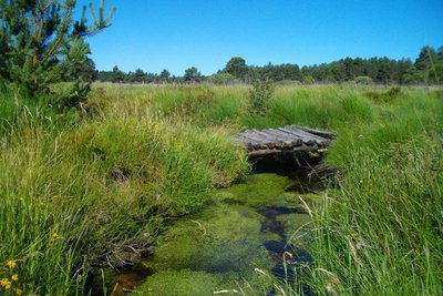
CC HCC  River
RiverThe Vézère
With a length of 211 km for a basin of 3736 km², the river Vézère has its source at an altitude of 700 m in the Longéroux peat bog, on the Millevaches plateau in Corrèze. The richness of the lower Vézère in prehistoric deposits gives it an incomparable prestige, which is why part of the Vézère valley has been classified as a UNESCO World Heritage Site.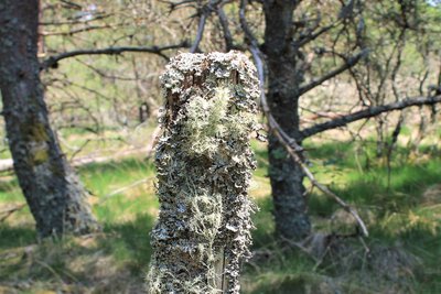
Lichen - O.Nugueo - CC HCC FloraLichen is everywhere
The altitude of this site, between 700 and 1,000 m, makes it the coolest and wettest area in Limousin. It is these particular weather conditions that explain the presence of different lichen species. Lichens disappear when there is too much air pollution. Given the multitude of species present on this site, we understand that the air here is clean.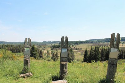
O.Nugueo - CC HCC PanoramaReading the landscape
Educational panels are installed here to help you understand the landscape. Please take a moment to read them to understand better the panorama that is available to you.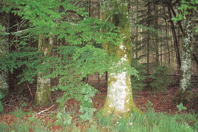
Les hêtres FloraRound-leaved Sundew
The round-leaved Sundew (rosolis rotundifolia) which cannot find its food in the soil will seek it in the animal environment by capturing small insects in its leaves.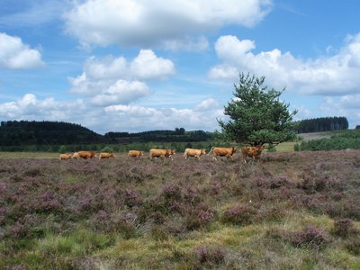
Vaches limousines sur la tourbière du Longeyroux - G.Salat - CC HCC  Peat bog
Longeyroux peat bog
The Longeyroux peat bog (255 hectares) occupies the bottom of a basin that collects rainwater from the surrounding puys; This is how the Vézère river was born. A cold and humid climate and an acid granitic soil have favoured the development of distinctive fauna and flora. A short, 30-minute interpretation trail provides a better understanding of this environment. To preserve this ecosystem, the site's enhancement policy encourages grazing by Limousin sheep and cows.
Description
Marking: follow the granite stones representing the heather (purple flowers)
Departing from the reception area, retrace your steps in the direction of Celle.
- 100 m before the cemetery take the path on the left, then at the next crossroads take another left. Go through the softwood forest and continue straight ahead.
- At the red gate, it is possible to enter the peat bog to see the "100 Stones" (go forward 100 m). Back at the gate, turn left. Cross the small stream to reach the fir plantation.
- Cross the meadow on the left by going through the two barriers, then take a wooden bridge that crosses the Vézère. Take the left turn at the edge of the woods.
- At the small road, turn left and follow it. It becomes a gravel track, continue until you reach the three educational information posts where you have to take the small path on the left signposted "return to the Longeyroux area". Cross the Vézère a second time.
- At the crossroads, turn left, continue for 100 m to reach the road. Turn left and follow it until you reach the Longeyroux area.
- Departure : Longeyroux reception area, Saint-Merd les Oussines
- Arrival : Longeyroux reception area, Saint-Merd les Oussines
- Towns crossed : Saint-Merd-les-Oussines, Meymac, Chavanac, and Saint-Sulpice-les-Bois
Forecast
Altimetric profile
Recommandations
Pick up the guide booklet to take with you - available at the tourist office. Waterproof footwear recommended. Be careful in foggy weather; there are few landmarks.
Is in the midst of the park
The national park is an unrestricted natural area but subjected to regulations which must be known by all visitors.
Information desks
Access and parking
From Meymac take the D 36 and then the D 979 towards Bugeat. Head towards the village of Celle. At its cemetery, take the road on the right towards the Longeyroux area car park.
Parking :
Longeyroux Reception area, Saint-Merd les Oussines Longeyroux Reception area, Saint-Merd les Oussines
More information
Report a problem or an error
If you have found an error on this page or if you have noticed any problems during your hike, please report them to us here: