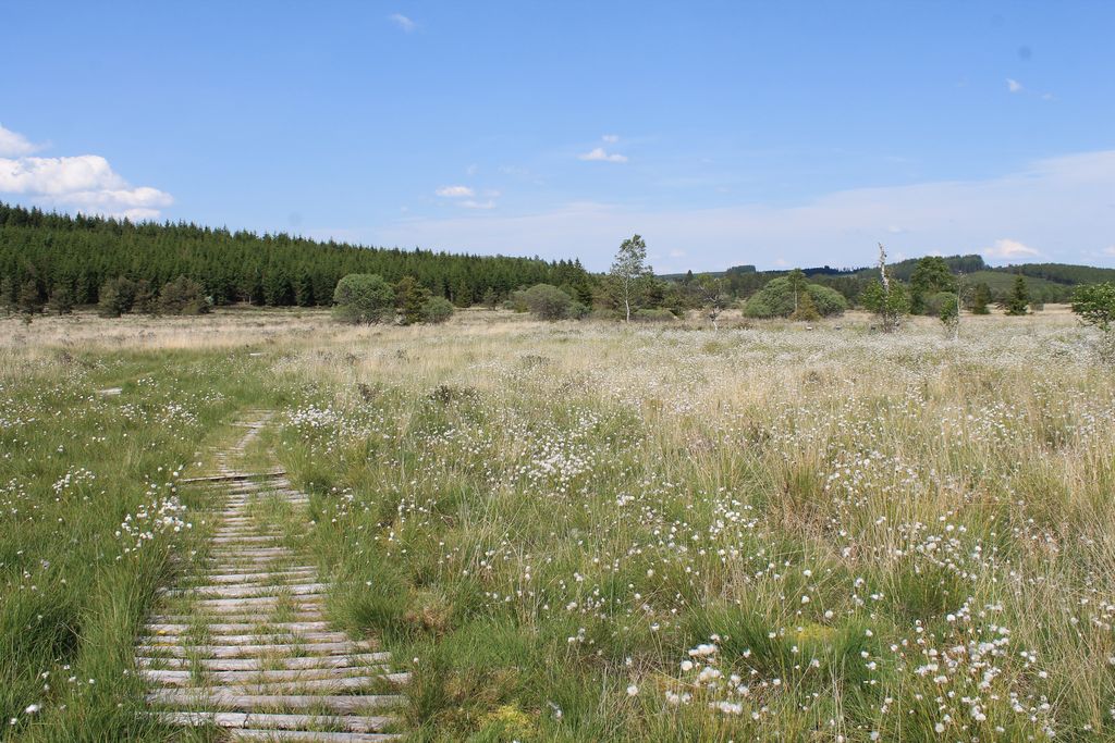
The cottongrass path
Saint-Merd-les-Oussines
The cottongrass path
Easy
0h30
905m
+24m
-24m
Loop
Embed this item to access it offline
The Longeyroux peat bog invites you to share its secrets. An interpretation trail has been built to immerse you in the heart of this very special site. With the help of the educational panels, you can learn how peat is formed as well as learning about its flora and fauna. Spend a few peaceful moments surrounded by an exceptional panoramic view of the bog and the extinct volcano cones nearby.
5 points of interest
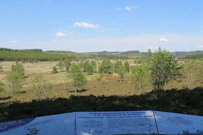
Panorama - O.Nugueo - CC HCC  Panorama
Panorama
Here you overlook the peat bogs spread out below. This place also offers you a panoramic view of the puys, or extinct volcano cones, that surround the peat bogs. On a clear day, you can admire one of the most iconic landscapes of the Millevaches plateau.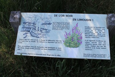
Panneau d'information sur l'exploitation de la tourbe - CC HCC  Peat bog
Peat formation process
Peat can only be formed in environments that are constantly saturated with water. They therefore need a positive water balance with inputs from multiple sources (rain, snow, fog, runoff, etc.). This balance must be equal to or greater than the losses (evaporation, transpiration, etc.). It takes about a century for between 1 and 2 centimetres of peat to form. The peat bogs of Longeyroux have a depth of 2 metres of peat.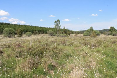
O.Nugueo - CC HCC  Flora
FloraAn adapted flora
The development of conventional fauna and flora was complicated in peatlands. Many species adapted themselves to the constraints of this environment. For example, cottongrass, the trail's symbol, grows in ever thicker tufts, which allow it to escape from the water. The drosera feeds on small insects that it attracts to its leaves with droplets of a juice it produces.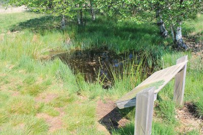
O.Nugueo - CC HCC  History
Family peat cutting
Until the beginning of the last century, families on the plateau used peat as fuel to heat their homes, as the region was not very heavily wooded at the time. To do this, they dug ditches in an area of peat to drain the water from it. Then they would remove pieces of peat in the form of briquettes and let them dry. In bad weather, they put these briquettes on the fire as we would use wood today.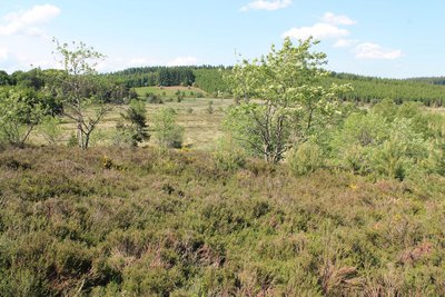
O.Nugueo - CC HCC FloraGrazing and callune
In the past, the peat bogs were used to graze sheep; with the agricultural decline linked to the rural exodus, these areas have been abandoned. Today, the Conservatoire des Espaces Naturels du Limousin has reintroduced Limousin sheep on these plots in order to maintain the callunes. Callune is a perennial plant that measures between 20 and 50 cm in height. Despite its similarity to heather, these two plants are very different.
Description
Markers: follow the carved granite stones representing the cottongrass (white flower) Leaving the reception area. Opposite the information panels, take the small path on the left located 10m further on.
- At the landscape reading table, follow the small path to descend into the bog.
- Take the small wooden bridge.
- Find and follow the planked wooden path.
- Departure : Reception area for Longeyroux, Saint-Merd-les-Oussines
- Arrival : Reception area for Longeyroux, Saint-Merd-les-Oussines
- Towns crossed : Saint-Merd-les-Oussines
Forecast
Altimetric profile
Recommandations
Waterproof shoes recommended
Information desks
Access and parking
From Meymac take the D 36, and then the D 979 towards Bugeat. Head towards the village of Le Celle. At the cemetery, take the road on the right towards the car park for the Longeyroux reception area
Parking :
Reception area for Longeyroux, Saint-Merd-les-Oussines
More information
Report a problem or an error
If you have found an error on this page or if you have noticed any problems during your hike, please report them to us here: