The Sources of the Vienne
An interpretive trail punctuated by the legend of the three sisters of the Vienne. Come and stroll around the three sources of the Vienne, this 372 km long river that rises at the foot of Mont Audouze and flows into the Loire.
6 points of interest
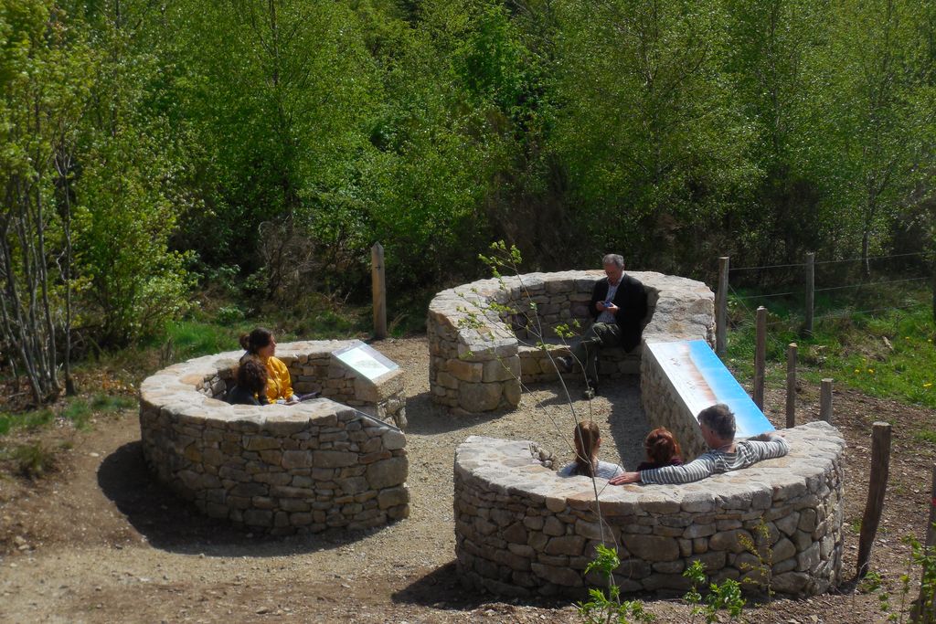
CC HCC  Panorama
Viewpoint
In front of you lies the Plateau de Millevaches. It is here that the legend of the sources of the Vienne was born. The story goes that the three daughters of the king who ruled the Plateau, after finding themselves widows and orphans, each took refuge in a dry stone shelter along the trail. These three shelters symbolise three of the sources from which the Vienne sprang.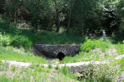
Source de la Vienne - G.Salat - CC HCC  Source
The first source
Here, the first of the three sources. It was built between the Neolithic and Gallo-Roman periods. It has been maintained up to now, mainly to water the herds that were brought to these valleys for grazing. The current layout is contemporary with the creation of the itinerary.
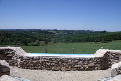
Source de la Vienne - G.Salat - CC HCC SourceThe second source
Here you are in the heart of a peaty meadow next to the second spring. This is, in fact, the source of the Vienne. Located at an altitude of 887m, it represents the highest point of the river.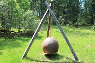
La cloche - O.Nugueo - CC HCC  Art
ArtThe bell
This bell features in Pierre Redon's work, Les Sons des Confins, on the theme of water. This work takes the form of an eight-step initiation course along the Vienne and Loire rivers. This route is another way of discovering the region, which is independent of the Sources de la Vienne. Find an artistic and technical presentation (mobile app) on the website www.marchesonore.com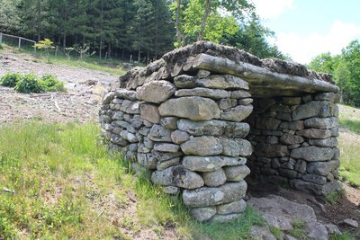
L'abri de berger - O.Nugueo - CC HCC  Small patrimony
The shepherd's shelter
A quick round trip to see an old shepherd's hut. This type of construction was very common between the 18th and 19th centuries. They were built by the shepherd himself with local stones. This small shelter allowed him to graze sheep while remaining sheltered in case of bad weather. Sometimes the shepherds also slept on the spot to protect their flock from possible predator attacks.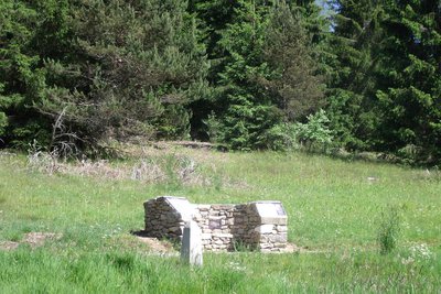
La troisième source - G.Salat - CC HCC SourceThe third source
This source is the last one on the route. The origin of its cavity is still mysterious today. Two hypotheses have been put forward. The first is that it formed "through wear and tear", i.e. because of the incessant trampling of the animals. The second one suggests it is more like a wild boar wallow. Today, the bed of the stream has widened along the line of the slope of the site.
Description
In the car park, cross the road and take the path opposite, signposted "Sources de la Vienne".
- At the orientation table, go down the trail that runs alongside the meadow.
- At the first of the sources, continue straight ahead and turn left at the crossroads, going up into the undergrowth. At the end, cross the field and climb up the trail to the right at the edge of the forest. On the forest track, turn left and follow it.
- When you come out of the woods, turn left into the clearing to see the second source. Then join the forest track, cross it and turn right on the one above. Continue straight ahead, leaving the tracks on your left.
- At the T-junction, turn right and continue for 50 m. Take the wooden stepladder to enter the meadow and continue to the third source spring (just before which, take a 100 m round trip to see a traditional shepherd's shelter).
- Continue through the pasture. Cross the fence using a second step ladder; Continue through the young plantation. Back on the forest track, turn left. At the next crossroads, take a small trail on your right that goes down to the first source. Go back up to the starting point.
- Departure : Car parking area for the Sources de la Vienne, Saint-Setiers
- Arrival : Car parking area for the Sources de la Vienne, Saint-Setiers
- Towns crossed : Saint-Setiers and Millevaches
Forecast
Altimetric profile
Recommandations
After the hike, it is possible to drive back on the D36 towards Féniers. 600 m. further on, park on the right. Take the trail that leads up to Mont Audouze (600 m AR)
Information desks
7 route d'Aubusson, 19290 Millevaches
Access and parking
From Meymac, take the D36 towards Féniers. Go through Millevaches and continue for 3 km. The car park is located at the intersection of the D36 and D21 (direction Peyrelevade).
Parking :
More information
Report a problem or an error
If you have found an error on this page or if you have noticed any problems during your hike, please report them to us here: