By Les Monts and Les Vergnes
Mérinchal
By Les Monts and Les Vergnes
Medium
4h
16,3km
+328m
-327m
Loop
Yellow markers
Embed this item to access it offline
From Merinchal, where the River Cher originates, this itinerary will take you to the foothills of the Monts d'Auvergne to discover the characteristic landscapes of the South East of the Creuse.
3 points of interest
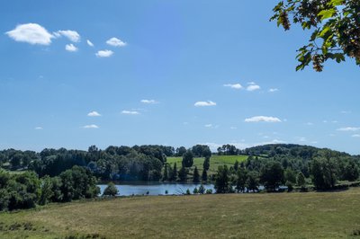
Mérinchal - Etang de Mondayraud - MCEA  Pond
PondMondayraud Pond
The pond of Mondayraud is classified ZNIEFF (Natural Zone of Interest for its Ecology, Flora and Fauna). This site is home to many bird species and is an important area for their migration. The area around the pond contains remarkable plant species. Willow groves, alder groves and wet meadows complete this rich natural area.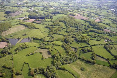
Panorama sur le bocage - J.Damase ( Creuse Tourisme)  Panorama
Panoramic view of the farmland crisscrossed by hedges and trees
At the end of the 18th century, Arthur Young was already sensitive to the hedged farmland of the region: “Hills, valleys, woods, paddocks, streams, lakes and scattered farmsteads form a thousand delightful pictures.” As for the toponym “Vergne”, it can refer to river dikes made of stones and fascines (piles of branches) or, more simply, to very wet meadows.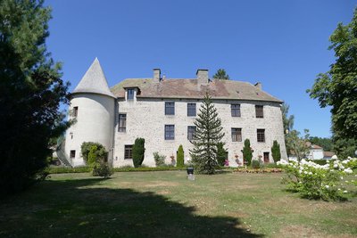
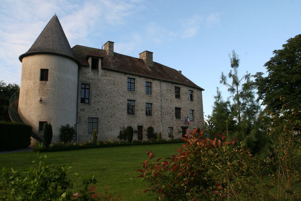
Château de la Mothe - CC Marche et Combraille en Aquitaine  Heritage site
Château de la Mothe
The Château de la Mothe was built in the 12th century. A pentagonal corner tower with a spiral staircase was added in the 15th century. This tower opens to the outside through an ogival door. This château was surrounded by a moat which was later filled in.
Description
Starting point: From Château de la Mothe turn right onto the D27.
- Follow the D27 on the left until you reach the D39, on the right (towards Montel de Gelat). Cross the level crossing and continue this road for 600 m.
- Take a path on the left towards the Mondayraud pond. Cross the road and continue this path until you reach the tarmac.
- Take this road to the right, then take the path immediately to the left. After a few metres, turn left and continue until you reach the road.
- Turn left onto it to join the D28, which you follow on the right.
- Take the first path on the left (old Roman road) overlooking the village of Les Monts. Follow it for 2.5 km to the road.
- At the road, turn right and then take the first track on the left.
- When you reach the tarmac, it is possible to continue to the left for 100 m and then take the second road on the right, which gives you a view of the Château des Vergnes (beginning of the 20th century).
- At the road, turn right, then about 350 m further on, take the first road on the left.
- Take the first path on the right. Follow it as far as the tarmac.
- Take the road on the right, and then the second on the right.
- Take the path on the left just before the railway track.
- Follow it to the tarmac, and then follow the path under the railway track until you reach the road.
- Turn left, and after the cemetery, and turn left again on the path that goes up to the tarmac.
- Turn left and pass the railway line.
- Take the path between the two hangars up to the road.
- Take the road on the right. Go through the village by turning left.
- At the top of the hill, choose the path opposite, to reach the D28. Turn right, cross the bridge and continue on Mérinchal.
- After the pond, turn left towards Létrade, then the first on the right to go down the road to the Château de la Mothe.
- Departure : Chateau de la Mothe, Mérinchal
- Arrival : Chateau de la Mothe, Mérinchal
- Towns crossed : Mérinchal, Chard, and Dontreix
Forecast
Altimetric profile
Information desks
Rue de l'Etang, 23700 Auzances
Access and parking
16 km from Auzances, follow the D27 then the D996.
Parking :
Chateau de la Mothe, Mérinchal
Accessibility
- Emergency number :
- 112
More information
Report a problem or an error
If you have found an error on this page or if you have noticed any problems during your hike, please report them to us here: