History and Heritage Trail - East Variant

Montboucher
History and Heritage Trail - East Variant
Medium
4h45
18,4km
+463m
-464m
Round trip
Yellow markers
Embed this item to access it offline
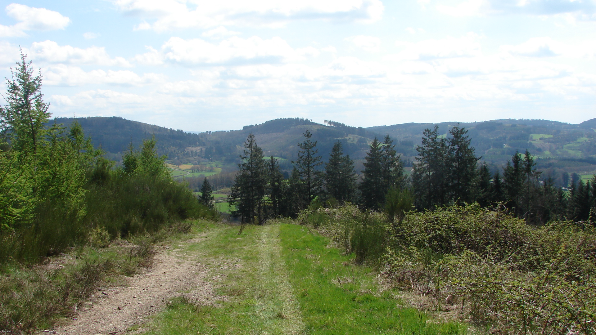
A half-day trip for you to discover prehistoric, Gallo-Roman and medieval remains, and buildings from modern and contemporary times, as well as a remarkable natural and landscape heritage.
3 points of interest

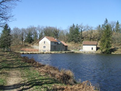
Le moulin de Montboucher - ©OTCSO  Heritage site
The Mill of Montboucher
A 19th-century building, this mill associated with a pond is today rented as a fishing lodge.
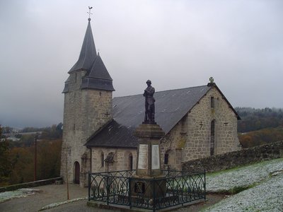
L'église de Saint Amand Jartoudeix - ©OTCSO  Heritage site
The church of Saint-Amand-Jartoudeix
Built in the 13th century to celebrate Saint Roch, it was enlarged and fortified in the 15th and 16th centuries.
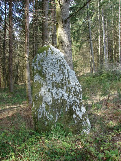
Menhir à Saint Amand Jartoudeix - ©OTCSO  Small patrimony
The Clides menhir
It appears on the 1830 land registry plan under the name "Pierre de l'ancienne justice" and ancient justice stone. At the time, the Clides site was still in use. It should be noted that on 15 May, the sun rises exactly in the extension of the horizontal axis of the menhir.
Description
- Walk past the church towards the cemetery and stay on the main road. Before reaching the cemetery (recommended detour), turn left onto a path that leads down to the D 36. When you get to the road, turn right and follow it until you reach the junction with the D 941. At the crossroads, follow the D 941 carefully on the right for 300 m and cross it to take the road on the left towards the Montboucher mill (watch out for traffic!). 300 m further on, turn right onto the dead-end road leading to the mill, pass in front of it, and continue on the path bordering the right-hand side of the pond to the village of Gorceix.
- At the metal cross in Gorceix, take the track which ascends on the right and, a few metres further on, another track on the right to the village of Le Clou.
- Once you reach the road, follow it on the left and go through the village.
- As you leave the village, take the first trail that ascends on the left, ignore a path on the left and continue straight on through the fields. After a left turn, turn right on a forest path. Where the three paths cross, take the one on the right that goes up to the top of the Puy de Saint-Amand-Jartoudeix, then leave the path on the left to reach a cross and a breathtaking view of the town. Continue straight ahead along the path that goes around the puy, leave a path on the right at a water reservoir, then a path on the left and finally a last path on the right.
- When you reach the road, fork left onto the left-hand road that goes up to the village, go past one road on the left, and go down towards the main road. When you reach it, follow it to the right until you reach the church and its cemetery, go past them, fork right and return to the bottom of the puy. Follow the main road on the left for 800 m towards Marcoux. Turn left onto a tree-lined path to join a road which you follow on the left towards a detached house. Take the path on the right which goes up and around the house. On the right-hand side of the path, you will find a small menhir and, a little further on, a stone cross deserves a short round trip. This path leads to the D941 in the village of Le Nouhaud, follow it on the left for 500 m and pass in front of the car park.
- After the car park, take the path on the right to reach the wood, the Bois du Nouhaud. Go straight on, cross the road, then take the path straight on towards La Besse. Enter the village, take the road on the right, then the path that descends on the left and after 200 m, take the track on the right.
- Take the road opposite, on the right of the house, and continue around the second farm. When the road makes a right-angled right turn, leave it, and take the path straight ahead alongside a big fence, then, a few metres further on, take the path on the left that runs alongside a meadow and goes through an area of forestry. At the end of this wood, turn right onto the farm track that goes up into the meadows, then goes down into a wood. Cross the river Béraude by a wooden footbridge, and then climb up to the private Chateau of Védrenas.
- In front of the entrance of the chateau, take the pathway on the right, follow it to the road. Continue on the left for 200 m, then take the first track on the right which leads to Montboucher. Cross the road straight ahead towards the housing development. At the top of this road, in the right-angled bend, a grassy path borders the gardens and drops back down to the road. Turn right towards the town centre and then right again towards the church.
- Departure : Church car park, Montboucher
- Arrival : Church car park, Montboucher
- Towns crossed : Montboucher, Saint-Amand-Jartoudeix, Sauviat-sur-Vige, and Saint-Pierre-Chérignat
Forecast
Altimetric profile
Recommandations
Of medium difficulty, this trail is intended for all sports enthusiasts, equipped with at least sturdy hiking boots and appropriate clothing.
Information desks
Place du Champ de Foire, 23400 Bourganeuf
Access and parking
8 km from Bourganeuf, follow the D941.
Parking :
Church car park, Montboucher
More information
Report a problem or an error
If you have found an error on this page or if you have noticed any problems during your hike, please report them to us here:
