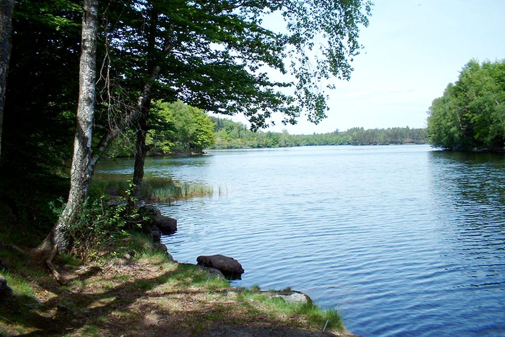
Circuit of the Lac de Faux
Faux-la-Montagne
Circuit of the Lac de Faux
Medium
2h
6,2km
+85m
-85m
Loop
Yellow markers
Embed this item to access it offline
Come and discover this dam built between 1947 and 1951. Its elegant form, where the simplicity, refinement and minimalism of the construction are sufficient to fulfil the functions assigned to them, has lines which are still fully in harmony with the landscape. There are only two examples of this work of art in Europe.
4 points of interest
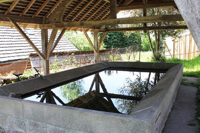
Les lavoirs de Faux-la-Montagne - OT Aubusson Felletin Tourisme  Small patrimony
The laundries of Faux-la-Montagne
Appearing in the 19th century through concern for public health and personal hygiene, public laundries were sociable places in villages, reserved for women, who gathered there out of common need and where everyone had their place. The men only came to maintain them, thus avoiding the jibes of the women doing the washing, who had the reputation of having very sharp tongues. Covered laundries were still frequently used until the 1950s.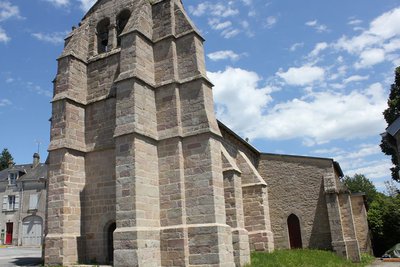
Eglise de Faux-la-Montagne - OT Aubusson Felletin Tourisme  History
Faux-la-Montagne
Faux-la-Montagne owes its name to its high altitude (more than 700 m above sea level) on the western edge of the Millevaches plateau. Although the region was not always wooded, many beech plantations (or fayards) must have existed in the Middle Ages on the outskirts of the village. Indeed "Faux", from the Latin fagus, means beech in Old French; In the 15th century, the village was called Faguo (an Occitan variation of the Latin fagus). Today, around Lake Faux, beech and oak mingle with coniferous trees, occupying what was still heathland grazed by sheep in the 19th century.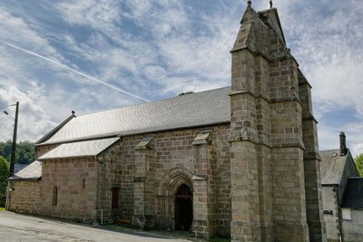
L'église de Faux-la-Montagne - B.Biache  Heritage site
The church of Faux-la-Montagne
This church, dedicated to Saint-Etienne, the first Christian martyr, was built in the 13th century and was listed as a historic monument in 1963. Its restoration in 2010 revealed its pink granite masonry, eight centuries after its construction.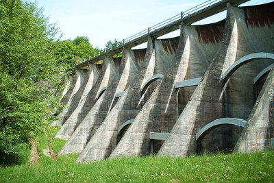
Le barrage à voûtes - Le Lac de Vassivière  Site
SiteThe arched dam
The multi-arch dam is 8 cm thick, 16.5 m high and 130 m wide.
Description
- From the Place de Faux-la-Montagne, opposite the 12th-century church, with the covered laundry on the right below, follow the road to Gentioux (D992) for 300 m until you reach the fountain at the edge of the village.
- Take the "Chemin de la Fontaine-Pouilleuse" on the left of the fountain, leave the ascending path on the left and carry on to the Traluamont crossroads near Lake Faux.
- Turn left onto the path that runs alongside the lake in a hardwood forest. About 700 m further on, go up the path on the left: it leads away from the lake and reaches a crossroads.
- Go down to the right on the trail, until you reach a clearing with lots of broom and find the shore of the lake.
- At the intersection, go down to the right behind the Dorat dam. This multi-arch dam is of a type rare in France. Go back up then continue to the right on the trail beside the lake until you reach a path under the trees. Turn right and take it, cross the bridge over the La Maulde River and continue until you reach a crossroads.
- Continue straight ahead until you reach a new intersection.
- Turn right and take the path that goes down through the undergrowth towards the lake. Go along it until you reach the D992.
- Follow the D992 on the right (in the direction of Faux-la-Montagne), cross the dam (viewpoint on both sides) and fork right just after it to find the trail to follow.
- Then turn left to reach Faux-la-Montagne.
- Departure : Square in front of the church, Faux-la-Montagne
- Arrival : The square in front of the church, Faux-la-Montagne
- Towns crossed : Faux-la-Montagne
Forecast
Altimetric profile
Information desks

Place Quinault, 23500 Felletin
Rue de Vassivière, 23460 Royère-de-Vassivière
Transport
Public transport >> www.aubusson-felletin-tourisme.com
Access and parking
35 km from Felletin, take the D992.
Parking :
Square in front of the church, Faux-la-Montagne
Accessibility
- Emergency number :
- 112
More information
Report a problem or an error
If you have found an error on this page or if you have noticed any problems during your hike, please report them to us here: