Chaleix Wood
Bugeat
Chaleix Wood
Easy
1h30
6,1km
+107m
-108m
Loop
Yellow markers
Embed this item to access it offline
This circuit takes us along an iconic river in the Massif Central, the Vézère. It rises from its source in the heart of the Longeyroux Peat Bog and flows, eventually, into the Dordogne. Even if the echo of the river is ever-present, this little fisherman's trail offers a different atmosphere all year round: the freshness of the undergrowth and blueberries in summer, autumn colours, an unobstructed view of the river in winter, and meetings with fishermen in spring...
3 points of interest
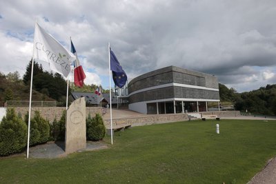
Espace 1000 Sources - CC HCC  History
Espace 1000 Sources
The circuit starts near the Espace 1000 Sources stadium, a training centre that welcomes groups of sports enthusiasts who love the great outdoors. Behind this centre is Alain Mimoun, winner of the Sydney 1956 Olympic Games marathon, who had fine-tuned his preparations in Bugeat.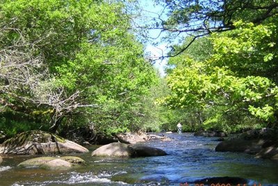
L.Gelly  River
RiverLa Vézère
Rising from its source in the heart of the Plateau de Millevaches in the Longeyroux peat bog, the Vézère flows into the Dordogne after having covered more than 200 km. Along the way, the confluence of the Vézère and the Petite Vézère is an ideal place to stop. The excellent quality of its waters is confirmed by the presence of the otter.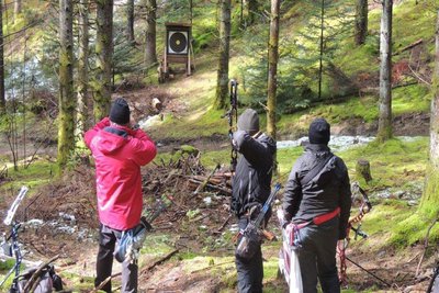
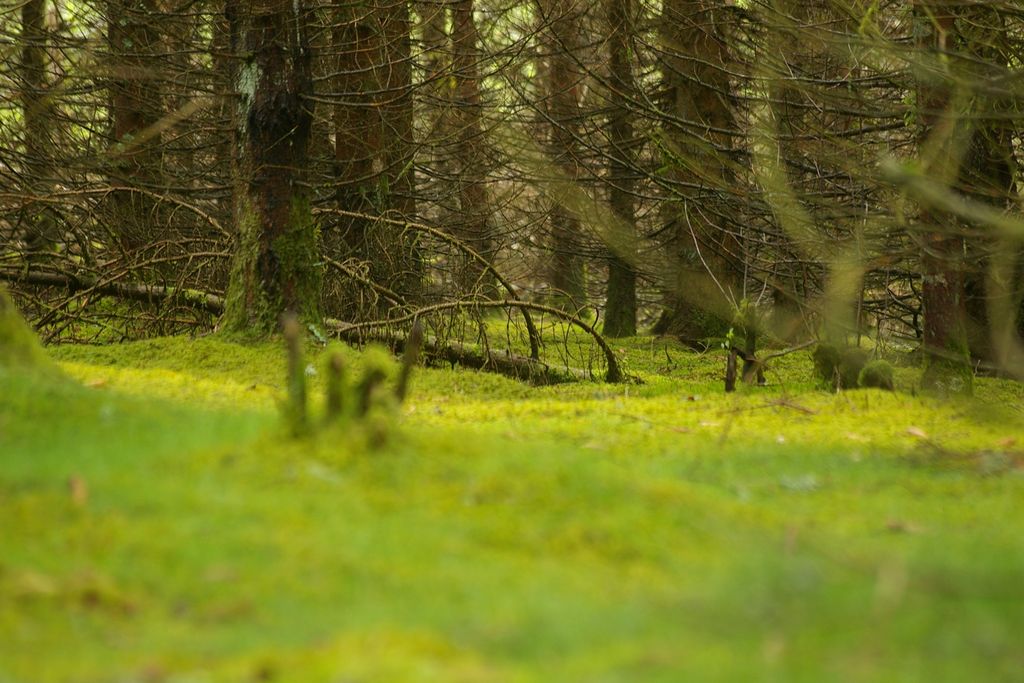
Le Bois de Chaleix - CC HCC  Forestry
Chaleix Wood
The Bois de Chaleix, with a ground area of about 150 ha, was acquired recently by the commune of Bugeat. Bordered by the Vézère river, it is composed of deciduous and coniferous trees. It offers many possibilities for sporting activities: hiking, orienteering, trail running, fishing and archery.
Description
Start behind the stadium grandstand. Take the path that leads towards the woods. Go over the barrier.
- At the crossroads, take the track on the left which runs alongside the Vézère. After the last of the chalets you can see on the other side, climb the steep little path. At the top, leave the main track; a poorly marked path goes back down to the river. Follow it for about 45 minutes. Several successive landmarks: the path turns in a meander of the river - alongside a first islet - goes over a large block of granite. It then joins a wider track away from the watercourse; follow it to the left for 300 metres.
- Before this track climbs into the undergrowth, take a path to the left alongside the river. Other landmarks: the hidden ruins of a mill on the other side (visible in winter), the path that rises above the water and then descends, the confluence of the Vézère and the Petite Vézère. 100 m after this confluence, join a more clearly marked path that leaves the watercourse and rises abruptly into the undergrowth. It gradually widens out onto the ledge.
- Turn left at the forestry track.
- When you get to a huge crossroads, follow the second track on the right. It passes in front of the ruins of a barn. At the end of the track, turn left to descend again. Carry straight on to return to the starting point.
- Departure : Lake of the Three Bridges, Bugeat
- Arrival : Lake of the Three Bridges, Bugeat
- Towns crossed : Bugeat
Forecast
Altimetric profile
Recommandations
Paths are liable to flooding at times.
Information desks

Transport
Bugeat Station
Access and parking
In Bugeat, on the D979, head towards the Espace 1000 Sources then the Etang des Trois Ponts. Start off behind the stadium grandstand.
Parking :
Lake of the Three Bridges, Bugeat
More information
Report a problem or an error
If you have found an error on this page or if you have noticed any problems during your hike, please report them to us here: