Of Mankind and Nature
8 points of interest
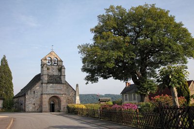
Bourg de Saint-Rémy - CC HCC  History
Bourg de Saint-Rémy
From the village of Saint-Rémy, a magnificent Sully oak tree adorns the village square. Sully, King Henry IV's minister in charge of beautifying roads and villages, encouraged the planting of remarkable trees. The 12th-century church has gravestones set into its granite paving. Outside, the semicircular apse of the choir is decorated with a modillion cornice with strange characters.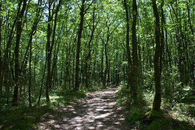
Forêt - CC HCC  Forestry
The Mirambel Forest
At the start of the walk, the Place de Saint-Rémy is embellished with a magnificent Sully oak tree. Sully, a minister to King Henry IV, had roads and squares embellished with remarkable trees. The paving of the church, which dates from the 12th century, includes several tombstones. The outside of the apse is richly decorated with a modillion cornice.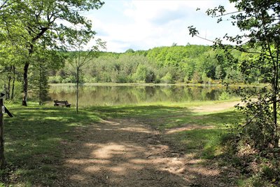
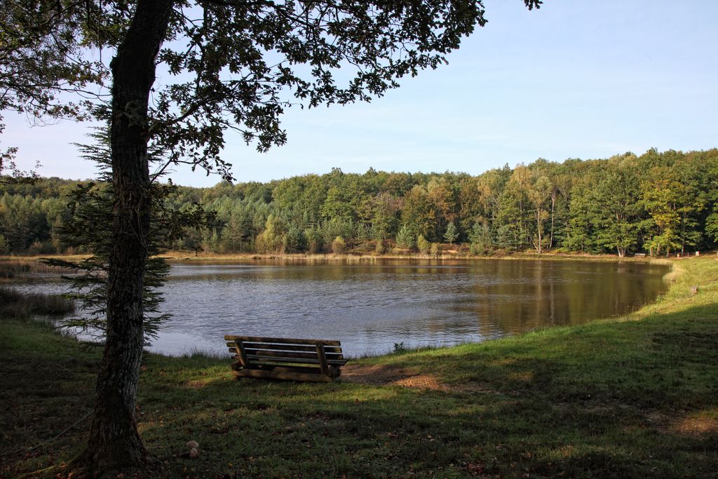
Etang - O.Nugueo - CC HCC  Fauna
FaunaOf man and nature
This lake was dug to supply water to fight forest fires. But nature has gradually regained its rights over this artificial environment: rushes, sedges, bulrushes; at the back, a floating area of soil has formed, the bog is gaining ground.
With a bit of luck, you might be able to spot the grey heron that has taken up residence here.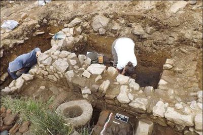
Fouille de villa à Saint-Rémy - G.Boguet HistoryGallo-Roman road
A road, said to date from antiquity, linking Ussel to La Courtine crosses the Mirambel forest. Close your eyes and imagine that under your feet there is a large concentration of rubble, tile fragments and wall facings. But where do they come from? Probably dwellings and other buildings located along this road. A little further north of the town, the "des Fonts" site, probably an old villa, is the subject of archaeological research.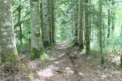
L'allée des gardes - O.Nugueo - CC HCC  Flora
FloraL’allée des Gardes
"L'allée des Gardes", rows of large coniferous trees, refers to the forest rangers who manage this massif. Behind this alley, the forest is managed through natural regeneration (as opposed to planting seedlings and young plants from nurseries): the undergrowth is cleared, some beautiful preserved trees play the role of seed trees. The seeds grow into a shrub; gradually the "old" seed trees are eliminated to make way for the young shoots.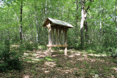
La sonate de Mirambel - O.Nugueo - CC HCC  Small patrimony
The Mirambel Sonata
This xylophone was made by the children from the Sainte-Fortunade special school in Corrèze. They have created this construction to try and demonstrate to us the variability of the sounds produced by the different species of trees according to their appearance, hardness and durability.
Enjoy and be lulled by this delightful auditory experience.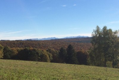
Monts d'Auvergne - Puy du Suc - CC HCC  Panorama
The Mountains of Auvergne
If the sun is shining on it, the neighbouring Auvergne will let you admire its volcanoes. On the right, the Massif du Sancy, on the left, the Monts du Cantal, in the centre the Plateau du Cézallier. However, it would be a pity to admire only the background of this landscape: the Haute-Corrèze countryside blends colours and shapes of meadows, coniferous and deciduous forests.
Résistants HistoryThe Resistance
The stele, or memorial stone, erected at this crossroads takes up the Song of the Partisans, the hymn of the Resistance. It forms part of the interpretation trail that partially intersects this hike. During the Second World War, in July 1943, 60 to 80 resistance fighters belonging to Vincent Faïta's group (communist resistance fighters of Italian origin) hid in this forest. Sheltered in simple huts made of branches, they came to take refuge there between two ambushes intended to slow down the German advance.
Description
Depart from the church car park. Take the road towards Couffy; go through the village.
- Turn right towards Combefort-Haut. 50 m further on, take the path on the right. Cross the stream, the Levades. At the intersection, go left for 100 m.
- At the next crow's foot, set off on the right-hand track.
- At the forestry track, fork right for 200 m.
- Turn left on the path where there is a wooden barrier. At the pond, continue along the track in front of you. Go left at the next intersection.
- Take the left-hand trail. Follow it until you reach a barrier.
- Take the track opposite for 100 m, and then the path to the right.
- Take the trail on the right (old Roman road). At the next intersection turn right. Go straight on at the next crossroads.
- At the crow's foot, turn right.
- At the crossing before the village, set off on the right-hand path. At the next crossing, go straight ahead and continue on the wide track.
- Take the right-hand path, pass the barrier, and continue. At the intersection at the right-angled bend, turn left. 200 m further on, take the trail on the right, which rises slightly at a right angle.
- At the barrier, cross the forest track to take the path through the forest in front of you. A few metres further on, take the right-hand trail.
- Go along the forestry track. 20 m further on, turn left onto a winding trail that climbs; continue until you reach the viewpoint over the Mountains of Cantal and the Massif du Sancy. Continue past the panoramic viewpoint until you reach the crossroads.
- At the place where the paths cross (memorial stone), take the descending left-hand path.
- At the track, take the way opposite you, and continue along the fence. At a crossroads of trails, continue on the small left-hand trail that still runs alongside the fence. Pass over the footbridge and follow this path to reach Saint-Rémy.
- Departure : Place de l'église, Saint-Rémy
- Arrival : Place de l'église, Saint-Rémy
- Towns crossed : Saint-Rémy, Courteix, Saint-Pardoux-le-Neuf, and Lignareix
Forecast
Altimetric profile
Recommandations
Information desks
Access and parking
Parking :
More information
Report a problem or an error
If you have found an error on this page or if you have noticed any problems during your hike, please report them to us here: