Between lake and pond
Saint-Hilaire-les-Courbes
Between lake and pond
Medium
4h
11,8km
+323m
-322m
Loop
Yellow markers
Embed this item to access it offline
The high vantage point that this route offers gives way to an exceptional view that imposes its gentle curves on the undulating landscape, all in protected natural surroundings.
3 points of interest
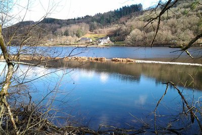
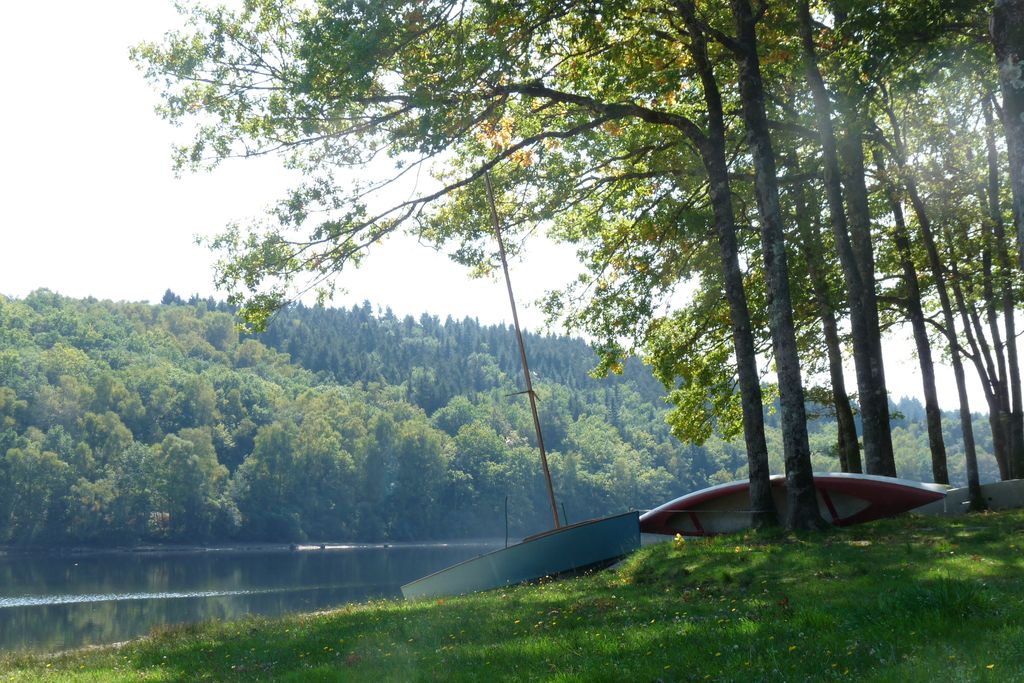
Le champs de l'eau (frayère à brochet) - Office de tourisme V2M  Lake
LakeThe "Champs de l’eau"
Site adjacent to Lake Bariousses, popular with fishermen for its carp swims and its many varieties of freshwater fish. The site also allows fishing for pike and zander due to the development of a pike spawning ground and the launching of fishing boats.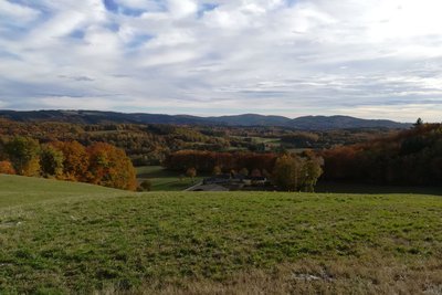
Le Puy du Mas - Office de tourisme V2M  Panorama
The Puy du Mas
A remarkable site, renowned for its open, 360° view. Located at an altitude of 727 m, it is the highest point in the district and offers fabulous view over all the surrounding mountains.
La Croix de la Goutte - Office de tourisme V2M  Small patrimony
The Croix de la Goutte
An ancient stone cross, indicating the presence of a crossing, here between four roads.
Description
- Head north along the shore of Lac des Bariousses for 1 km past the "Champs de l'eau" site. At the crossroads with the D157, turn right. After 150 m, turn left to walk to the village of La Brunerie. Before the first house, take the left-hand track, and continue for 1.5 km to reach the D940.
- Cross the road to take the D160 opposite, then take the second road on the left after 400m towards the village of La Nouaille. As you enter the village, take a stony track on the right, just after the first barn.
- At the crossing, turn left, then go up the track to the top (viewpoint on the right overlooking the Puy du Mas). Go down, leaving the first track on the right, cross a small stream, climb 100 m and go up a small hill on the right. After about 600 m, after a descent into the undergrowth, turn right again.
- Walk up to the local road leading to the village of la Goutte. At the crossroads (Croix de la Goutte), turn left to go back down to the D940. Turn left again and go along the B-road to return to the starting point.
- Departure : In front of the holiday cottage gate, Les Combelles
- Arrival : Devant le portail du gîte de vacances, les Combelles
- Towns crossed : Saint-Hilaire-les-Courbes and Treignac
Forecast
Altimetric profile
Recommandations
Caution due to road traffic
Information desks
Le Bourg, 197170 Saint-Hilaire-les-Courbes

1 place de la République, 19 260 Treignac
Transport
Stations: Bugeat (10km); Lacelle (6km)
Access and parking
Leave Treignac by the RD 490 towards Lac des Bariousses. After the shore, 1.5 km further on, take the road on the right which goes down towards the lake.
Parking :
The Champ de l’eau car park
More information
Report a problem or an error
If you have found an error on this page or if you have noticed any problems during your hike, please report them to us here: