Mills and rocks
Tarnac
Mills and rocks
Medium
3h30
12,6km
+333m
-334m
Loop
Yellow markers
Embed this item to access it offline
This path, considered by some to be one of the most beautiful in Corrèze, starts from Tarnac and goes up part of the course of the Vienne. It passes by a public spring located just behind the 11th-century church and placed under the protection of Saint George. Its water has healing properties.
8 points of interest
Office de tourisme V2M  Heritage site
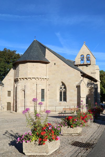
The Church of Tarnac
The church of Saint-Gilles and Saint-Georges de Tarnac has the particularity of being of Romanesque origin from the 12th century, enlarged in the 14th and 15th centuries by a Gothic aisle. This characteristic makes it a monument that is unique in the region.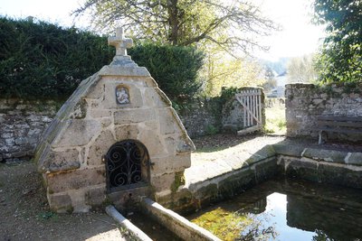
La Fontaine Saint-Georges - Office de tourisme V2M  Heritage site
The Saint-Georges Fountain
The Saint-Georges spring dates from the 17th century and also includes a covered laundry not far from the church. This fountain is in the image of many Christianised fountains in the Limousin, a saint is dedicated to them, thus giving this water healing virtues. That is why the water from this spring was once considered as pure and holy as holy water. Saint-Georges is a legendary martyr saint; the patron saint of knights, he personifies the ideal of chivalry; he engaged in a fierce battle with the dragon and triumphed with the help of Christ.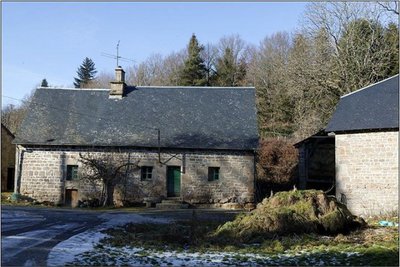
Hameau de Servières - J.Luce  Small patrimony
The Hamlet of Servières
An authentic granite village of traditionally built dwellings which still represents an important part of the Corrèze heritage today.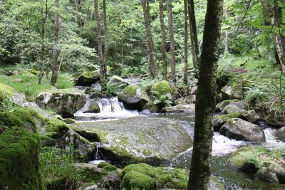
La Vienne - Office de tourisme V2M  River
RiverThe Vienne
This high valley of the Vienne with its rocks, water holes and mills offers remarkable views, especially of the flow of this great 370 km river that flows into the Loire.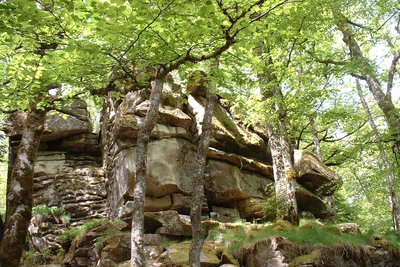
Les Rochers de Servières - G.Salat - CC HCC  Geological interest
The Rocks of Servières
Servières is a mysterious site where the granite rock is affected by both horizontal and vertical fracturing, which cuts it into blocks several metres wide. Horizontal cracks (or diaclases) give a "millefeuille" appearance”.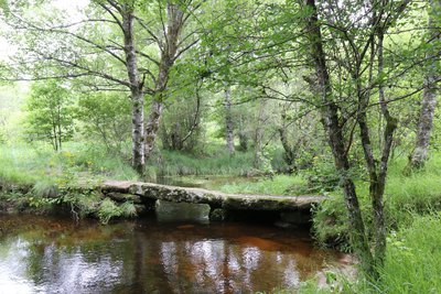
Le petit pont de pierres plates - Office de tourisme V2M  Heritage site
Small flat stone bridges
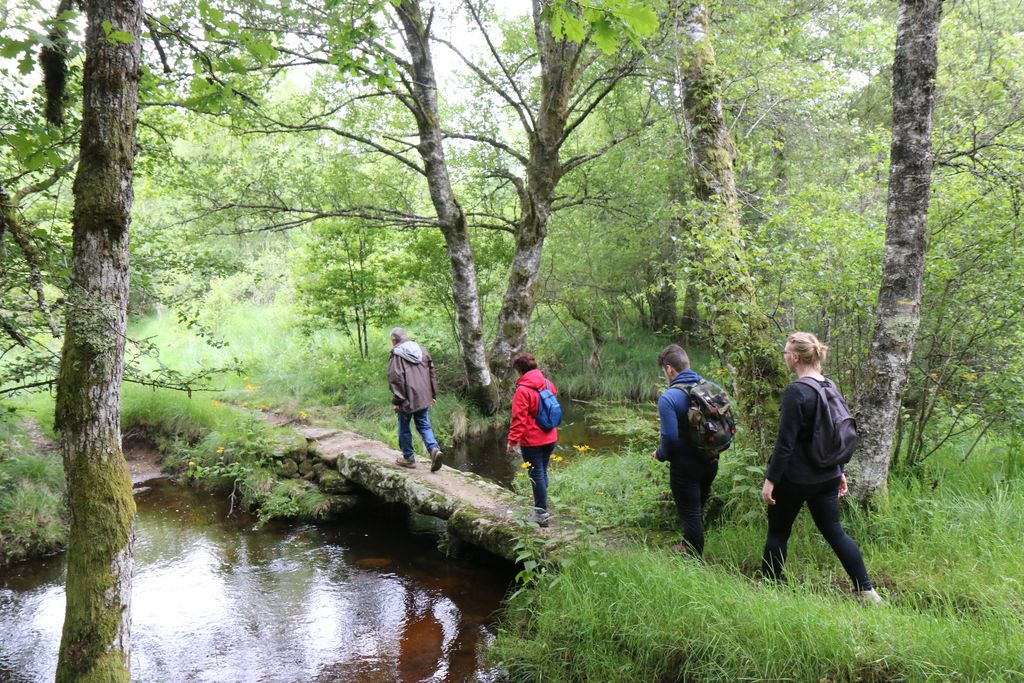
These "plank bridges" are typical of the Plateau and allow you to cross small watercourses. Made of several granite slabs, resting on stone piles erected in the stream bed, they allowed the shepherds to pass with their animals.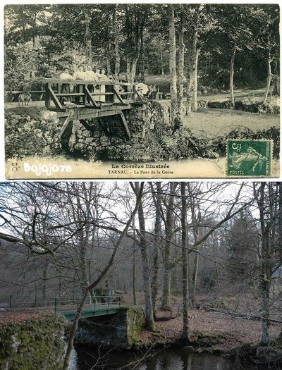
Le Pont de Lagorce - Office de tourisme V2M  Small patrimony
The bridge of La Gorce
A bridge that was formerly made of wood and is now replaced by a metal bridge, the La Gorce bridge still allows walkers to cross the Vienne and offers a view of this 370 km long river.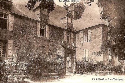
Château de Tarnac - Office de tourisme V2M  Heritage site
Le Château de Tarnac
The Château de Tarnac is characteristic of the early 17th century. Today, it is a private property that cannot be visited. It has a rectangular main building with two square pavilions, one on each side, and triangular pedimented dormers surmounted by balls. On the rear facade, access was via a porch, which has now been removed. Inside, it has a central straight staircase that crosses the main building from side to side and defines two huge rooms on either side. In the basement, there is the old kitchen with its barrel-vaulted ceiling, and which still has its fireplace and bread oven. On the ground floor, two salons retain their French-style ceilings, having main beams with moulded edges.
Description
Take the road towards Peyrelevade for 800 metres.
- At the last house, follow the "Chez Troussas" trail on the right. It rises into the undergrowth above the road. After 45 minutes of walking, leave this path and climb up to the right through the woods for 20 metres; a path goes down to the edge of the forest.
- Take the track on the right that runs alongside a meadow and forms the arc of a circle. At the next crossroads, turn left: this wide track goes to the hamlet of "Chez Troussas".
- Continue until you reach the hamlet of La Gane. Cross the road; the track opposite goes down to the Vienne. Cross the bridge and go up on the left until you reach the hamlet of Servières. (It is possible to go up the Vienne on the right before the bridge to reach the small Servières dam, a 15 min return trip via a slabbed pathway).
- Follow the track to the left in the hamlet for 150 m (or to the right to go into this superb granite village). Then, take the small path that descends on the left. Pass the ruined "Bombard" mill; you will arrive on the Rochers de Servières site. The path continues along the banks of the Vienne and then on a paved path that goes up into the undergrowth.
- Where the tracks cross, turn left towards Le Trech. Cross the Chandouille on several small flat stone bridges called "planks". You will arrive on a path that goes up into the undergrowth to reach the road we take on the left to reach the hamlet of Le Trech.
- Cross the road and go into the hamlet. As you leave, at the crossroads, follow the path on the right. At a crossroads of tracks, descend on the left in the direction of Tarnac. Then continue the descent by the tarmac road.
- 100 metres after a chalet, take the track on the right which goes to the hamlet of Lagorce. Continue, then turn right onto the path to go down to the bridge over the Vienne. Go back up the path until you reach the road to Tarnac and turn right to enter the village.
- Departure : Place de l'église, Tarnac
- Arrival : Place de l'église, Tarnac
- Towns crossed : Tarnac and Peyrelevade
Forecast
Altimetric profile
Recommandations
It is possible to do this itinerary by trail bike.
Is in the midst of the park
The national park is an unrestricted natural area but subjected to regulations which must be known by all visitors.
Transport
Nearest railway station: Bugeat (10 km)
Access and parking
30 km from Treignac, take the D940 then right on Bugeat the D979 then right on Toy Viam/D160
Parking :
Place de l'église, Tarnac
Report a problem or an error
If you have found an error on this page or if you have noticed any problems during your hike, please report them to us here:
