The Abbesses' path - Route 2
Combressol
The Abbesses' path - Route 2
Medium
3h30
12,6km
+283m
-283m
Loop
Yellow markers
Embed this item to access it offline
This hike begins with a landmark site, the Notre-Dame du Deveix chapel. You can then enjoy the different forest landscapes on your way to the village of Bonnesaigne. Here you can walk around the site and look for the replacement stones from the former Bonnesaigne Abbey.
6 points of interest
CC HCC  Heritage site
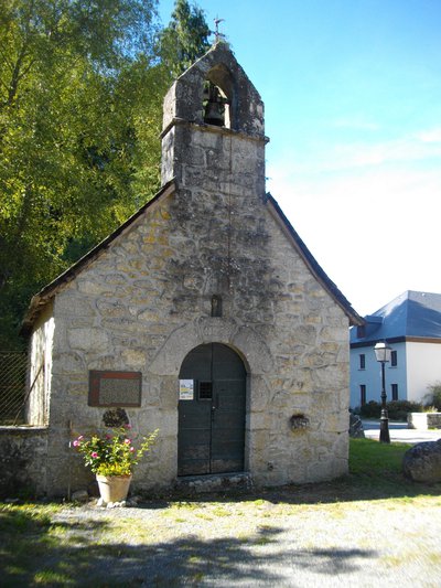
The Chapel of Deveix
This chapel is dedicated to the Virgin and was built in the 17th century at the request of the last abbess of Bonnesaigne, Gabrielle de Beaufort-Canillac. It was destroyed during the Revolution and rebuilt in the 19th century. You can admire the 17th century Virgin of Pity, which was returned to the chapel after being protected from looting and the Revolution by the villagers.
Even today, a pilgrimage takes place every year in September.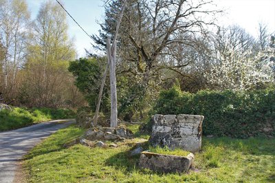
G.Salat - CC HCC  Small patrimony
Traditional winch and peg wells
This type of well is not very common in the Haute-Corrèze because the water table is not as deep as in the north of the Limousin. It consists of a wooden structure that supports the winch and peg system.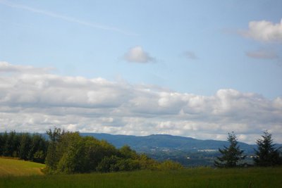
CC HCC  Panorama
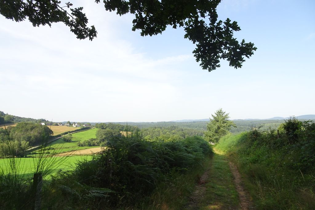
View over the plateau of Millevaches
Also called "Limousin Mountain" this large granitic plateau straddles the departments of Corrèze, Creuse and Haute-Vienne. Peat bogs, dry moors with heather, deciduous forests and meadows all contribute to its authentic landscapes.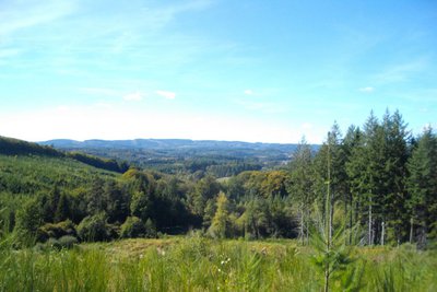
CC HCC PanoramaView over the Monédieres massif
A viewpoint over the Monédières massif with the Suc au May and the Puy de la Monédières. The Monédières massif is one of the seven landscape entities attached to the Millevaches Regional Natural Park in Limousin and covers an area of about 60 km². This protected granite region is located in the foothills of the Massif Central. Its dry moors are classified as Natura 2000 areas, synonymous with it being an exceptional site for flora and fauna.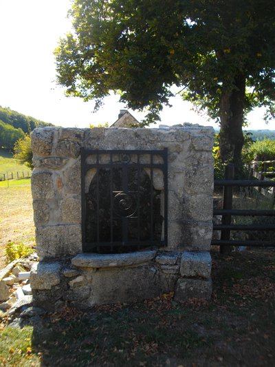
CC HCC Small patrimonyWell and spring at Lherm
The springs and fountains in the area generally have a similar architecture. They consist of a pile of three granite blocks, a horizontal deck resting on two vertical pedestals. On the other hand, at the crossroads of many departments, the area seems to have had a variety of architectural influences in the shaping of its wells.
G.Salat - CC HCC Heritage siteReplacement stone
The abbey of Bonnesaigne was abandoned by the abbesses in the 18th century after numerous pillages and fires. Like many other buildings, it was then transformed into a stone quarry. The stones were used to make other buildings. Today you can still see them in the village of Bonnesaigne used in the village houses.
Description
Opposite the Chapelle Notre Dame du Deveix behind the hotel, take the little old Turgotière road on the left.
- Continue straight ahead.
- Leave the road, take the path on the left and then climb the path on the right. (Off the route: continue along the road for 20 m, view of the village of Combressol)
- Don't forget to leave the road and go up a narrow forest track to the right. (Off the route: on the trail to the left, Maquis stele)
- Leave the D100 and take the path to the right, soon leaving it to turn right into the forest.
- Just before Lherm, turn onto the small road on the left. (Off the route: further down at the crossroads straight on for a two-minute round trip, sunken path and spring after the first house on the left).
- At the end of the village, leave the path that goes to La Luzège, and go up the road on the left.
- Don't forget to leave the road and go up the narrow path on the left (small windmill).
- Leave the D100 and take the forest track on the right.
- Continue straight ahead.
- Leave the road and climb the track to the left.
- Turn left where the tracks cross.
- Straight on: the Abbesses' path on the right, the fishery on the left and abbey ruins on the right. (Off the circuit: on the left, numerous remains of the Abbey and the Barry fountain).
- Leave the road by a narrow path on the right, opposite the spring hidden in the ditch on the left.
- Departure : Chapel of Notre Dame du Deveix, Combressol
- Arrival : Chapel of Notre Dame du Deveix, Combressol
- Towns crossed : Combressol
Forecast
Altimetric profile
Recommandations
Be sure to locate the starting point, some distance from the town of Combressol. This walk has a shorter route (7.5 km marked circuit 1, which is the subject of a separate description sheet). It crosses an interpretation circuit at Bonnesaigne (which is also the subject of a description sheet).
Information desks
Access and parking
From the D1089 Egletons-Ussel, head towards "Chapelle de Combressol". The chapel is located 150 m after the D1089.
Parking :
Chapel of Notre Dame du Deveix, Combressol
More information
Report a problem or an error
If you have found an error on this page or if you have noticed any problems during your hike, please report them to us here: