Lemovices or Arvernes - circuit 2
This is a very special valley... The fauna, the flora and the climate here are rather Auvergne-like, as is the architecture; The former railway line ran from one bank of the Chavanon to the other, following the contours of the land, linking the Auvergne to Paris via the Limousin. We are at the border of the two regions, drawn here by the Chavanon, which meant "the excavator" in old French.
4 points of interest
G.Salat - CC HCC  Heritage site
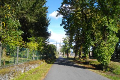
Town of St-Etienne aux Clos
Saint Etienne aux Clos was probably created by the union of two parishes: Esclaux and a larger village, better placed in relation to the communication routes, which took the name of Saint Etienne.
You can find the old shop fronts at the end of the esplanade, away from the road. The café, still in operation, is worth a visit.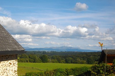
G.Salat - CC HCC  Panorama
Le Sancy
This hike will offer you several viewpoints overlooking the highest volcano in mainland France, the Puy de Sancy. At 1885 metres above sea level, this summit is the highest point of the Massif Central. The two streams, the Dore and the Dogne, originate there, and their confluence forms the Dordogne.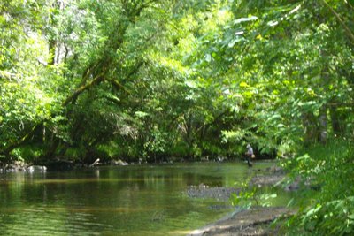
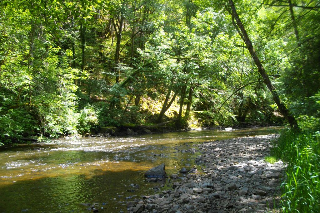
G.Salat - CC HCC  River
RiverThe Chavanon valley
A natural boundary between the Corrèze and the Puy de Dôme, the Chavanon is born from the confluence of two streams, the Ramade and the Méouzette.
It continues its course through gorges then flows into the Dordogne, upstream of the Bort-les-Orgues dam reservoir.
Classified Natura 2000 along its entire course, it is a river famous for its trout.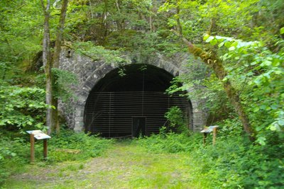
G.Salat - CC HCC Heritage siteThe railway
It may come as a surprise to see such a splendid roadbed at the bottom of the valley, but soon the size of the walls reminds one of the remains of a railway. We are on the old Paris-Béziers line, which crossed the Massif Central. The filling of the Bort les Orgues dam led to the closure of the line in 1950. This closure benefited the bats that found refuge in the old Froides Maisons tunnel.
Description
Departure from the esplanade on the edge of the departmental road. Head off towards the church; go past the front of the building, and before the café, turn left into the Chemin des Tilleuls.
- Find the road and follow it to the right. Go straight on at the next crossroads. Follow the signage carefully on this section: ignore a path to the right and then another to the left. The path becomes a trail and starts to descend. At the crossroads, fork left: the path winds down to the Chavanon.
- Continue to the left, over a small footbridge. Continue for 200 m. At the crossroads, go straight on (to the right, off the circuit, is the railway bridge), you will recognise the old trackbed. Continue; just before a tunnel, turn right onto a path that leads down to the Chavanon and then back to the other tunnel entrance.
- Continue for 300 m, then fork left (go straight on for circuit III): a path winds up to reach the plateau. Continue along a grassy path to Loubatière. Follow the road to the right. Go straight ahead to reach the D 27 through the village of Froides Maisons.
- Follow the departmental road to the left for 200 m, then take a path to the right through a wood, alongside a meadow and into the woodland undergrowth.
- At the end of the trail, follow the earth path to the left. Turn right after the tree-felling area. Continue straight ahead to return to the starting point
- Departure : Bourg, St-Etienne aux Clos
- Arrival : Bourg, St-Etienne aux Clos
- Towns crossed : Saint-Étienne-aux-Clos
Forecast
Altimetric profile
Recommandations
Please note: This circuit is a shorter version of a longer circuit (12 km) which is the subject of a special description sheet.Please note: This circuit is a shorter version of a longer circuit (12 km) which is the subject of a special description sheet.
Information desks
Access and parking
Coming from Ussel, follow the RD 1089 towards Clermont-Fd. Fork right and take the D 27 towards St-Etienneaux Clos
Parking :
More information
Report a problem or an error
If you have found an error on this page or if you have noticed any problems during your hike, please report them to us here: