Lemovices or Arvernes - circuit 1
Merlines
Lemovices or Arvernes - circuit 1
Medium
2h
5,6km
+198m
-198m
Loop
Yellow markers
Embed this item to access it offline
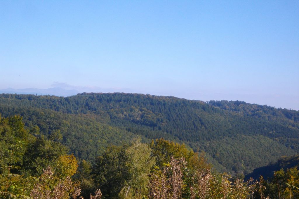
This is a very special valley... The fauna, the flora and the climate here are rather Auvergne-like, as is the architecture; The former railway line ran from one bank of the Chavanon to the other, following the contours of the land, linking the Auvergne to Paris via the Limousin. We are at the border of the two regions, drawn here by the Chavanon, which meant "the excavator" in old French.
6 points of interest
G.Salat - CC HCC  Heritage site
The railway
It may come as a surprise to see such a splendid roadbed at the bottom of the valley, but soon the size of the walls reminds one of the remains of a railway. We are on the old Paris-Béziers line, which crossed the Massif Central. The filling of the Bort les Orgues dam led to the closure of the line in 1950. This closure benefited the bats that found refuge in the old Froides Maisons tunnel.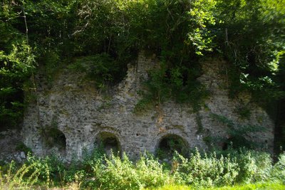
G.Salat - CC HCC Heritage siteLime kilns
On the way back from the hike, don't hesitate to cross the bridge over the D27E2. You will be surprised by the cavities in the cliff. The lime kilns were installed next to a cipolin quarry; cipolin is a variety of metamorphic limestone. The firing yielded an excellent lime that was used in construction and for soil improvement. It left by train from Savennes - St-Etienne station. The factory was in operation until 1957 and employed up to 50 workers in the summer.
G.Salat - CC HCC  River
RiverThe Chavanon valley
A natural boundary between the Corrèze and the Puy de Dôme, the Chavanon is born from the confluence of two streams, the Ramade and the Méouzette.
It continues its course through gorges then flows into the Dordogne, upstream of the Bort-les-Orgues dam reservoir.
Classified Natura 2000 along its entire course, it is a river famous for its trout.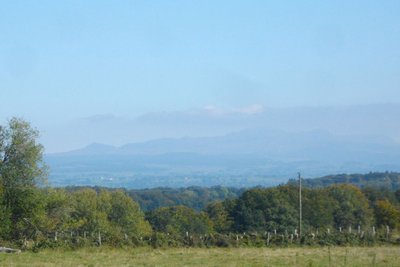
G.Salat - CC HCC  Panorama
Le Sancy
This hike will offer you several viewpoints overlooking the highest volcano in mainland France, the Puy de Sancy. At 1885 metres above sea level, this summit is the highest point of the Massif Central. The two streams, the Dore and the Dogne, originate there, and their confluence forms the Dordogne.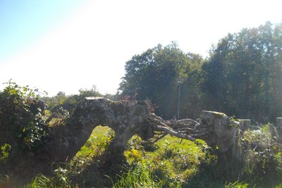
G.Salat - CC HCC  Expertise
Hedge laying
Note the old beech trees that have been cut down along the roadside. The basis for this seems very strange: it is an ancient technique, called "laying", which involves pruning trees to give them a shape that makes a natural hedge to keep livestock in. This technique has been replaced by barbed wire and has gradually disappeared.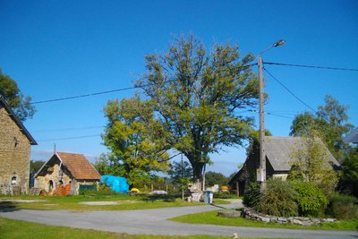
G.Salat - CC HCC Heritage siteLe village of Esclaux
The villages of Haute-Corrèze have all been involved in agriculture. Walking through these hamlets always produces interesting discoveries during a hike: barns, large country houses, crosses and monuments, traditional local architecture, etc. At Les Esclaux, note the village layout with a small square in the centre of the village around which are built a barn, houses and a farm outbuilding.
Description
Set off on the opposite side of the road on the old trackbed.
- Before the last ""SNCF level crossing"" house, go up the path on the right. Cross the road when you get to the village of ""Chez L'Amour"" and continue along the trail. It joins a path that you take on the left. It climbs in a wide loop, leaving small trails on the right and left.
- At the road, turn left, and go through the village of Chez Troiville. At the next crossroads, turn left towards Esclaux (circuit III goes straight on).
- In the village, follow the trail on the left, which runs alongside the house, continues through the meadows, and then twists and turns down into the wood. Stay on the main path; At the road, the path ahead goes slightly off to the left; stay on the main path again to find the old track bed at the end of the valley. Turn left to get back to the starting point."
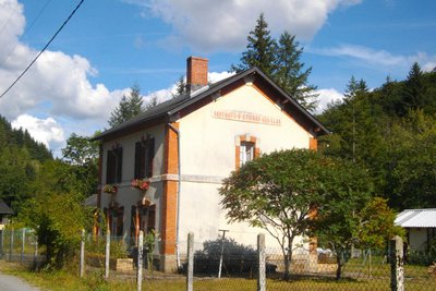
- Departure : The former Savennes station, St-Etienne aux Clos
- Arrival : The former Savennes station, St-Etienne aux Clos
- Towns crossed : Merlines and Saint-Étienne-aux-Clos
Forecast
Altimetric profile
Recommandations
Please note that the route does not start from the village of St-Etienne aux Clos but from the old station at the bottom of the valley. It is a variant of two longer trails that start from the village and are the subject of a specific description. One section is shared with circuit III.
Information desks
Access and parking
Coming from Ussel, follow the RD 1089 towards Clermont-Fd. Fork right and take the D 27 towards St-Etienne. Continue for 5 km and then turn right towards Savenne station.
Parking :
The former Savennes station, St-Etienne aux Clos
More information
Report a problem or an error
If you have found an error on this page or if you have noticed any problems during your hike, please report them to us here: