Lemovices or Arvernes
This is a very special valley... The fauna, the flora and the climate here are rather Auvergne-like, as is the architecture; The former railway line ran from one bank of the Chavanon to the other, following the contours of the land, linking the Auvergne to Paris via the Limousin. We are at the border of the two regions, drawn here by the Chavanon, which meant "the excavator" in old French.
6 points of interest
G.Salat - CC HCC  Heritage site
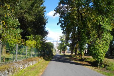
Town of St-Etienne aux Clos
Saint Etienne aux Clos was probably created by the union of two parishes: Esclaux and a larger village, better placed in relation to the communication routes, which took the name of Saint Etienne.
You can find the old shop fronts at the end of the esplanade, away from the road. The café, still in operation, is worth a visit.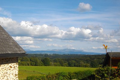
G.Salat - CC HCC  Panorama
Le Sancy
This hike will offer you several viewpoints overlooking the highest volcano in mainland France, the Puy de Sancy. At 1885 metres above sea level, this summit is the highest point of the Massif Central. The two streams, the Dore and the Dogne, originate there, and their confluence forms the Dordogne.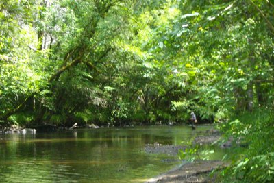
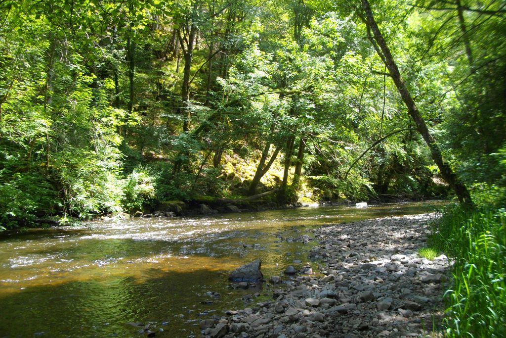
G.Salat - CC HCC  River
RiverThe Chavanon valley
A natural boundary between the Corrèze and the Puy de Dôme, the Chavanon is born from the confluence of two streams, the Ramade and the Méouzette.
It continues its course through gorges then flows into the Dordogne, upstream of the Bort-les-Orgues dam reservoir.
Classified Natura 2000 along its entire course, it is a river famous for its trout.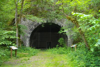
G.Salat - CC HCC Heritage siteThe railway
It may come as a surprise to see such a splendid roadbed at the bottom of the valley, but soon the size of the walls reminds one of the remains of a railway. We are on the old Paris-Béziers line, which crossed the Massif Central. The filling of the Bort les Orgues dam led to the closure of the line in 1950. This closure benefited the bats that found refuge in the old Froides Maisons tunnel.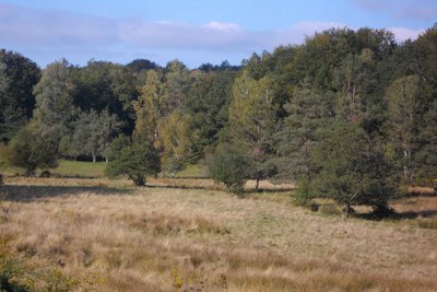
G.Salat - CC HCC  Flora
FloraThe Dognon and the wetland
Situated at the bottom of a valley, you will cross the Dognon in the middle of a wetland. These wet meadows and bogs provide small reserves of fodder in times of drought. Livestock finds food there during periods of very hot and dry weather. In the spring, these areas are also good for dragonflies.
G.Salat - CC HCC  Site
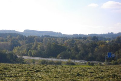
SiteThe A89
Between Auvergne and Limousin, this route, nicknamed "the motorway of the presidents" because it crosses the political strongholds of Valery Giscard d'Estaing, Jacques Chirac and François Hollande, the A89 links Bordeaux to Lyon by crossing the Massif Central. It is 550 km long and was put into service along its entire route in 2018.
Description
- Find the road and follow it to the right. Go straight on at the next crossroads. Follow the signage carefully on this section: ignore a path to the right and then another to the left. The path becomes a trail and starts to descend. At the crossroads, fork left: the path winds down to the Chavanon.
- Continue to the left, over a small footbridge. Continue for 200 m. At the crossroads, go straight on (to the right, off the circuit, is the railway bridge), you will recognise the old trackbed. Continue; just before a tunnel, turn right onto a path that leads down to the Chavanon and then back to the other tunnel entrance.
- Continue, leaving the circuit 2 trail on the left
- After the last house with its SNCF architecture, go up the path on the left. Cross the road at the village of Chez L'Amour and continue on the trail. This trail joins a path that you take on the left. It climbs in a wide loop, leaving small trails on the right and left.
- At the road, turn left, and pass through the village of Troiville. Ignore the road to Esclaux on the left. At the departmental road, cross over, and take the path opposite. Turn right onto the road.
- At the next village, leave the road and descend to the Dognon. Cross on the footbridge; go back towards the track and follow it to the left. Turn left at the next junction and then right at the Y-junction. The track becomes a road. It joins a larger road which you follow to the left for 300 m.
- Follow the track to the left, cross the Dognon again. Continue straight on up into the wood for some time.
- Turn right after the tree-felling area. Continue straight ahead to return to the starting point
- Departure : Bourg, St-Etienne aux Clos
- Arrival : Bourg, St-Etienne aux Clos
- Towns crossed : Saint-Étienne-aux-Clos
Forecast
Altimetric profile
Recommandations
Please note that this circuit has a shorter cut (circuit II) and is adjacent to another loop that starts at the old station at the bottom of the valley (circuit I). These itineraries are described in a separate sheet.
Information desks
Access and parking
Coming from Ussel, follow the RD 1089 towards Clermont-Fd. Fork right and take the D 27 towards St-Etienneaux Clos.
Parking :
More information
Report a problem or an error
If you have found an error on this page or if you have noticed any problems during your hike, please report them to us here: