From the Diège to the Vienne
Millevaches Blue markers
From the Diège to the Vienne
Difficult
4h30
14,3km
+347m
-347m
Loop
Embed this item to access it offline
The first part of the circuit offers magnificent views of the small tributaries of the Diège that flow through the heather moors. On the other hand, the slope of the Vienne appears much more wooded. Numerous springs rise on this slope and quickly join to form the Vienne. A rich and satisfying circuit!
5 points of interest
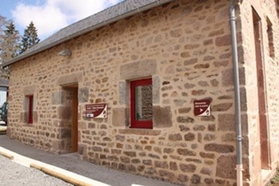
La Maison du Parc - PNR de Millevaches en Limousin  Heritage site
La Maison du Parc
The Maison du Parc invites young and old, residents and visitors alike, to discover the wealth of local heritage. It has a small shop. In addition to mouth-watering products bearing the Regional Natural Park "Valeurs" brand, various books are on sale (the "Carnet de Voyage(s) en Millevaches" travel journal, topoguides, etc.). In summer, activities are offered at the Maison du Parc, helping you explore the visitor centre's surroundings in several different ways.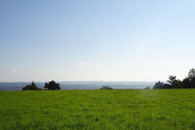
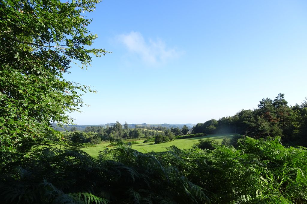
J.Primpier - PNRML Heritage siteThe Millevaches plateau
Culminating at an altitude of nearly 1,000 metres at Mont Bessou, the Millevaches plateau takes its name not from the number of cattle grazing on its green pastures but from the expression ‘one thousand springs’, as there is so much water. Also called "Limousin Mountain" this large granitic plateau straddles the departments of Corrèze, Creuse and Haute-Vienne. Peat bogs, dry moors with heather, deciduous forests and meadows all contribute to its authentic landscapes.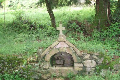
CC HCC  Small patrimony
The Longy spring
Because water seems to rise from the ground for no reason, springs are often thought to possess a spiritual and magical character. They are called the Bonnes Fontaines - good springs - in the Limousin because they are said to have healing qualities. They are also said to be Christianised because they often corresponded to ancient Celtic places of worship. A healing saint was attributed, and a cross was erected in the immediate vicinity. Very little is known about the Longy spring: which saint was attributed to it? What healing virtue was associated with it?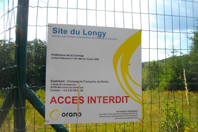
CC HCC  History
The former uranium quarry
You may be surprised when you leave the peaceful village of Longy to see a fence with signs mentioning the presence of a former Areva quarry. Although small, this site was mined for uranium between 1981 and 1983.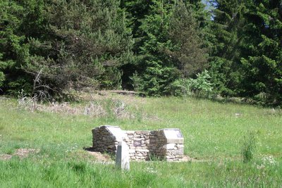
G.Salat - CC HCC  Source
The Sources of the Vienne
Five Sources of the Vienne Sources A tributary of the Loire, this 370 km long river has its source a few kilometres upstream from Peyrelevade (an interpretation circuit (which is the subject of a descriptive sheet) allows you to get to know it). Classified as a Natura 2000 site, it winds through wetlands and peat bogs. This has allowed the establishment of many mills along its course.
Description
- Departure from the village square. Go up the street to the right of the church. At the crossroads, take the road to the right for 100 metres to the D 36. Cross the road and go straight ahead.
- At the crossroads, go down a wide track on the right. At the next crossroads, turn left onto a track that goes towards a high-voltage line.
- Turn left when you reach the trail. It goes through woods and across moors offering several points of view on the tributary valleys of the Diège and the village of Sornac to join a tarmac path, then the road (take care - follow the signposting carefully on this long portion - there are not very many landmarks).
- When you reach the main road, do not go towards Malepouge but turn left. Follow the road for 500 metres. A track goes down through the undergrowth to an old quarry. Follow this track to the right, cross the stream and go up to the small road.
- Take the road to the left and then go left again at the next crossroads. This road goes to Audouze.
- At the entrance to the hamlet, a path goes to the left, down to the stream, and then back up to Longy.
- Go through the hamlet, and continue on the road. At the crossroads, take the road to the right. At the next crossroads, follow the road to the right for 20 metres and then take the path on the left. It goes around a meadow (the wetland in the pasture is one of the sources of the Vienne) through moors and forests.
- Where the tracks cross, go up the forest path on the left (on the right is the second source of the Vienne at 200 m: it will become a small road going back to Millevaches, going over the stile and into the pasture.
- Departure : Place de l’église, Millevaches
- Arrival : Place de l’église, Millevaches
- Towns crossed : Millevaches, Saint-Sulpice-les-Bois, Sornac, and Saint-Setiers
Forecast
Altimetric profile
Recommandations
Is in the midst of the park
The national park is an unrestricted natural area but subjected to regulations which must be known by all visitors.
Information desks
7 route d'Aubusson, 19290 Millevaches
Access and parking
14 km from Meymac, follow the D 36.
Parking :
Place de l’église, Millevaches
More information
Report a problem or an error
If you have found an error on this page or if you have noticed any problems during your hike, please report them to us here: