The Templars
The region was marked by the presence of the Templars (Templar tombs in the church at Courteix) and by the Seigneury of Châteauvert (medieval tomb in the church at Couffy). At the Bois des Trois Faulx, the Maquis stele, and nearby, the sapes (basic shelters used as hiding places) used by Maquis members and recently restored, you can recall the commitment of the Resistance fighters. This circuit offers a succession of open views over the Plateau de Millevaches and the Monts d'Auvergne, passages in the undergrowth and crossings of typical villages of the Haute-Corrèze. There are two possible starting points, the church at Courteix or the town hall in Couffy-sur-Sarsonne, from which you join the main circuit making a round trip.
7 points of interest
G.Salat - CC HCC  Heritage site
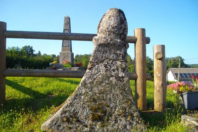
Couffy
On your way back from your walk, don't hesitate to take a break in Couffy. In addition to the cross of Oradour before the village and the Gallo-Roman cippe (the old lid of a deceased person's funerary urn), the small church dedicated to St-Martin (probably represented on the image of a bishop holding a book carved on the portal of the building) houses the recumbent effigy of the Lord of Châteauvert.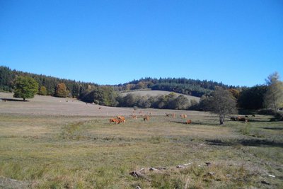
G.Salat - CC HCC  Peat bog
Wet meadows
Situated at the bottom of valleys, often in spring areas or on the bank of a stream that is barely flowing, wet meadows and peat bogs provide small reserves of fodder in times of drought. Livestock finds food there during very hot and dry weather events. In the spring, these areas are also good for dragonflies.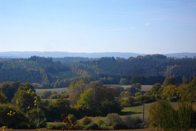
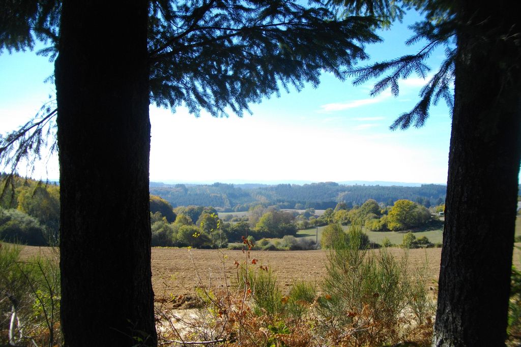
G.Salat - CC HCC  Panorama
The Plateau of Millevaches
Culminating at an altitude of nearly 1,000 metres at Mont Bessou, the Millevaches plateau takes its name not from the number of cattle grazing on its green pastures but from the expression ‘one thousand springs’, as there is so much water.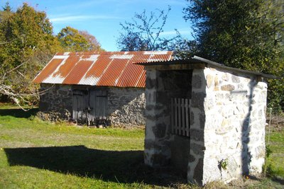
G.Salat - CC HCC Heritage siteThe Le Gardy well
The villages of Limousin were all heavily involved in agriculture. Walking through these hamlets always produces interesting discoveries during a hike: barns, large country houses, crosses and monuments, traditional local architecture, etc.
As you go through the village of Le Gardy, take a look at the well on your left.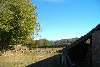
G.Salat - CC HCC PanoramaThe Massif du Sancy
This hike will offer you several viewpoints overlooking the highest volcano in mainland France, the Puy de Sancy. At 1885 metres above sea level, this summit is the highest point of the Massif Central. The two streams, the Dore and the Dogne, originate there, and their confluence forms the Dordogne.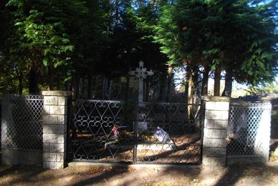
G.Salat - CC HCC  History
The Maquis stele
The forests of the Haute Corrèze were often used as shelters, hiding places and training bases for the members of the Maquis during the Second World War. A group of more than 120 resistance fighters found refuge in the Bois des Trois Faulx. At the end of September 1943, German troops attacked the camp, and several Maquis members were killed in the fighting.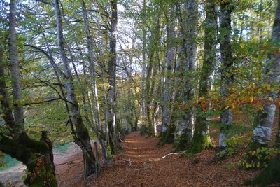
G.Salat - CC HCC Heritage siteThe beech tree alley
While the first part of the route leads through coniferous forests with numerous logging areas, this magnificent path leads to a beech forest.
Historically, the department of Corrèze was not forested. In 1900, forests in Corrèze occupied only ¼ of the territory. Today, almost half of the department's surface is wooded. The significant decline in agriculture has encouraged planting, particularly of softwoods, with a clear predilection for planting Douglas fir.
Description
Departure from the town hall in Couffy. Go up to the D21 and turn left for 400 m.
- Follow the track to the left that leads to Lachaud. In the village, take the road to the right. Turn right again at the rest area. Before a bend in the road, take the earth path straight ahead.
- At a crossroads, take the track on the left (straight ahead for the variant). At a bend in the track, do not take the path that goes straight ahead but turn left to Le Gardy.
- Take the road to the right. It joins the D 21, which you follow to your left. Pass over the Mazonne and take the road to the right, towards Regeat. 100 m after the crossroads, follow the track to the left. Before Régeat, go up the path on the left to the stele.
- Continue to climb alongside the meadow. Join a path, which you take to the right. At the Y junction, go straight down to the road, which you follow to the right to reach Chassergue.
- Turn right into the village at the farm. The path descends into the undergrowth. Then, at a Y-shaped crossroads, turn left and continue alongside the wetland to reach the road.
- Follow it to the left for 50 m, then take the path to the right. Cross the bridge. Turn left at the next crossroads to join the T-junction. Leave the circuit for the church at Courteix: (1.5 km round trip): Turn left and go through La Chabanne. Turn left at the crossroads to get to Courteix.
- Take the path to the right. At the next two Y junctions, turn left. When you reach a beech forest, turn right to join the road, which you follow to the left for 500 m to return to the departure point.
- Departure : Parking at the town hall, Couffy
- Arrival : Parking at the town hall, Couffy
- Towns crossed : Couffy-sur-Sarsonne, Lamazière-Haute, Aix, and Courteix
Forecast
Altimetric profile
Recommandations
The start is at 12 km d'Eygurande: This path consists of a large circuit you can join either at Courteix or at Couffy, making a round trip. There is also a shorter route for this long circuit, which is described in detail in a separate sheet: follow the D21 towards Couffy . The town hall is 1 km on the left before the village.
Information desks
Access and parking
The departure point is 12 km from Eygurande: follow the D21 towards Couffy. The town hall is 1 km on the left before the village.
Parking :
More information
Report a problem or an error
If you have found an error on this page or if you have noticed any problems during your hike, please report them to us here: