Les Orgues circuit
This hike around these impressive cliffs allows you to overlook the city of Bort-les-Orgues. It also offers many views of the Monts d'Auvergne: the Cantal and the Puy de Sancy stand proudly in front of you. The 'organ pipes' end up dominating you, letting you admire their majesty from all angles. This is a favourite trail in spring or autumn with interesting changes in the landscape.
3 points of interest
G.Salat - CC HCC  Panorama
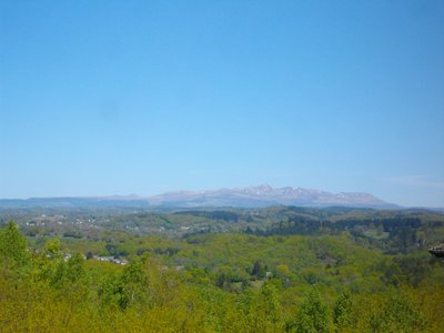
View over the Puy de Sancy
This hike will offer you a remarkable view of the highest volcano in metropolitan France, the Puy de Sancy. At an altitude of 1885 metres, this summit is the highest point in the Massif Central. The two streams, the Dore and the Dogne, originate there and their confluence forms the Dordogne.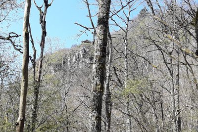
G.Salat - CC HCC  Geological interest
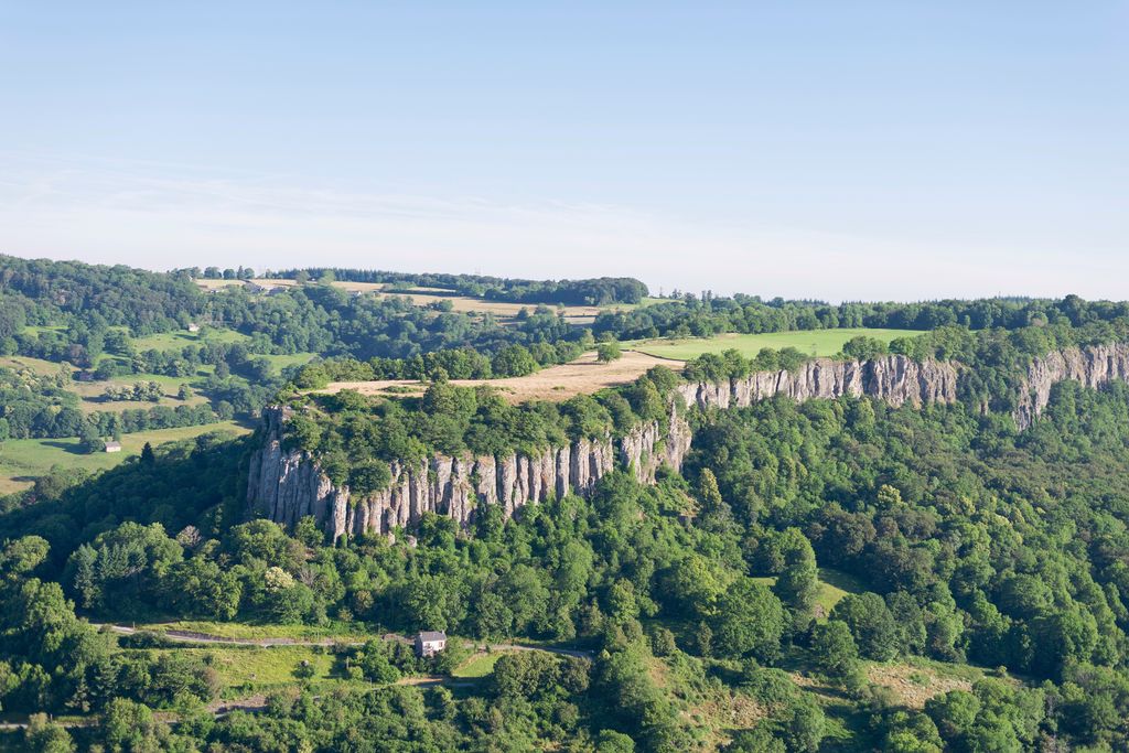
At the foot of the Organs
Admire these 100-metre-high cliffs that stretch nearly two kilometres. They are 15 million years old. The cooling lava flow at the origin of the site formed these immense columns called "orgues", certainly in reference to the musical instrument. This flow, once at the bottom of the valley, was brought to the surface by the action of erosion, and is therefore in "inversion of relief". These cliffs are home to a large population of Red Kites.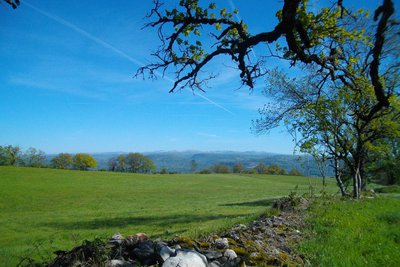
Gilbert Salat - HCC PanoramaView of the Cantal Mountains
Another Auvergne massif with the Sancy, the Monts du Cantal, presents itself to us during this hike. This massif is, in fact, the last vestige of a stratovolcano born 13 million years ago, the largest in Europe, now dismantled by collapse and glacial erosion.
Description
The itinerary starts at the Les Orgues car park. At the belvedere, take the path on the left and follow the blue markings in the undergrowth.
- Where the trail borders a meadow, turn right and continue straight ahead. At the house on the left, enter the woods.
- At the dry-stone wall, turn right. Go straight ahead towards a ruined barn, continue straight ahead. Go down through the woods, and in the bend, take a right turn. (before turning, a 50 metre round trip through the undergrowth on your left leads to a view over the Lac de Bort). Continue straight ahead. The Les Organs rock formations are on the right, and a view over the town on the left. Follow the trail halfway down the slope for a long distance, ignore a trail on the left (Bort information panel) and continue until you reach the road.
- Turn right onto the road, follow it for 100 metres. Go up the steps on your right. Also, turn right onto the next road. At the outer edge of the village of La Colombière, take the path to the right: leave a path on the right and follow the ""parking"" sign.
- Take the track to the left at the top of the path. At the Y-junction, go straight ahead. Then follow the path on the left before the entrance to the meadow to reach the esplanade."
- Departure : Les Orgues car park, Bort-les-Orgues
- Arrival : Les Orgues car park, Bort-les-Orgues
- Towns crossed : Bort-les-Orgues
Forecast
Altimetric profile
Recommandations
Do not take the path overlooking Les Orgues between La Colombière and the Les Orgues car park; it is not open to the public.
Information desks
Access and parking
6 km from the tourist office of Bort-les-Orgues. Take the D 127 following the signs to the Les Orgues site.
Parking :
More information
Report a problem or an error
If you have found an error on this page or if you have noticed any problems during your hike, please report them to us here: