
The Circuit of Lake Viam
Use the information panels along the circuit to find out about Lake Viam, its history and its evolution.
8 points of interest
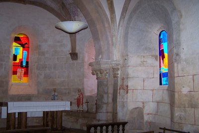
Intérieur de l'Eglise Saint-Martin - Mairie Viam  Heritage site
Restored Church of Saint Martin
The building was probably built in the 12th century, and then rebuilt at the end of the 14th century, a remarkable feat, and was never provided with side chapels. The west door opens through a beautiful frieze portal and has four bays covered by ribbed vaults, the last one constituting the semicircular chevet choir. Restored in 2013, the church of Saint-Martin has magnificent contemporary stained glass windows. Self-guided tour, from 9.00 to 20.00.
Free visit to the Gallo-Roman remains.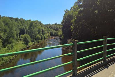
OT Terres de Corrèze  River
RiverThe Vézère
With a length of 211 km for a basin of 3736 km², the river Vézère has its source at an altitude of 700 m in the Longéroux peat bog, on the Millevaches plateau in Corrèze.
The Vézère flows south-westwards and carves a valley intersected by small hydroelectric dams, Monceaux-la-Virole (Lake Viam), Treignac (Lake Bariousses),
Peyrissac and finally the Saillant dam.
The richness of the lower Vézère in prehistoric deposits gives it incomparable prestige, which is why part of the Vézère valley has been classified as a UNESCO World Heritage Site.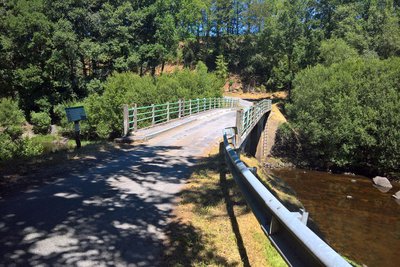
OT Terres de Corrèze  Site
SiteThe old Viam bridge and the new Sirieix bridge
In the past, around 1822, the Viam Bridge, built in wood and made of planks stood at the water's edge. It was swept away during a flood of the Vézère in 1902, and was then rebuilt, this time in stone, and completed in 1907.
This bridge linked Viam to the villages of Sirieix, Couignoux and Monceaux.
When the dam was impounded in 1946, the bridge was drowned and could only be seen again when the lake was emptied, as in 1985 and 2010.
The construction of the dam obliged the commune to open a new access road to
Monceaux, passing over the crest of the dam. A bridge over the river Vézère, now called "le Pont de Sirieix" was built for the road leading to Sirieix and Couignoux.
More details can be found in panel no. 4.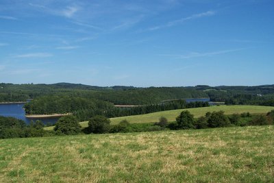
Le lac de Viam - B.Bouche  Lake
LakeLake Viam
Filled in 1946, this dammed lake marks the passage of the Millevaches plateau with its streams snaking through wet peaty hollows towards higher areas where the watercourses come together. It is the first upstream hydroelectric structure on the Vézère.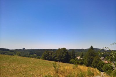
OT Terres de Corrèze  Panorama
Le Haut de Couignoux
The physicochemical alteration of the granite has created a disconcerting landscape because it is difficult to read. There are no well-marked valleys or vast plains but a succession of basins and hills; a so-called "honeycombed" landscape". Nor are there any raging mountain streams, as the water, trapped in the wetlands of these basin bottoms, scarcely flows.
As a result, from this rocky promontory which culminates at an altitude of 730 m, one can see the Puy Pader, the Puy Niouloux, the Lake, the village of Viam and the Belvedere, as well as the Monceau Dam.
Panel no. 6 is located there and contains more information.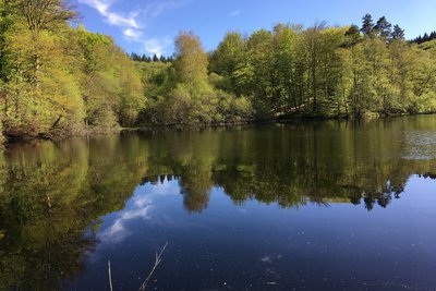
l'Etang de Mouno - Mairie de Gourdon-Murat  Pond
PondEtang de Mouno
The pond, once owned by the Domaine de Monceaux, is an environment in its own right, sheltering fish, insects and batrachians (frogs and toads), as well as a highly specific flora. It is also an interface, a junction point, on the border of several different environments. On-site, a panel will provide you with more information about the area.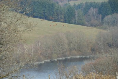
OT Terres de Corrèze  Fauna
FaunaThe Viam-Lestards national forest
A 'domaniale' forest is, in France, a forest belonging to the State. It is managed by the National Forestry Office (ONF) in accordance with the Forestry Code. They were established in the time of Charlemagne, categorising them as "the first natural areas to be rigorously managed".
The forest occupies an area of approximately 1.17 km².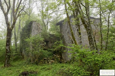
S.Colpin Heritage siteThe château of Monceau
The village of Monceaux passed in 1442 from the Lords of Murat to the Comte family who built the château in 1582 and owned it until 1897.
The presence of a domestic chapel was recorded in the 18th century (ruined). Since the land registry of 1822, the two square towers flanking the north façade have collapsed. A coat of arms above the entrance door probably represented the arms of the Comte family.
Further information can be found on information panels no. 1 and no. 10.
Description
- From the car park, go down by the terrace towards the village hall. The path starts on the left and passes over a dike. Then go back up the road to the intersection with the D979. Then turn right towards Bugeat.
- Turn right towards Sirieix. Follow this road to the village of Couignoux. In the village, turn left and go up towards Le Monteil. 100 m before the hamlet, fork right. Continue for quite a long time between meadows and woods on the main track.
- Pass to the right of the Etang de Salemagnières (also called Etang de Mouno) and go back up until you reach a wide crossroads. Then turn to the right to reach the dam. Cross the structure and continue along the track until you find the D160 where you turn right to return to Viam.
- Departure : Esplanade, Terrace in the lower part of the village, Viam
- Arrival : Esplanade, Terrace in the lower part of the village, Viam
- Towns crossed : Viam, Bugeat, and Saint-Hilaire-les-Courbes
Forecast
Altimetric profile
Recommandations
Follow the orange VTT markings and the green no. 15.
Take care: in periods of very high water, this course is not recommended.
Only use the marked paths and observe the direction of travel.
Take sensible precautions, if you are going alone, ensure that someone knows where you are going and your route.
Don't overestimate your level of ability, take suitable equipment in good condition.
Respect the environment and private property (Château de Monceaux) In case of an accident, call the emergency services 18 or 15 or 112.
Information desks

Access and parking
From Bugeat, on the D979 head towards Treignac. From Treignac or Limoges head towards Bugeat. At the crossroads of the D160/D979, head towards Viam. Enter the town and park in the first car park.
Parking :
More information
Report a problem or an error
If you have found an error on this page or if you have noticed any problems during your hike, please report them to us here: