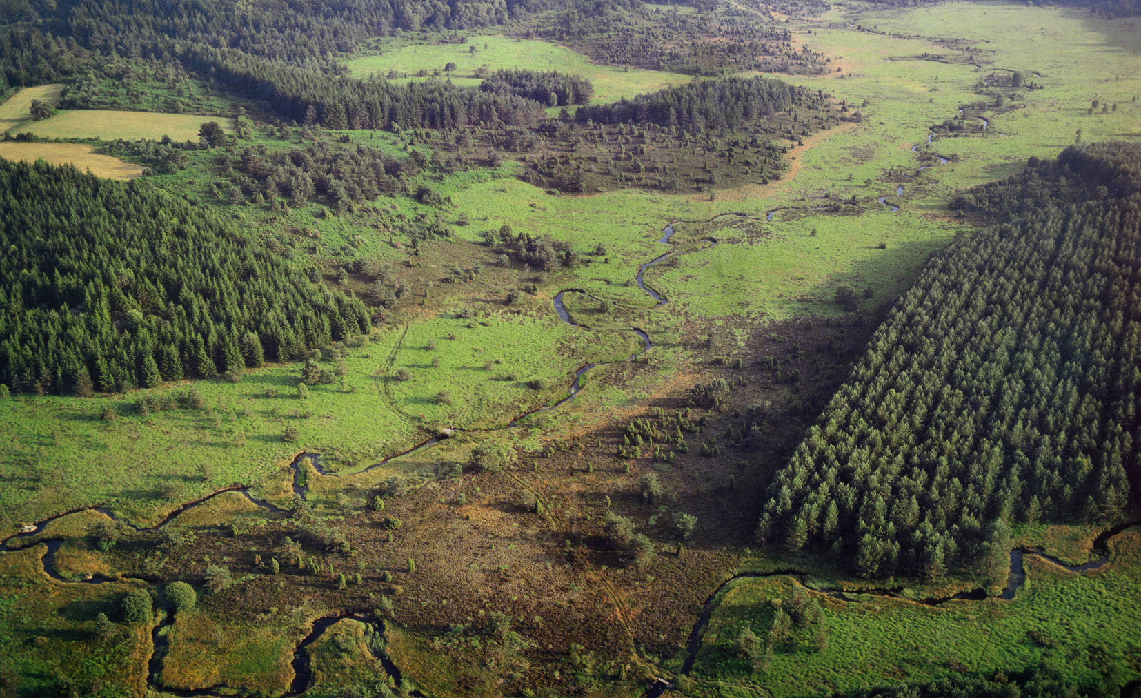
Discovery trail of the moors and peat bogs of Mazure: Large Loop
17 points of interest
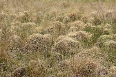
Gros plan sur la tourbière - ©J.DAMASE/ADRT23  Peat bog
Peat bogs, a thousand-year-old treasure
The peat bog is located in a kind of very wet bowl (alveolus) fed by runoff and a stream. The ubiquitous water prevents the decomposition of organic matter (plant/animal), which explains the formation of peat.
Peat bogs provide many ecological services:
- they store large quantities of water which they purify and gradually release.
- they store carbon (in the peat).
- they are home to a specific fauna and flora that guarantee biodiversity.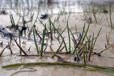
Flore remarquable de la mazure - ©Thierry Arbault  Flora
FloraRare aquatic plants
Many plant species thrive only in acidic, stagnant, shallow freshwater environments. As the abundance of habitats containing all these characteristics is decreasing, the areas where these plants develop are generally areas where biodiversity is protected. The Mazure peat bog meets these different criteria and thus we see various rare plants evolving within it, such as the floating water plantain, the American shoreweed and the spiny-spored quillwort.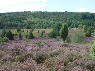
Landes de la Mazure - ©OTCSO  Agricultural diversity
Heath, pasture and traditions
In the 19th century, open environments dominated the landscape. With the rural exodus, afforestation has developed strongly either because of the abandonment of grazing activities or because of the planting of trees (often resinous). At the same time, livestock farming, essentially ovine (sheep), has become bovine (cows). Nevertheless, today, sheep farming is being revived in areas difficult to access and old plantations are being converted into heathland, such as on this site.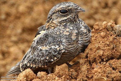
Faune remarquable - ©Jean-Marc Rabby  Fauna
FaunaA specific fauna
Birds, butterflies, dragonflies, lizards... all find refuge on the Mazure site. They are often very shy and difficult to observe. The European nightjar, for example, is a migratory bird with a "dead leaf" colour plumage, and it nests on the ground. The marsh fritillary is a brown, orange and pale yellow butterfly that lays its eggs only on the small scabious plant. The sand lizard is insectivorous and lives in colonies in burrows. The black darter is a dragonfly characteristic of bogs.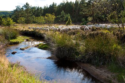
Sur les berges du ruisseau de Haute Faye - ©OTCSO  River
RiverThe river, a whole ecosystem
An ecosystem is a set of interactions between living beings (animals, plants...) and their environment (geology, climate...). The river's water quality depends on the presence or absence of trees/shrubs on the banks, aquatic plants, fish, crustaceans, insects, as well as fungi and bacteria. They are links in a food chain that are essential to the life and health of rivers, but not only that. They are themselves a link in the biodiversity chain, in particular by serving as an ecological corridor.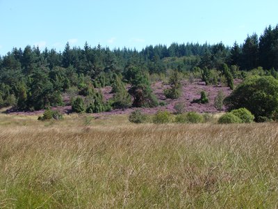
Landes et tourbières de la Mazure - ©OTCSO  Peat bog
An exceptional ecological site
This site benefits from a strong ecological and landscape interest which makes it part of a dynamic of protection both at the national level (listed site, classified as a Natural Zone of Ecological, Fauna and Flora Interest) and at the European level (Natura 2000 site). Nearly 120 species have been inventoried there, including 16 species protected at national and European level. In addition, 14 types of habitat are present on the Mazure site, 5 of which are considered to be decisive.
Site des tourbières et landes de la Mazure - ©J.DAMASE/PSC  History
Originally, a partnership
This site largely belonged to the private company, EDF, which planned to make a hydroelectric reservoir. As early as 1996, aware of the ecological potential of the site, the Conservatoire d'Espaces Naturels began negotiations to buy the land. In 2005, the Community of Communes became the owner for a symbolic one Euro and arrived at an agreement with the Conservatory and the National Forestry Office to entrust them with its management. It is thanks to this partnership that the site now receives so much attention and is open to the public.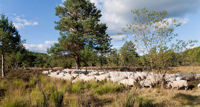
Paturage dans les landes et tourbières de la Mazure - ©OTCSO  Flora
FloraBiodiversity
The partnership set up aims to restore and maintain the site's biodiversity. Open environments (moors, grassland, peat bogs) have a natural tendency to become wooded. In order to preserve the mosaic of environments, which guarantees the diversity of the animal and plant species hosted, an action programme is being implemented in particular through Natura 2000: logging and extensive grazing.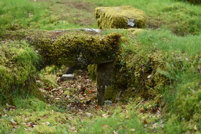
Pont planche en granite - ©J.DAMASE/PSC  Expertise
Century-old landscapes
Granite is a ubiquitous component of the local landscape. A solid material, it has long been used by the inhabitants of the Creuse to build farms, mills, bridges, low walls, pond dikes, bollards, etc. The masons of the Creuse have thus acquired specific expertise which they have put to good use in several large towns. Plank bridges are one of those typical constructions consisting of a deck made of granite slabs cut from large blocks.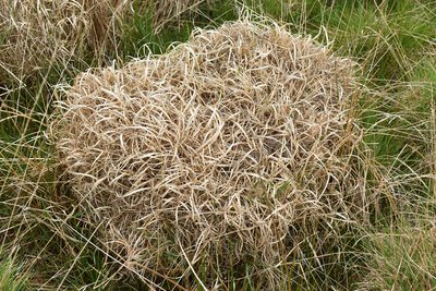
Gros plan motte de tourbière - ©J.DAMASE/PSC  Peat bog
Peat bogs and man
The gates of Hell on Earth... that's how peat bogs were considered centuries ago! To dry them out and allow them to be cultivated or planted, many have been drained and thus lost their ecological functions. Since the 1980s, scientific progress has demonstrated the value of preserving them, particularly because of their role in the water cycle and in terms of biodiversity. Despite this reputation, peat bog soil (peat) was traditionally used as a fuel, replacing wood, which was a scarce commodity at the time.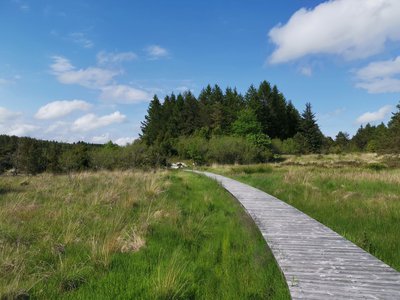
Tourbière de la Mazure - ©bsavarypro  Peat bog
La Mazure peat bog
Covering an area of 280 hectares, this site, located in the communes of Monteil au Vicomte, Royère de Vassivière and St-Pierre-Bellevue is one of the most remarkable in the region in terms of well-preserved habitats but also in terms of rare and protected species.
It abounds in a mosaic of environments (streams, peat bogs, moors and forest) and many rare animal and plant species worthy of preservation.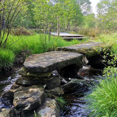
Pont planche - bsavarypro  Small patrimony
The plank bridges
The plank bridge consists of two ends and a central pillar made of matching blocks that support granite beams. None of the construction is visible, the "planks" are just placed side-by-side. This type of bridge does not appear on the 1831 land registry map. It can be dated to the end of the 19th century. "Offerings" were a fee in kind or working hours, which each owner owed to the commune according to his property. Property tax has replaced this fee since the 1950s. The maintenance of bridges, roads or common lanes was ensured by this means.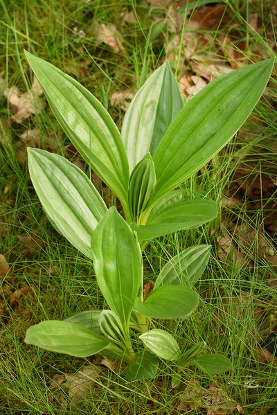
Arnica des montagnes, flore remarquable de la mazure - ©J.DAMASE/PSC  Flora
FloraFrom plants to medicine
Several plants found here have medicinal and homeopathic properties. While their use is sometimes outdated, this is not always the case. Cranberries are now known for their berries, which we consume as Cranberry juice. The Stag's-horn clubmoss is a tiny fern that looks like a moss and has diuretic properties (beware it is protected, collection is prohibited). Mountain Arnica is well known for the treatment of bruises in the form of ointment.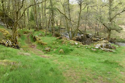
Ruines de moulins - ©J.DAMASE/PSC  Small patrimony
Water and the mill
Man's use of the driving force of water to grind cereals has been a true symbol of progress. In the past, only human or animal power operated the "blood" mills. The old water mills of the Limousin had an important function in rural societies. On streams, mills were equipped with diversion canals (mill races) or small ponds to increase water flow. Bucket mills, with their horizontal wheel, were more common than vertical wheel mills.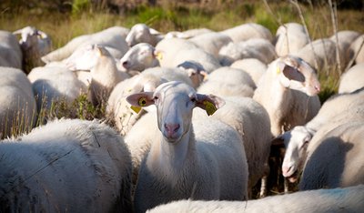
Des brebis bien gardées - ©OTCSO  Agricultural diversity
Well-kept sheep
Old postcards/photographs bear witness to the ancient practices of grazing in Creuse. Since 2008, grazing has been reintroduced on the site during the summer period. The flock of Limousin ewes is guarded, as in the past, by a shepherd accompanied by dogs, who can manage the grazing pressure necessary to maintain the conservation of the site. The Limousine breed has been recognised since 1943. It is hardy and adapts very well in these environments by grazing different species of plants that provide it with everything it needs to thrive.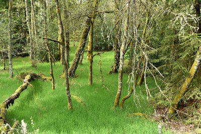
Vue boisée de la Mazure - ©J.DAMASE/PSC  Forestry
The Limousin forest: economy and ecology
During the rural exodus of the 19th century, the desertion of peasant land led to the reforestation of abandoned land. Marius Vazeilles (1881-1973), general warden of Water and Forests from 1912 to 1919 and then a forestry expert, was one of the main driving forces behind the development of the Limousin forest. Aid was put in place (National Forest Fund) after the Second World War to encourage the planting of Norway spruces, Scots pines and Douglas fir. In one century, between 1908 and 2002, the Limousin forest grew by around 430,000 hectares!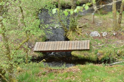
Passerelle dans les landes et tourbières de la Mazure - ©J.DAMASE/PSC  Small patrimony
Water control
Water is a resource that farmers have always known how to value. Several testimonies are present on the site. Fisheries are rectangular water reservoirs delimited by stone walls and fed by canals. They were used to irrigate the meadows so that the grass would grow faster, in particular thanks to the levades (irrigation canals) which distributed the water.
Description
- From the car park, head towards the footbridge over the stream, pass the barrier and follow the wide track to the next intersection.
- Turn right, go through the woods up to a viewpoint with a bench. Continue a little in the woods, then go down towards the river to the ruins of a mill.
- Follow the old headrace to the footbridges that allow the stream to be crossed.
- Take the duckboards and continue straight on the path for a good distance.
- At the intersection, take the left-hand path, which then branches off to the left at a footbridge and passes over the dike of an old pond.
- Cross the river again and remember to close the gate. Climb the steep path that goes off to the right to reach a panoramic view.
- Descend onto the heath to a turtle-shaped rocky outcrop.
- Just past this rock, there are two options. The one presented here is the option of the large loop (another sheet presents a smaller loop: "Discovery trail of the moors and peat bogs of Mazure n°22: Small loop"). Take the path that goes straight down and then goes up towards the rocky outcrop that offers a beautiful view.
- Go down to the bottom of the valley. Once you reach the peat bog, the path branches off to the right. The landscaping allows you to cross the wettest areas and reach a stone bridge (known as a "plank bridge").
- Cross the river, turn left to reach a coniferous forest.
- Continue straight through this forest for a long distance until you reach the intersection of four paths.
- Turn left, go through the woods and then continue alongside the peat bog on a path lined with old low walls.
- At the intersection with another trail, continue straight ahead until you reach some duckboards, then a small stone bridge that allows you to cross the river again.
- Just after a small round trip to the right you can explore the remains of mills. Turn left, continue straight on a path that runs along the edge of the peat bog near the heather moors.
- A large duckboard allows you to cross a very wet area (caution). The path continues straight ahead on the edge and then branches off to the right into a shrubby area and climbs up into a fenced meadow.
- A fenced corridor makes it possible to cross this meadow in complete safety (beware, however, of apiary). At the end of the meadow, take the path opposite (slightly to the left) in a coniferous forest.
- The path then continues through a leafy forest, branching off to the right to an old fishery.
- Continue on the right, following the watercourse, until the next intersection with a wide path.
- Take this path on the left, go on alongside the fenced pasture and continue straight on the path (taken on the outward journey) to return to the car park.
- Departure : Devil's Rock
- Arrival : Devil's Rock
- Towns crossed : Le Monteil-au-Vicomte, Royère-de-Vassivière, and Saint-Pierre-Bellevue
Forecast
Altimetric profile
Recommandations
Information desks
23460 ROYERE DE VASSIVIERE
Place du Champ de Foire, 23400 Bourganeuf
Access and parking
Parking :
Report a problem or an error
If you have found an error on this page or if you have noticed any problems during your hike, please report them to us here:
